
Method for using base station power measurements to detect position of mobile stations

a technology of power measurement and mobile station, applied in the direction of measuring devices, instruments, electrical equipment, etc., can solve the problems of inability to receive good signals, gps receivers cannot receive good signals inside buildings, and gps based approaches are not perfect ways to detect the position of mobile stations

Inactive Publication Date: 2005-10-13
BENQ CORP
View PDF7 Cites 69 Cited by
  • Summary
  • Abstract
  • Description
  • Claims
  • Application Information

AI Technical Summary

Benefits of technology

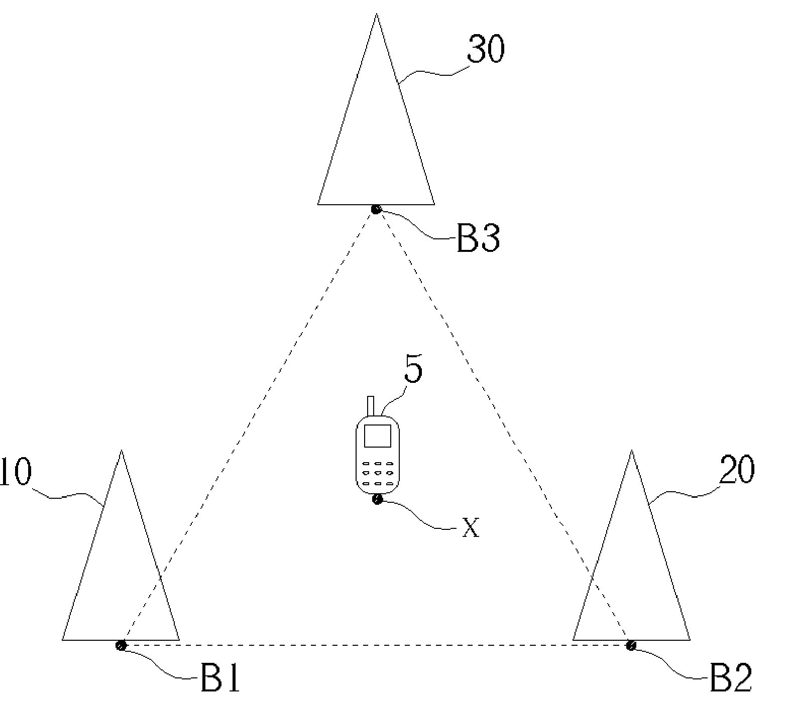
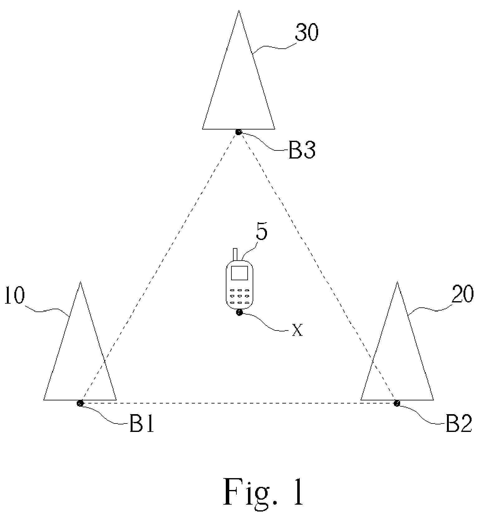
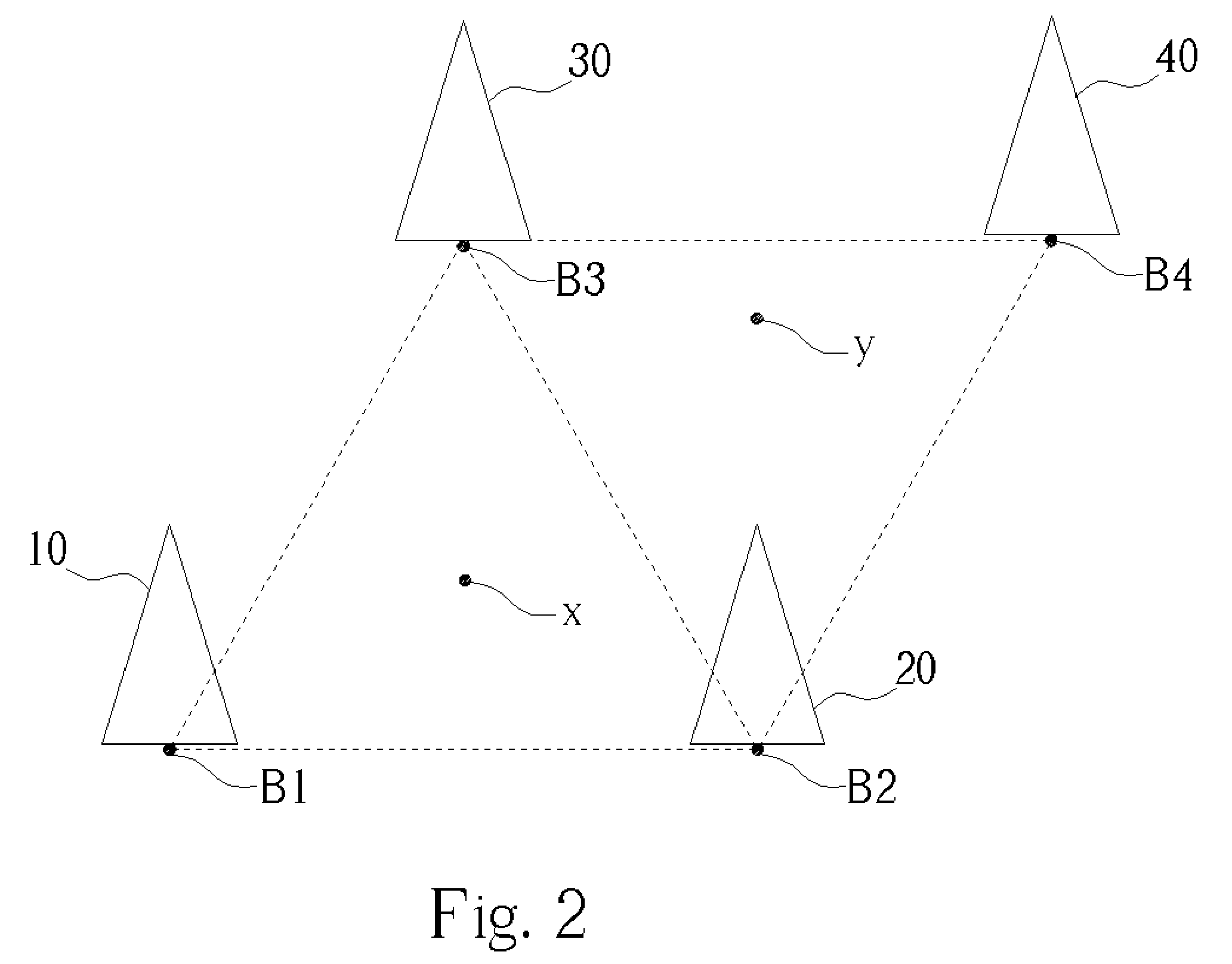
[0007] According to the claimed invention, a method of using power measurements from base stations to calculate position of a mobile station is proposed. The method includes providing position coordinates for a plurality of base stations in a mobile phone network, measuring Received Signal Strength Indicator (RSSI) levels of nearby base stations with a mobile station, identifying three base stations for which the mobile station measures strongest RSSI levels, the mobile station receiving the position coordinates of the three identified base stations, calculating a curved path of possible positions of the mobile station for each of the three identified base stations according to the measured RSSI levels of each of the three identified base stations, and calculating the position of the mobile station based on the position coordinates of the three identified base stations and the three curved paths of possible positions of the mobile station.
[0008] It is an advantage of the claimed invention that RSSI level measurements are used to determine an equivalent GPS location of the mobile station. Thus, even when mobile stations cannot receive good quality GPS information from the satellites, the mobile stations will still be able to perform the same type of location services. More importantly, the claimed invention method does not require any extra hardware for the mobile stations, and the neighboring cell RSSI measurement is part of the cell selection and reselection routines already used in Global System for Mobile communications (GSM) protocols and can be extended to the Code Division Multiple Access (CDMA) protocols.

Problems solved by technology

Unfortunately, the GPS based approach is not a perfect way for mobile stations at any time any place.
For example, a GPS receiver cannot receive good signals inside buildings and cannot receive good signals under severe weather conditions.
Like other wireless communication technologies, GPS receivers suffer from interference effects.
They also suffer from line-of-sight problems.
For example, the users may already know that a GPS receiver cannot receive good quality signals inside buildings.
Meanwhile, when the GPS receiver cannot receive good quality signals, it will not provide accurate location services.
If the mobile station cannot derive its location through the GPS receiver properly, the mobile station will have problems reporting its location to the related system.
Thus, the GPS approach adopted by the North American wireless market is a problem prone approach for location services such as E911.

Method used


Image

  • Method for using base station power measurements to detect position of mobile stations
  • Method for using base station power measurements to detect position of mobile stations
  • Method for using base station power measurements to detect position of mobile stations

Examples


Embodiment Construction

[0019] The goal of the present invention method is to measure the RSSI levels of base stations in neighboring cells to calculate the location of a mobile station. If the GPS location information of each base station can be known beforehand, then the location information derived from the base station RSSI measurement process can be translated to GPS information directly.

[0020] In the CDMA protocol, the GPS location information of each base station is broadcast through system information messages. Currently, in the GSM 2G and 2.5G (GPRS) protocols, GPS information is not provided, but it is included in the GSM 3G Wideband CDMA (W-CDMA) protocols. It is a small enhancement for GSM-GPRS protocols to include the GPS information to be associated with each base station, and including the GPS information will help to provide a better location service through the GSM communication protocol. The mapping between the base station's GPS location and its base station identification is a one-to-o...


PUM


Abstract

A method of using power measurements from base stations to calculate position of a mobile station. The method includes providing position coordinates for a plurality of base stations in a mobile phone network, measuring Received Signal Strength Indicator (RSSI) levels of nearby base stations with a mobile station, identifying three base stations for which the mobile station measures strongest RSSI levels, the mobile station receiving the position coordinates of the three identified base stations, calculating a curved path of possible positions of the mobile station for each of the three identified base stations according to the measured RSSI levels of each of the three identified base stations, and calculating the position of the mobile station based on the position coordinates of the three identified base stations and the three curved paths of possible positions of the mobile station.

Description

BACKGROUND OF INVENTION [0001] 1. Field of the Invention [0002] The present invention relates to detecting a location of a mobile station, and more specifically, to a method for using embedded functionality in mobile stations to measure base station power levels for determining a location of the mobile station. [0003] 2. Description of the Prior Art [0004] The Global Positioning System (GPS) is a popular approach used for location detection. The North American wireless market has mandated that after the year 2003, mobile stations (handsets) will need to provide a GPS receiver in order to support Emergency 911 (E911) services. Currently, there are several GPS approaches. Among these, the typical GPS without Selective Availability (SA) approach (accuracy of the original GPS system is subject to accuracy degradation under the government imposed Selective Availability program) is chosen by the above E911 services. [0005] Unfortunately, the GPS based approach is not a perfect way for mob...

Claims


Application Information

Patent Timeline
IPC IPC(8): G01S19/27H04B1/38H04W64/00
CPCH04W64/00
Inventor CHENG, STEVEN D.
Owner BENQ CORP
Learn More