System and method for mosaicing digital ortho-images

a mosaicing system and digital ortho-image technology, applied in the field of remote imaging techniques, can solve the problems of large scale factor, difficult even to robust imaging systems, time-consuming and laborious rendering processes, etc., and achieve the effects of high quality, improved image fidelity and clarity, and efficient and reliable stitching

Active Publication Date: 2005-12-01
VI TECH LLC
View PDF20 Cites 48 Cited by
  • Summary
  • Abstract
  • Description
  • Claims
  • Application Information

AI Technical Summary

Benefits of technology

[0008] The present invention provides a versatile system for efficiently and reliably stitching together images, collected from high-resolution digital imaging sensors, into a seamless, high quality, wide FOV mosaic image. The mosaicing processes of the present invention efficiently stitch thousands of small, digital sub-images into a single, high-quality composite image. The present invention provides processes that tonally balance images based on green-dominant pixels, providing greater image fidelity and clarity even where image anomalies occur. The present invention transforms original sub-images only once during generation of the final mosaic—reducing processing time and image distortions due to iterative manipulations.
[0013] In addition, the present invention also provides a method of establishing a seam line between adjacent image strips that minimizes perspective imaging effects of elevated features in the image strips. An initial seam line between the image strips is selected. The initial seam line is divided into small segments. The position of an elevated feature in a particular segment is determined; and the route of the seam line in that segment is then altered based on the position of the elevated feature.
[0014] The present invention also provides a method for rendering multiple, partially-overlapping input image strips of a target terrain into a seamless image mosaic of the target terrain that includes normalizing the intensity of each input image to a desired mean and standard deviation. A reference image and a secondary image, having a partially overlapping area and a common boundary area are provided. A segmented seam line between the reference and secondary image strips, that minimizes perspective imaging effects of elevated features in those images, is established. The boundary area is divided into segments corresponding to the segments of the seam line. A balancing correlation matrix is computed for each such segment. Pixel values are modified within each segment, along a gradient that starts at the boundary and terminates at a predetermined transition distance, by the balancing correlation matrix for that segment. The system also comprises a subsystem for providing smooth transition from the balancing correlation matrix of one segment to the next by defining a transition area at the interface between two segments and using distance-weighted average values of the two corresponding matrices to scale pixels in this area. The pixels at the boundary are further feathered to eliminate any remaining visible seam.
[0015] The present invention further provides a method of processing color input images to reduce bias caused by man-made structures or water bodies. The method includes selecting green-dominant pixels from a first input image and computing an average intensity value thereof. Green-dominant pixels are then selected from a second input image, and an average intensity value thereof is computed. The average intensity values of the first and second input images are then compared, and the first or second input image is processed responsive to the results of the comparison.

Problems solved by technology

A major challenge facing some such remote imaging applications is one of image resolution.
Depending upon the particular system used (e.g., aircraft, satellite, or space vehicle), an actual digital imaging device may be located anywhere from several hundred feet to several miles above its target, resulting in a very large scale factor.
Providing images with very large scale factors, that also have resolution tolerances of inches, poses a challenge to even the most robust imaging system.
Often, such rendering processes are very time-consuming and labor intensive.
In many cases, those processes require iterative processing that measurably degrades image quality and resolution—especially in cases where thousands of sub-images are being rendered.
In cases where the imaging data can be processed automatically, that data is often repetitively transformed and sampled—reducing color fidelity and image sharpness with each successive manipulation.
If automated correction or balancing systems are employed, such systems may be susceptible to image anomalies (e.g., unusually bright or dark objects)—leading to over or under-corrections and unreliable interpretations of image data.
In cases where manual rendering of images is required or desired, time and labor costs are immense.

Method used


Image

  • System and method for mosaicing digital ortho-images
  • System and method for mosaicing digital ortho-images
  • System and method for mosaicing digital ortho-images

Examples


Embodiment Construction

[0029] While the making and using of various embodiments of the present invention are discussed in detail below, it should be appreciated that the present invention provides many applicable inventive concepts, which can be embodied in a wide variety of specific contexts. The specific embodiments discussed herein are merely illustrative of specific ways to make and use the invention and do not limit the scope of the invention.

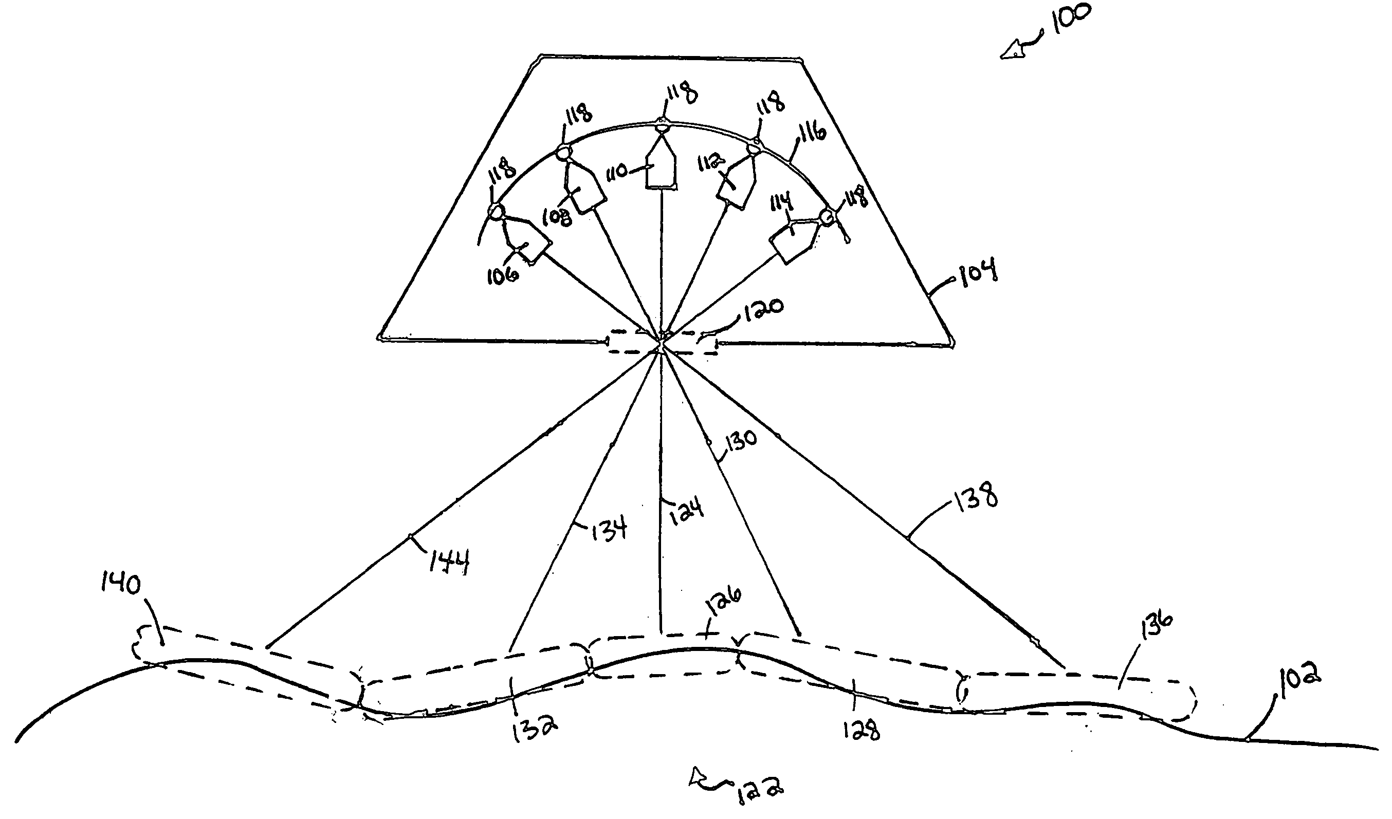
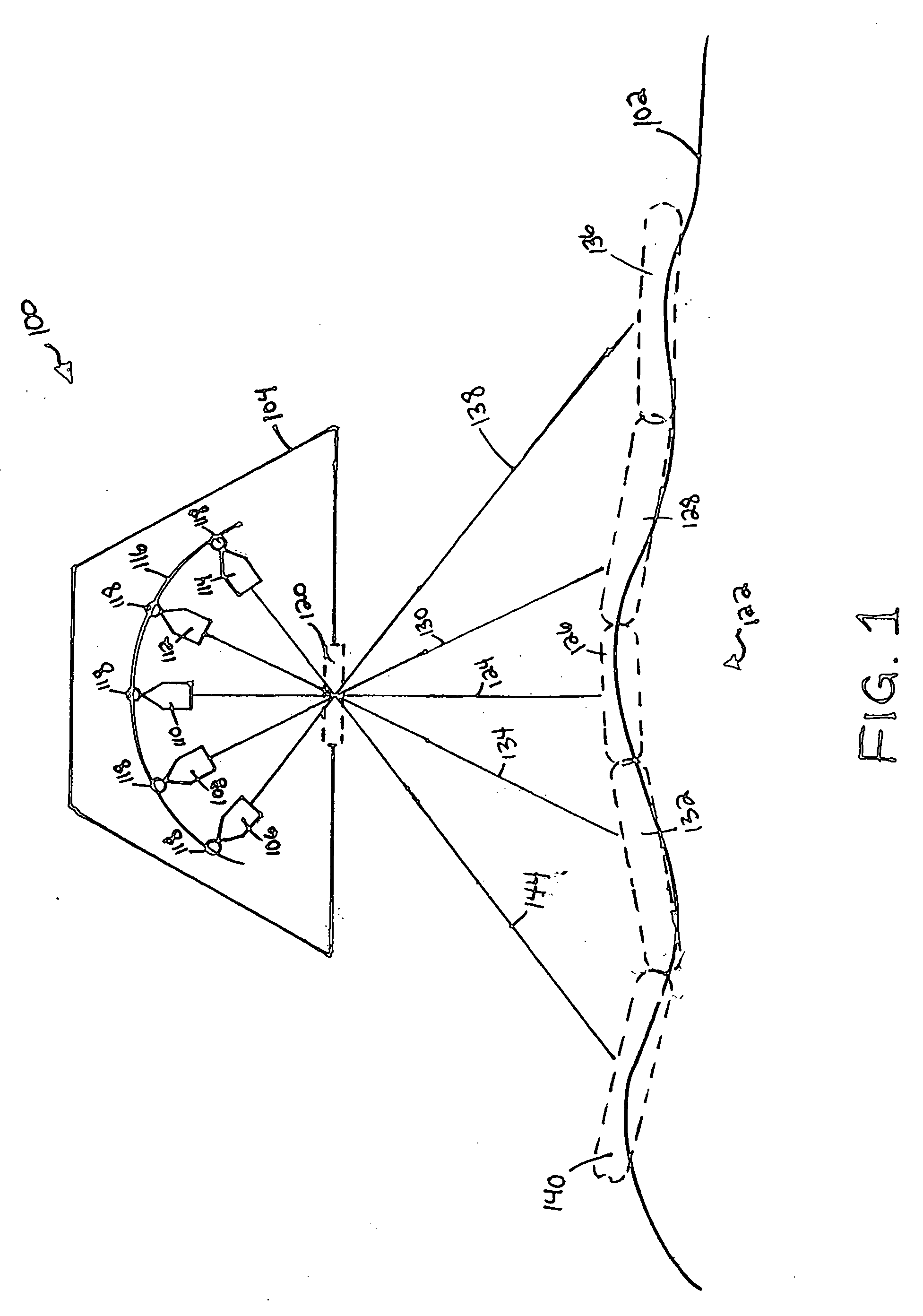
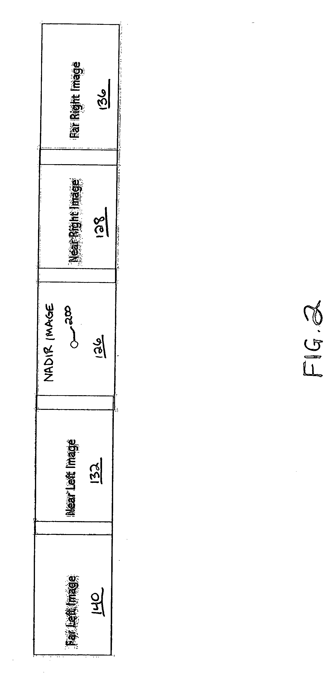
[0030] The present invention provides a versatile system for efficiently and reliably stitching together images, collected from high-resolution digital imaging sensors, into a seamless, high quality, mosaic image covering a wide FOV. The mosaicing processes of the present invention efficiently stitch (or mosaic) thousands of small, digital sub-images into a single, high-quality composite image. Processing the image data in digital format provides greater efficiency and lowers processing costs. The present invention provides processes that tonally balance images...


PUM


Abstract

The present invention provides a system and method for mosaicing multiple input images, captured by one or more remote sensors, into a seamless mosaic of an area of interest. Each set of input images captured by the remote sensors within a capture interval are ortho-rectified and mosaiced together into a composite image. Successive composite images, along a given flight path, are then mosaiced together to form a strip. Adjacent strips are then mosaiced together to form a final image of the area of interest.

Description

CROSS-REFERENCES TO RELATED APPLICATIONS [0001] This application is a continuation of the following U.S. patent application Ser. No. 10 / 247,441, filed Sep. 19, 2002.TECHNICAL FIELD OF THE INVENTION [0002] The present invention relates, generally, to the field of remote imaging techniques and, more particularly, to a system for rendering high-resolution digital images over very large fields of view. BACKGROUND OF THE INVENTION [0003] Remote imaging is a broad-based technology having a number of diverse and extremely important practical applications—such as geological mapping and analysis, military surveillance and planning, and meteorological forecasting. Aerial and satellite-based photography and imaging are especially useful remote imaging techniques that have, over recent years, become heavily reliant on the collection and processing of digital image data. Spatial data—characterizing real estate improvements and locations, roads and highways, environmental hazards and conditions, ...

Claims


Application Information

Patent Timeline
Patent Type & Authority Applications(United States)
IPC IPC(8): G06T3/40
CPCG06T3/4038
Inventor MAI, TUY VUSMITHERMAN, CHESTER L.
Owner VI TECH LLC
Why Eureka
Try Eureka