Image-enhanced vehicle navigation systems and methods

a vehicle navigation and image technology, applied in the field of image capture, image storage, image access methods and technologies, can solve the problems of users of the wwmx website finding it difficult to find an image of what, and the price of freedom

Inactive Publication Date: 2006-11-30
OUTLAND RES
View PDF99 Cites 204 Cited by
  • Summary
  • Abstract
  • Description
  • Claims
  • Application Information

AI Technical Summary

Problems solved by technology

This allows for more freedom than the confluence technology, but such freedom comes with a price.
Because there are an incredibly large number of possible coordinates and because all ...

Method used


Image

  • Image-enhanced vehicle navigation systems and methods
  • Image-enhanced vehicle navigation systems and methods
  • Image-enhanced vehicle navigation systems and methods

Examples


Embodiment Construction

[0022] The following description is not to be captured in a limiting sense, but is made merely for the purpose of describing the general principles of exemplary embodiments. The scope of the embodiments disclosed below should be determined with reference to the claims.

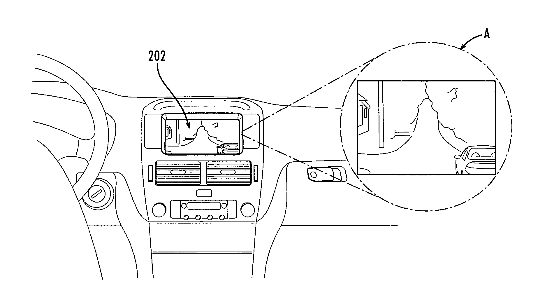
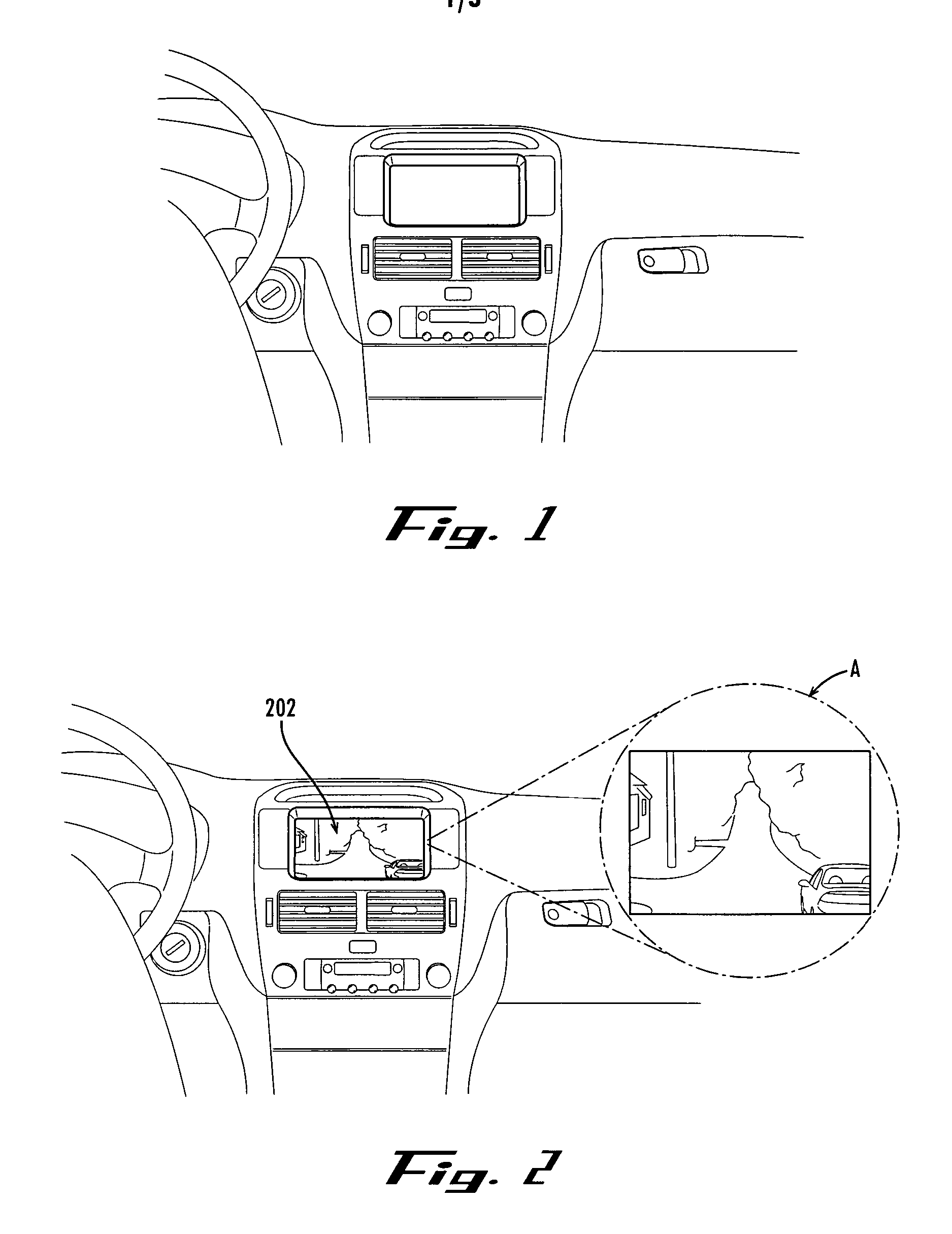
[0023]FIG. 1 illustrates an interface of an exemplary vehicle navigation system within which embodiments disclosed herein can be incorporated.

[0024] Referring to FIG. 1, vehicle navigation systems often include a display screen for adapted to show maps and directions to the operator of the navigation system (e.g., the driver of the vehicle). U.S. Pat. No. 5,359,527, which is hereby incorporated by reference, can be understood to disclose that such vehicle navigation systems implement navigation planning routines adapted to provide an operator with a route from a present position of a vehicle to a concrete destination location by displaying the route on a map-like display. Such a system often includes destination deci...


PUM


Abstract

A method of presenting images to a user of a vehicle navigation system includes accessing location data indicating a particular location included within a route determined by a vehicle navigation system and accessing corresponding direction data, obtaining a captured image based on the accessed location and direction data, and displaying the obtained image to the user. The obtained captured image corresponds approximately to a driver's perspective from within a vehicle and depicts a view of or from the particular location along the particular direction indicated by the direction data. Location data includes spatial coordinates such as GPS data, a street index, and/or other locative data either absolute or relative to a particular street or intersection. Direction data includes a travel direction of the vehicle upon a street corresponding to the particular location. Additionally, data indicating time-of-day, season-of-year, ambient environmental conditions, etc., may be used to obtain and/or correlate obtainable images.

Description

[0001] This application claims the benefit of U.S. Provisional Application No. 60 / 685,219, filed May 27, 2005, which is incorporated in its entirety herein by reference.BACKGROUND [0002] 1. Field of Invention [0003] Embodiments disclosed herein relate generally to image capture, image storage, and image access methods and technologies. More specifically, embodiments disclosed herein relate to enhanced navigation systems that support methods and apparatus for capturing, storing, and accessing first-person driver's eye images that represent what a driver will see at various navigation destinations and intermediate locations. [0004] 2. Discussion of the Related Art [0005] Combining the prevalence and power of digital cameras and handheld GPS devices, a website has been developed by the United States Geological Survey (USGS) called confluence.com. This web site is a storage location for digital photographs, indexed by latitude and longitude, the photographs depicting a camera view captu...

Claims


Application Information

Patent Timeline
IPC IPC(8): G01C21/32
CPCG01C21/3647
Inventor ROSENBERG, LOUIS B.
Owner OUTLAND RES
Why Eureka
Try Eureka