
Landmark search system for digital camera, map data, and method of sorting image data

a technology of image data and search system, which is applied in the field of landmark search system for digital camera, map data, and method of sorting image data, can solve the problems of insufficient data retrieval, and insufficient image data retrieval

Active Publication Date: 2007-05-17
FUJIFILM CORP
View PDF24 Cites 62 Cited by
  • Summary
  • Abstract
  • Description
  • Claims
  • Application Information

AI Technical Summary

Benefits of technology

The present invention provides a system and method for quickly searching for landmarks in a camera location. The system includes a digital camera, map data storage, and a search device that searches the map data based on the camera position to retrieve the landmark data. The map data includes area data of divisional areas and place data for each area, which includes landmark names and areas. The system also allows for sorting the image data based on the landmark data and revising the place data after it is associated with the image data to sort the image data differently. The technical effects of the invention include improved efficiency and accuracy in identifying landmarks and the ability to sort image data based on the landmark data.

Problems solved by technology

In the prior art disclosed in Japanese Laid-open Patent Application No. 2003-209886, however, it takes time for retrieval of the position information.
Therefore, it takes certainly long time for the data retrieval.
Indeed image data is superior to photo-prints in view of preservation properties, but, with regard to efficiency of sorting and searching the images, the image data is inferior to the photo-prints, because the photo-prints may be put in order by filing them into albums or the like.
However, if position data obtained from the GPS satellite is inaccurate because of a low GPS function, and thus a wrong place-name or landmark is selected, the image data will be sorted wrongly.

Method used


Image

  • Landmark search system for digital camera, map data, and method of sorting image data
  • Landmark search system for digital camera, map data, and method of sorting image data
  • Landmark search system for digital camera, map data, and method of sorting image data

Examples


Embodiment Construction

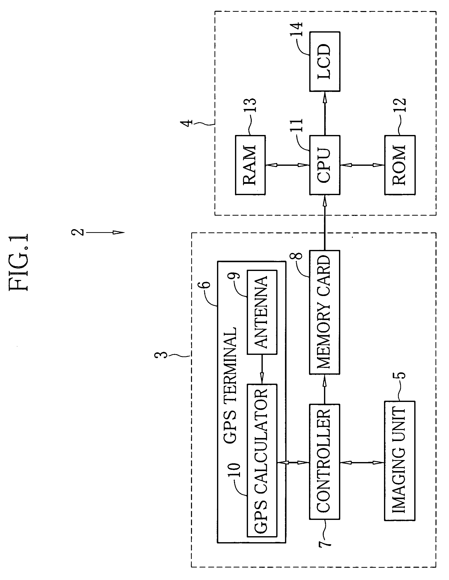
[0043] As shown in FIG.1, a camera location landmark search system 2, an embodiment of the search system of the present invention, is comprised of a digital camera 3 and a personal computer 4.

[0044] The digital camera 3 is provided with an imaging unit 5 that comprises a shutter button and a taking lens in a conventional manner, a GPS terminal 6 for locating a present camera position and getting position data of the present camera position, and a controller 7. A memory card 8 for storing captured image data is detachably attached to the digital camera 3. The GPS terminal 6 has an antenna 9 and a GPS calculator 10. The antenna 9 is for receiving electric waves from a GPS satellite that is going around the earth. The received electric wave is sent to the GPS calculator 10, which stores a calculation program for calculating based on the electric wave position data of the present camera position, i.e. latitude and longitude of the present camera position.

[0045] When an image is captur...


PUM


Abstract

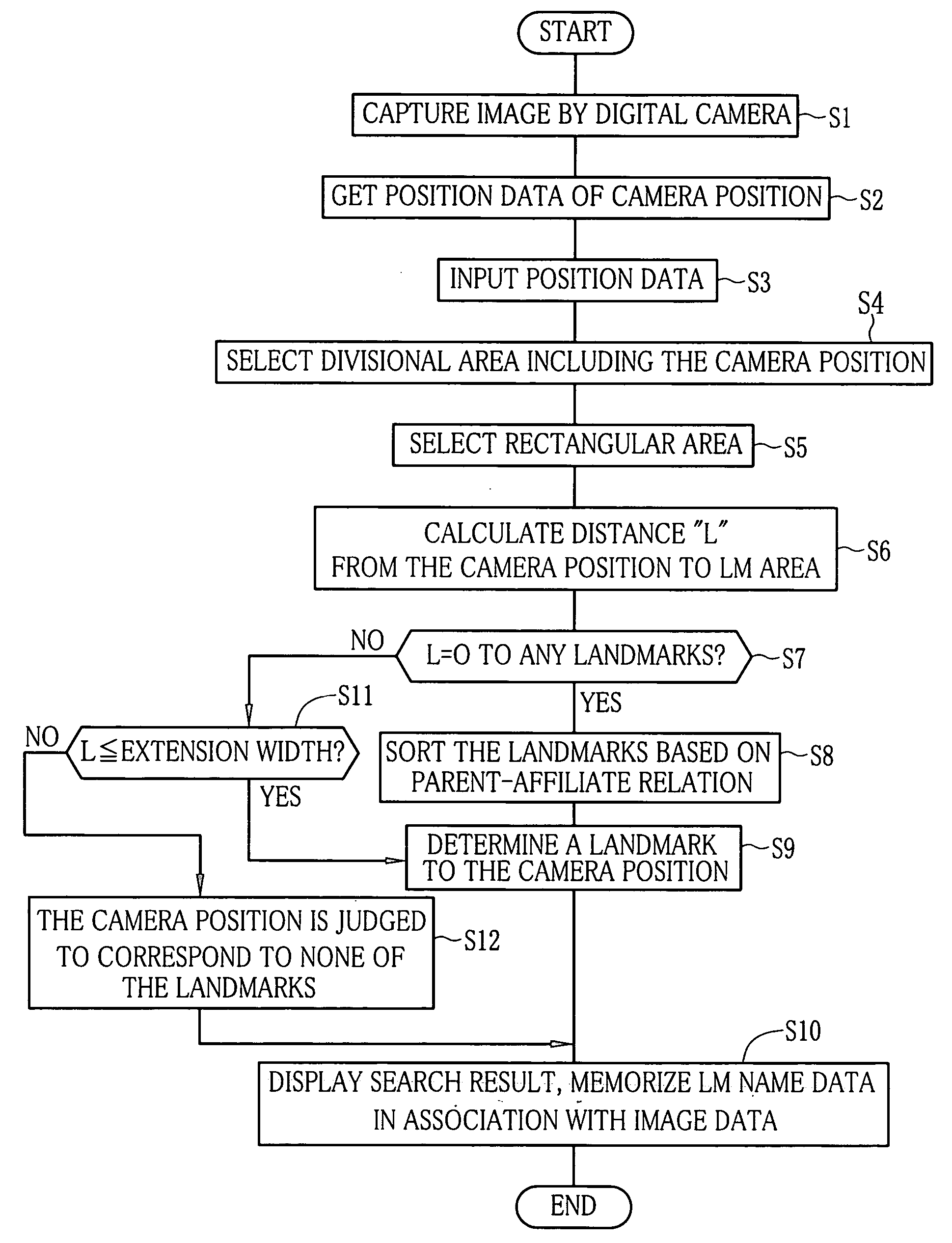
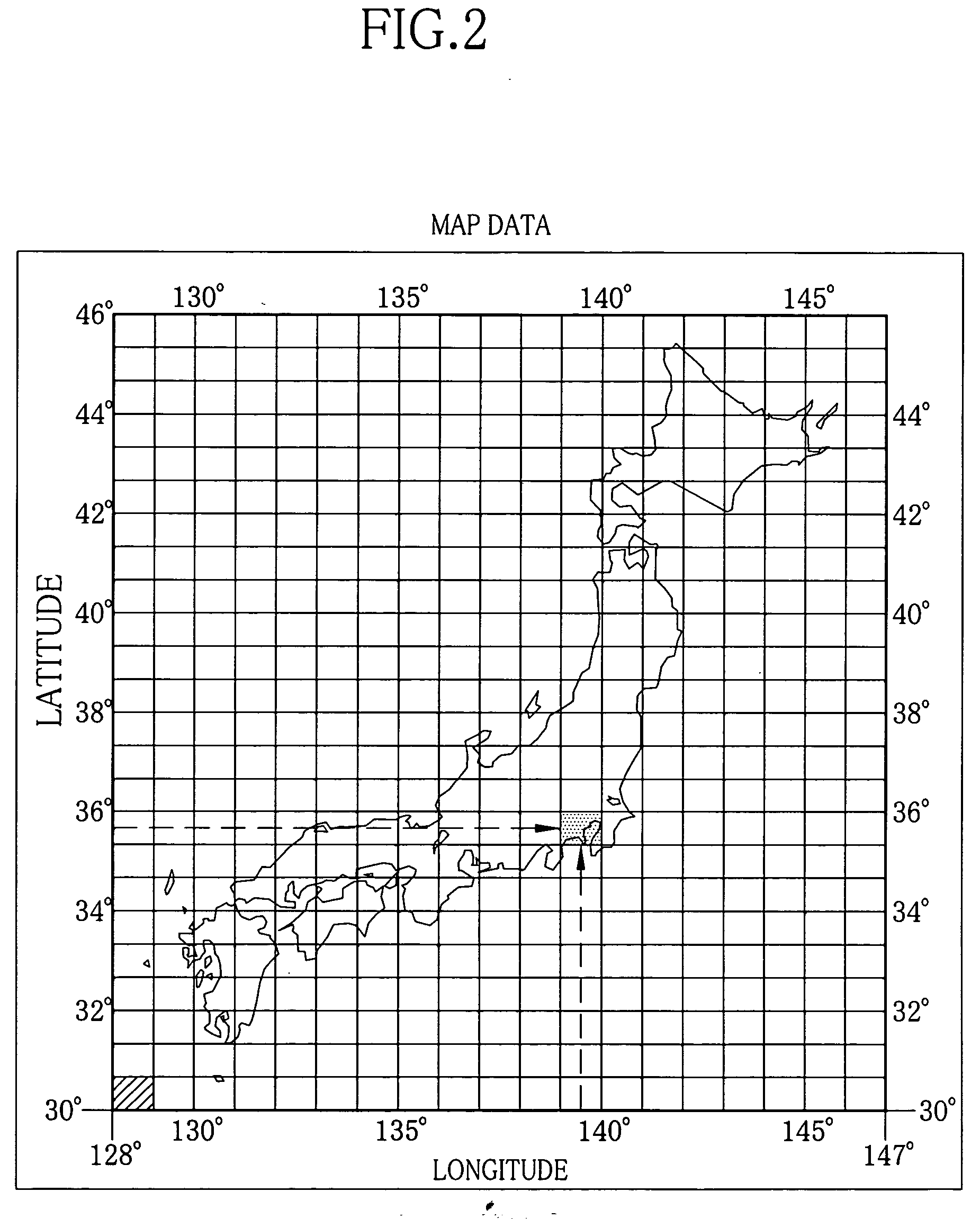
In a camera location landmark search system, when an image is captured by a digital camera, a GPS calculator calculates position data indicating a camera position. The position data and image data of the captured image are memorized in association with each other. Map data is divided at regular intervals of latitude and longitude into a lot of areas. Based on the position data, a divisional area including the camera position is selected with reference to a divisional area index table of the map data, and landmark data prepared for the determined divisional area are retrieved from a landmark data table of the map data. Based on the landmark data, a landmark corresponding to the camera position is determined, and the landmark name is memorized in association with the image data. The image data as sorted according to the landmark names may be displayed with the landmark names.

Description

FIELD OF THE INVENTION [0001] The present invention relates to a landmark search system for searching for a landmark that is contained an image captured by a digital camera, and map data for the landmark search system. The present invention relates also to a digital camera, and a method and apparatus for sorting image data captured by the digital camera. BACKGROUND OF THE INVENTION [0002] In the field of digital cameras, it is getting popular to get position data, data of latitude and longitude, of a camera location from the GPS (Global Positioning System), and memorize the position data in association with captured image data. An exemplar of such a digital camera is a camera phone with a GPS receiver. Also, a device for deducing the name of an imaged place or landmark from the attached position data has been suggested. [0003] For example, Japanese Laid-open Patent Application No. 2003-209886 discloses a mobile terminal, a position information providing system and an imaging system,...

Claims


Application Information

Patent Timeline
Patent Type & Authority Applications(United States)
IPC IPC(8): G06K9/46G06K9/00G06V10/24
CPCG06F17/30265G06F17/3087G06K9/32G06F16/9537G06F16/58G06V10/24
Inventor OHASHI, YOUSUKE
Owner FUJIFILM CORP
Learn More