Display method and apparatus for adjusting contrast of map elements for navigation system

a technology of contrast and display method, applied in the direction of navigation, surveying and navigation, instruments, etc., can solve the problems of limiting important landmarks, affecting the safety of driving, and the driver may not be able to see the minor streets, so as to achieve the effect of easy and accurate identification of actual locations

Active Publication Date: 2008-10-02
ALPINE ELECTRONICS INC
View PDF3 Cites 18 Cited by
  • Summary
  • Abstract
  • Description
  • Claims
  • Application Information

AI Technical Summary

Benefits of technology

[0020]According to the present invention, the navigation system evaluates the representations of map elements and adjusts the contrast of the representations based on various factors. Thus, the navigation system allows a user to more easily and accurately identify the actual locations of the map elements, such as a destination, road networks, road level, etc., in a congested area by adjusting the representation contrast. Accordingly, the navigation system is able to provide various contrast of icons, such as building images, landmark icons, POI icons, traffic icons such as one-way icons, and roads, against the background color on the screen. Further, it becomes possible to make the minor streets more visible in an open or less congested area by adjusting the contrast of the minor street against the background on the screen of the navigation system.

Problems solved by technology

If the driver tries to read or otherwise detect desired information from the complicated map image on the monitor screen, it may distract his attention from the safe driving.
However, when this method is applied to an open area such as a country side in the same scale and color as illustrated in FIGS. 2B and 3B, the driver may not really be able to see the minor streets.
However, because this method simply limits the landmarks by the number, sometimes it may have to limit important landmarks.

Method used


Image

  • Display method and apparatus for adjusting contrast of map elements for navigation system
  • Display method and apparatus for adjusting contrast of map elements for navigation system
  • Display method and apparatus for adjusting contrast of map elements for navigation system

Examples


Embodiment Construction

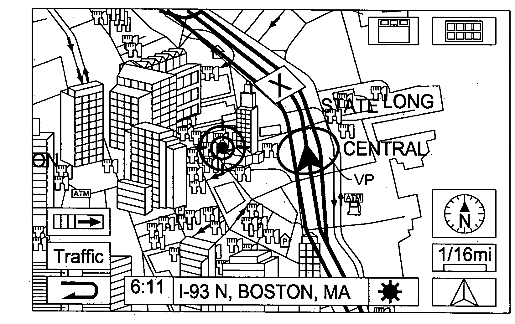
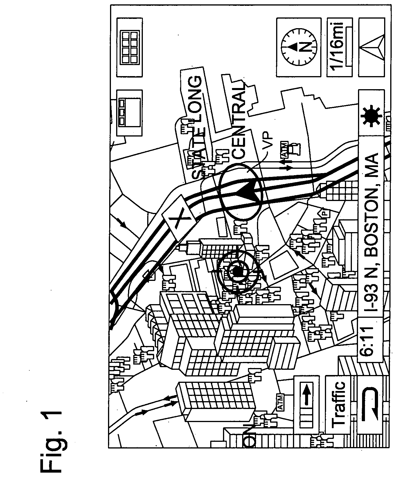
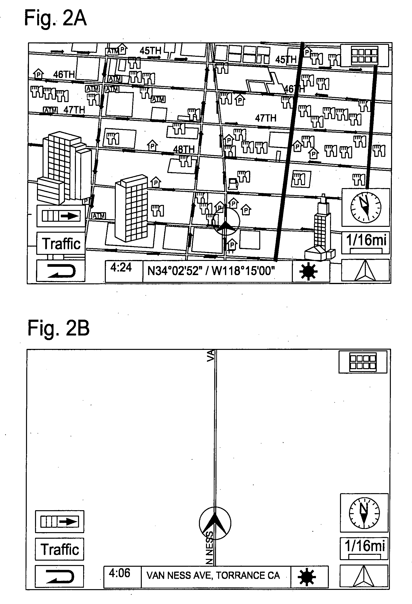
[0034]The present invention will be described in detail with reference to the accompanying drawings. In the present invention, the navigation system evaluates the representations of map elements and adjusts the contrast of the representations based on various factors. Thus, the navigation system allows a user to more easily and accurately identify the actual locations of the map elements, such as a destination, road networks, road level, etc., in a congested area by adjusting the representation contrast. Further, the navigation system makes it possible to display minor streets more visible in an open or less congested area by adjusting the contrast of the minor streets against the background on the screen. It should be noted that within the context of the present invention, each map element may also be referred to as “icon”.

[0035]FIG. 4 shows an example of a structure of a vehicle navigation system for implementing the display method of the present invention. While the vehicle navig...


PUM


Abstract

A method and apparatus of valuing contrast of representation on background displayed on a screen of a navigation apparatus, by counting a number of the presentations on the background of the screen, adjusting contrast of the representations against the background displayed on the screen in response to the number of the representation on the background, and displaying the representations on the screen based on the adjusted contrast of the representation. The contrast of the representations against the background is set lower than original contrast against the background when the number of the representations is equal to or more than a predetermined number. The contrast of the representations is set higher than current contrast when the number of the representations on the screen is less than a predetermined number.

Description

FIELD OF THE INVENTION[0001]This invention relates generally to a method and apparatus for valuing representation contrast for a navigation apparatus, and more particularly, to a method and apparatus for evaluating representation contrast of map image for a navigation system and adjusting the contrast of representations, such as building images, roads, POI icons, traffic icons, etc., against background color to make a current position and road networks more visible in a congested area and to make minor streets more visible in an open or less congested area on a monitor screen.BACKGROUND OF THE INVENTION[0002]A navigation system provides travel guidance for enabling a user to easily and quickly reach the selected destination. A typical example is a vehicle navigation system in which a vehicle is equipped with a navigation function to guide a driver to a destination through a calculated route. Such a navigation system detects the position of the user's vehicle, and reads out map data ...

Claims


Application Information

Patent Timeline
Patent Type & Authority Applications(United States)
IPC IPC(8): G09G5/00
CPCG01C21/367
Inventor WAKO, HIKARU
Owner ALPINE ELECTRONICS INC
Why Eureka
Try Eureka