Airborne Electromagnetic (EM) Survey System

a technology of electromagnetic survey and airborne electromagnetic, which is applied in the direction of electric/magnetic detection for transportation, using reradiation, instruments, etc., can solve the problems of affecting the survey data, overwhelming the receiver, and affecting the ability of the secondary field to sense, so as to minimize the size and weight of the structure, reduce noise, and maximize the rigidity of the structure

Active Publication Date: 2008-10-09
CGG DATA SERVICES +1
View PDF0 Cites 22 Cited by
  • Summary
  • Abstract
  • Description
  • Claims
  • Application Information

AI Technical Summary

Benefits of technology

[0013]The present invention provides an improved rigid transmitter loop structure for use in an airborne electromagnetic (EM) surveying system, and ha...

Problems solved by technology

Because the secondary field emanating from the underlying terrain is generally much smaller in amplitude than the primary electromagnetic field, the primary electromagnetic field can overwhelm the receiver and interfere with its ability to sense the secondary field.
The secondary fields of these eddy currents constitute noise, which can adversely impact the survey data and generally increase the difficulty in obtaining reliable geological information from this data.
However, separating the transmitter and receiver by housing the receiver in a bird leads to technical problems, with the receiver changing position relative to the transmitter, and detecting much of the primary field from the transmi...

Method used


Image

  • Airborne Electromagnetic (EM) Survey System
  • Airborne Electromagnetic (EM) Survey System
  • Airborne Electromagnetic (EM) Survey System

Examples


Embodiment Construction

[0022]The invention will be described for the purposes of illustration only in connection with certain embodiments; however, it is to be understood that other objects and advantages of the present invention will be made apparent by the following description of the drawings according to the present invention. While a preferred embodiment is disclosed, this is not intended to be limiting. Rather, the general principles set forth herein are considered to be merely illustrative of the scope of the present invention and it is to be further understood that numerous changes may be made without straying from the scope of the present invention.

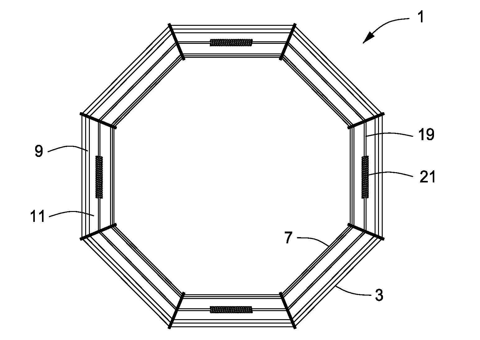
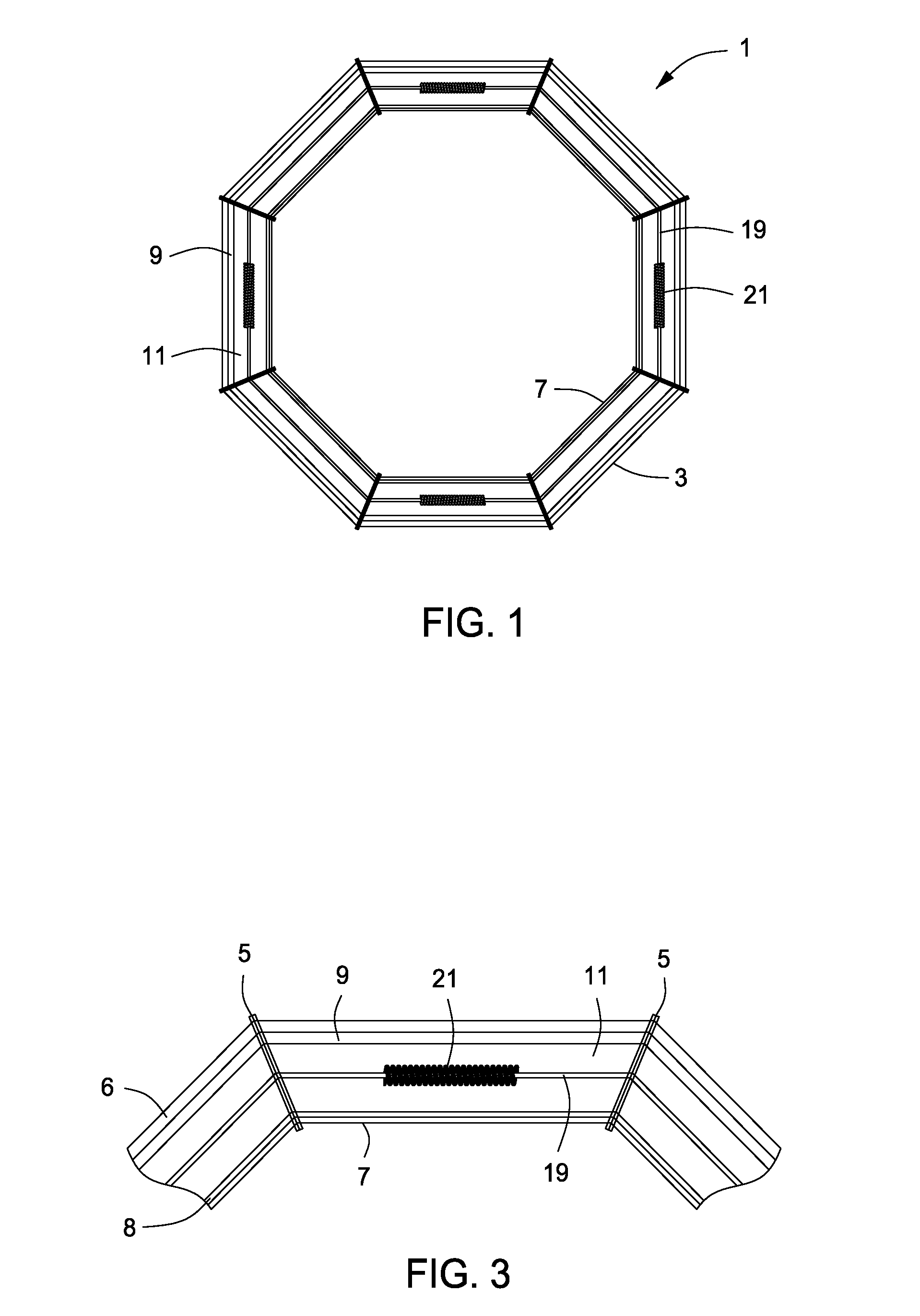
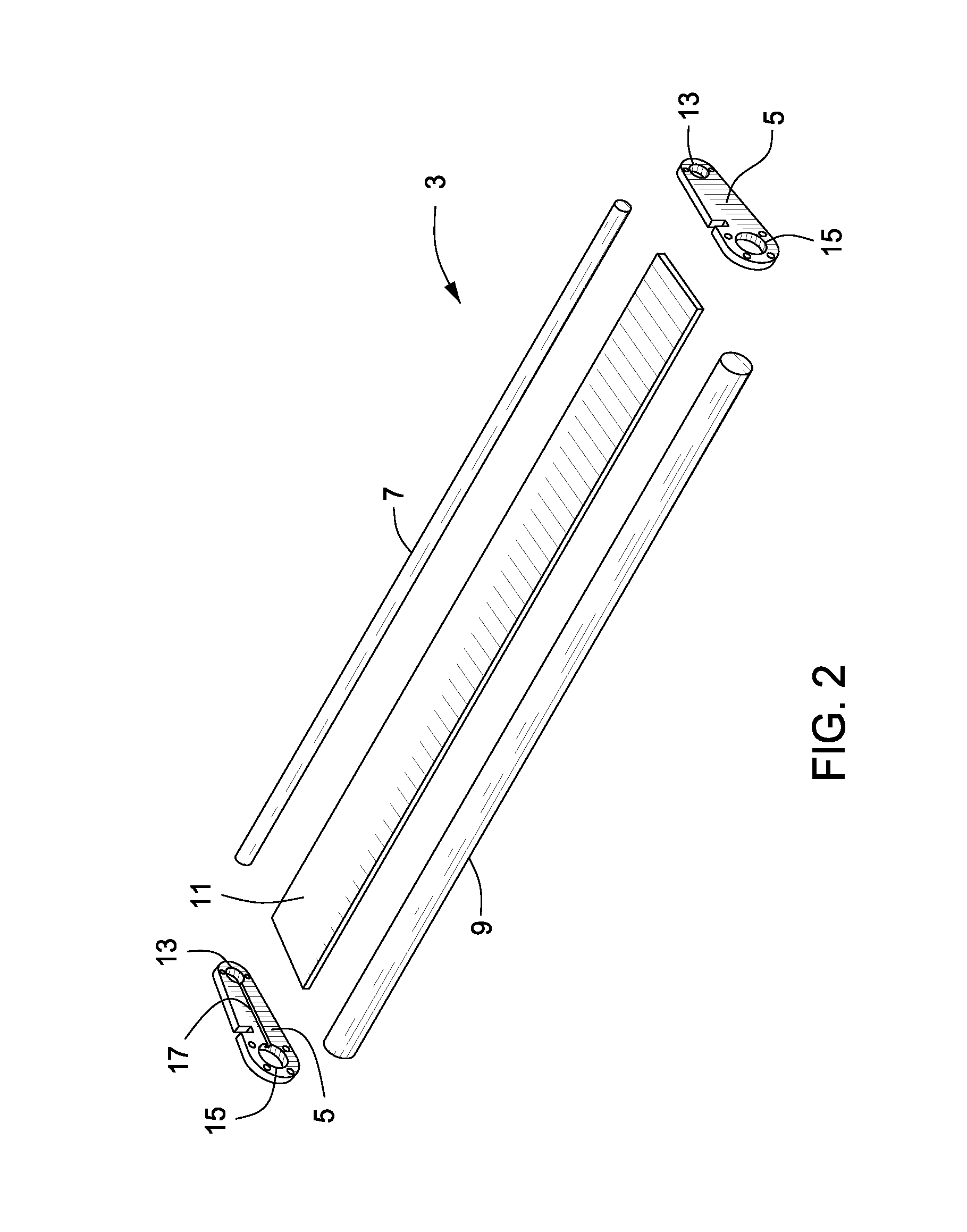
[0023]The present invention consists of an airborne electromagnetic survey system, which includes a transmitting assembly for conducting geological surveying, and is designed to be towed by an airborne vehicle. Preferably, the vehicle is a helicopter, but those having ordinary skill in the art will appreciate that other vehicles, such as vertical take-...


PUM


Abstract

An airborne electromagnetic survey system for conducting geological mapping is disclosed. A transmitter closed loop structure is used in the system and is designed for connection to a towing airborne vehicle. The transmitter loop structure comprises a plurality of interconnected loop segments, and transmitting means are fitted to at least one of the loop segments for generating and transmitting an earthbound primary electromagnetic field effective for geological surveying. Sensing means are fitted to the loop segments for receiving and sensing a vertical component of a secondary resulting electromagnetic field which arises from an interaction of the primary electromagnetic field with ground bodies that are traversed by the sensing means, while simultaneously nulling the primary electromagnetic field. Helical sensing means are positioned in close proximity to the transmitting means to receive and sense a horizontal electromagnetic field contained in the secondary resulting field, while simultaneously nulling the primary electromagnetic field.

Description

TECHNICAL FIELD OF THE INVENTION[0001]The present invention relates to an airborne time-domain electromagnetic survey system for conducting geological mapping.PRIORITY CLAIM TO RELATED APPLICATIONS[0002]The application claims priority to Canadian Application Serial No. 2,584,037, filed Apr. 5, 2007, the entire contents of which are incorporated herein by reference.BACKGROUND OF THE INVENTION[0003]The advantage of airborne electromagnetic surveying systems is that a greater amount of surface area can be covered when conducting geological surveying for mineral exploration. In conducting airborne electromagnetic surveying, usually an airborne vehicle is fitted with a transmitter, which can be mounted on or towed by the airborne vehicle, such as a helicopter, airplane or other aircraft, for emitting a primary electromagnetic field for surveying terrain over which the airborne vehicle is flying. A receiver then receives and records a resultant field, corresponding to the interaction of t...

Claims


Application Information

Patent Timeline
IPC IPC(8): G01V3/16
CPCG01V3/165
Inventor MILES, PHILIP J.BERRINGER, JASONHODGES, DAVID G.WOLFGRAM, PETER A.
Owner CGG DATA SERVICES
Why Eureka
Try Eureka