Geographically self-labeling access points

a technology of geo-location and access points, applied in the field of geo-location systems, can solve the problems of gps devices typically needing a significant amount of time to acquire position signals, and the addition of global positioning systems to computing devices is difficult, and the effect of increasing the number of circuits

Inactive Publication Date: 2009-04-02
RICOH KK
View PDF16 Cites 161 Cited by
  • Summary
  • Abstract
  • Description
  • Claims
  • Application Information

AI Technical Summary

Problems solved by technology

While most present-day computing devices include an ability to communicate wirelessly with other devices or a network, most present-day computing devices do not include any way to determine the location of the computing device.
However, the addition of such global positioning systems to computing devices suffers from a number of deficiencies.
First, the additional circuitry can be expensive.
Second, GPS devices typically need a significant amount of time to acquire position signals from satellites as well as perform the calculations necessary to determine location.
For example, an initialization of the GPS circuitry can take several minutes.
Finally, the greatest disadvantage with GPS systems is that they do not function properly inside office buildings and in high density urban environments.
The physical structure of the office buildings interferes with the position signals from the satellites which are sensitive to timing differences caused by signal bounces, and are too weak to penetrate many structures.
First, it requires that the user's computing device have a connection to the Internet in order to access the database and retrieve information from it, or have an extensive local database that may be out of date.
Second, the location can only be identified to a level of precision of the transmission range of the access point.
Furthermore, the limitations of cost, inoperability indoors and requiring an Internet connection have reduced the applications that have been developed to use location information.
Typically, location information has not been added to a variety of other activities because of the aforementioned limitations.
For example, there are of uses for location information ranging from asset tracking to record-keeping to routing that have not been implemented or adopted because of the expense in obtaining geographic information.
Another problem in the art is how to label devices with their geographic location.
Especially for devices that need to transmit their location, it is difficult to precisely locate a computing device and then provide that information so the computing device can send its location to others.
Additionally for many installed computing devices, it is not an option to add a GPS system or similar device.

Method used


Image

  • Geographically self-labeling access points
  • Geographically self-labeling access points
  • Geographically self-labeling access points

Examples


example

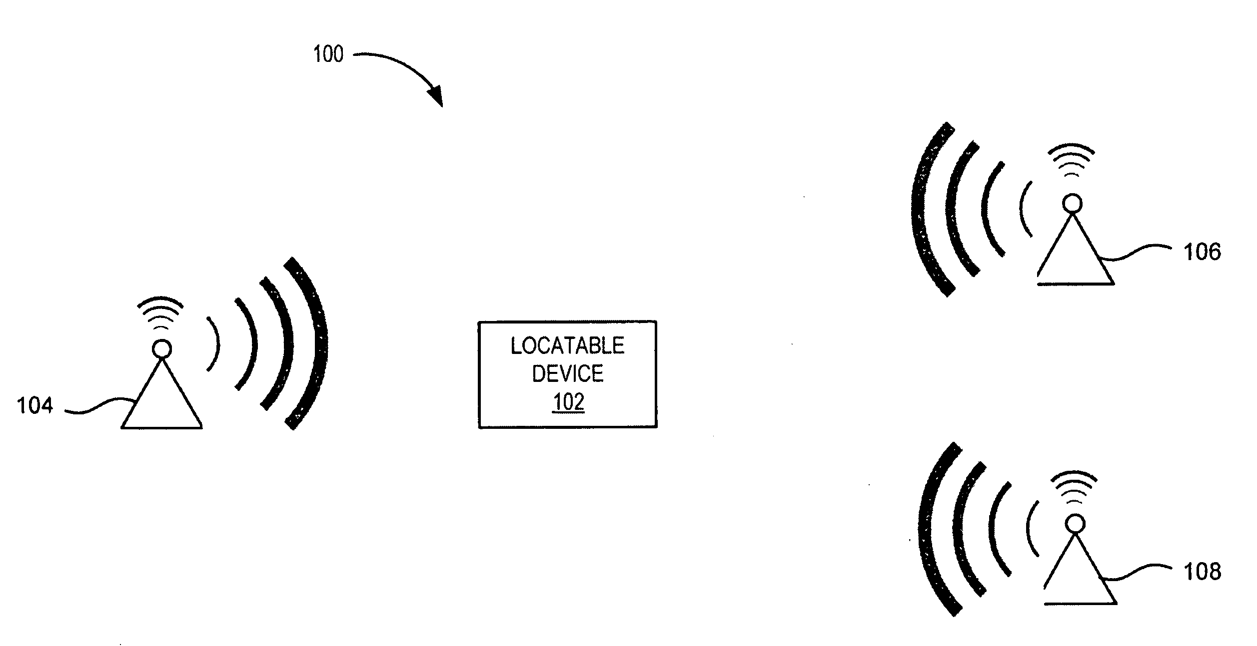
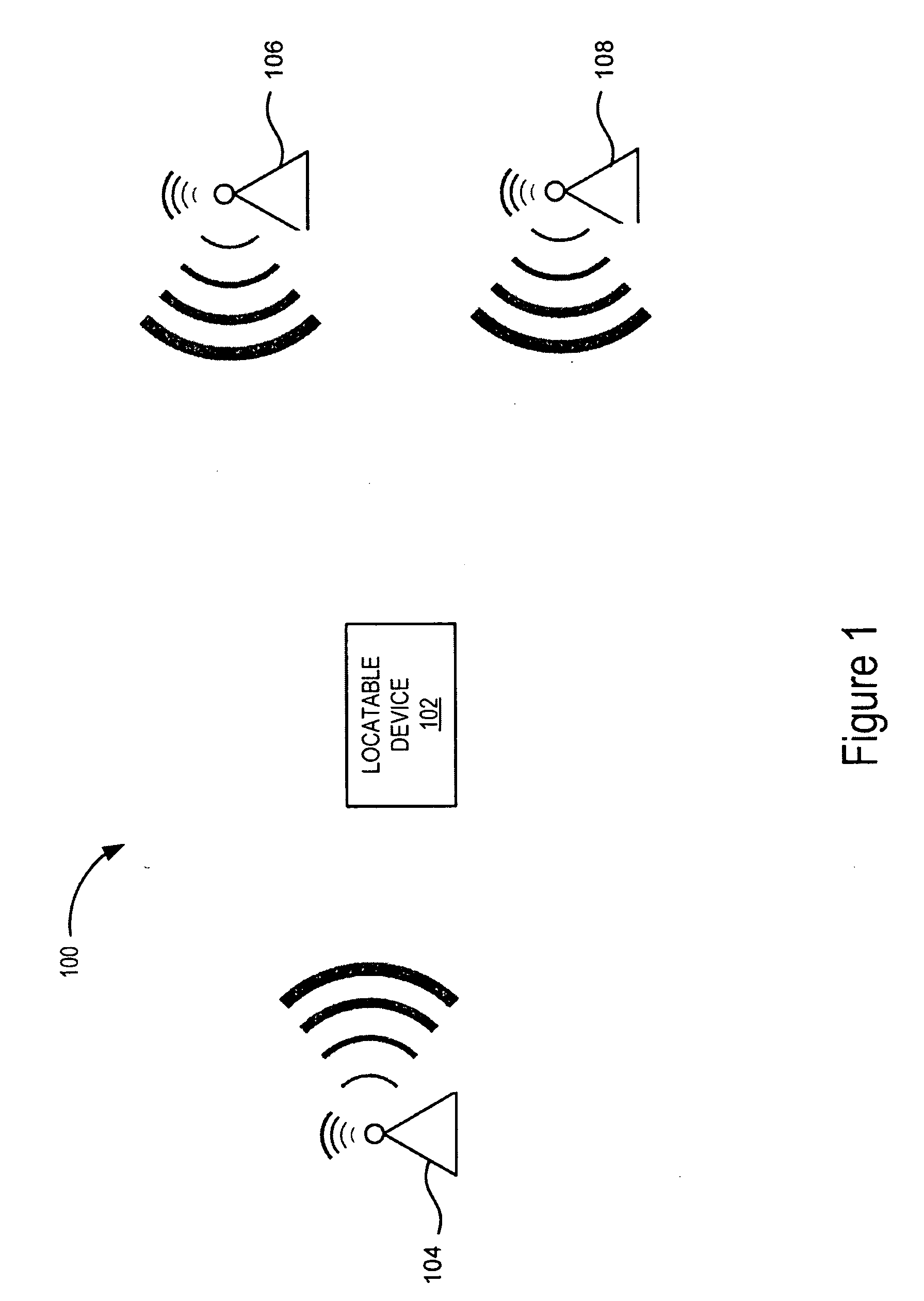
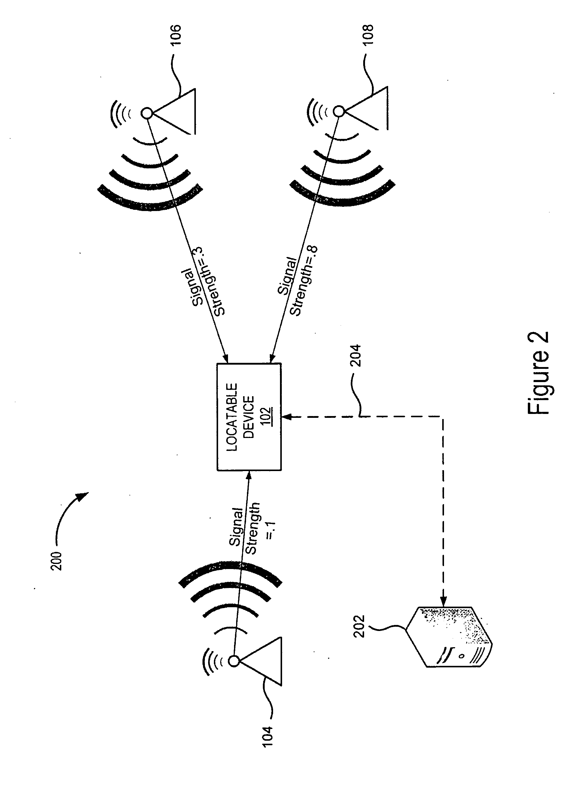
[0081]Referring now to FIG. 9, one embodiment of a method for determining the location of the locatable device 102 will be described. The method begins by receiving 902 location information from a plurality of access points 104, 106 and 108. For example the location information can be a geographic code or a prefix and a geographic code. In one embodiment, the method receives location information from at least three access points. While the geographic information from one access points can be used to determine the general location, it will result in a number of possible locations. Next method determines the signal strength of the signal received from each access point 104, 106 and 108. Referring now also to FIG. 2, example signal strengths for each access point is shown. The method then computes 906 the geometric center, C, of the access points 104, 106 and 108. Next method normalizes 908 the signal strength received from each access point 104, 106 and 108. For example, the signal st...


PUM


Abstract

The present invention provides systems and methods for self-labeling access points with their geographic location from received beacon frames. In particular, the present invention transmits beacon frames including temporary location information from mobile devices. The beacon frames are received by an access point, filtered by the access point and then used to determine a location. Once the location has been determined, the access point uses the determined location to self-label itself by converting the location information to a geographic code and inserting it as part of the SSID of the access point's beacon signal. The present invention also includes a number of methods using geographic codes including a method for generating and transmitting geographic codes for mobile devices, a method for determining a location of an access point, a method for self-labeling an access point, and a method for filtering beacon frames.

Description

CROSS REFERENCE TO RELATED APPLICATIONS[0001]This application is a continuation-in-part application of U.S. patent application Ser. No. 12 / 132,507, titled “Applications For Geographically Coded Access Points,” filed Jun. 3, 2008, and U.S. patent application Ser. No. 12 / 132,508, titled “Applications For Geographically Coded Access Points,” filed Jun. 3, 2008. This application also claims priority under 35U.S.C. § 119(e) from U.S. Provisional Patent Application No. 60 / 977,055, titled “Geographic Tagging of Network Access Points,” filed Oct. 2, 2007, and from U.S. Provisional Patent Application No. 60 / 979,659, titled “Applications And Users Of GeoFi System” filed Oct. 12, 2007, both of which are incorporated by reference herein in their entirety.BACKGROUND OF THE INVENTION[0002]1. Field of the Invention[0003]The present invention relates to the field of geographic location systems in general, and specifically, to the use of network access points to provide geographic information. Still...

Claims


Application Information

Patent Timeline
Patent Type & Authority Applications(United States)
IPC IPC(8): H04W64/00
CPCG01C21/206H04W64/003G01S5/0236
Inventor PIERSOL, KURT W.BARRUS, JOHN W.SAVITZKY, STEPHEN R.CHEMISHKIAN, SERGEY
Owner RICOH KK
Why Eureka
Try Eureka