
Mobile Navigation System with Graphic Crime-Risk Display

a navigation system and graphic technology, applied in traffic control systems, navigation instruments, instruments, etc., can solve problems such as false sense of security, and achieve the effect of high crime and safety-based routing

Active Publication Date: 2010-04-22
RIO SISA IDEA FARM
View PDF10 Cites 41 Cited by
  • Summary
  • Abstract
  • Description
  • Claims
  • Application Information

AI Technical Summary

Benefits of technology

[0005]The present invention provides a GPS system that provides a graphical display of the risk of criminal activity in the area to put a traveler to an unfamiliar city on a more equal footing with those more familiar with the area. Such data, by giving travelers a more complete picture of their surroundings, can assist the traveler in making informed decisions about travel routes, stopping points, and schedules. The graphical display of criminal activity risk can distinguish between different types of criminal activities, the severity of the risk, the geographic scope of the risk, and even the risk as a function of time of day.
[0007]Specifically then the present invention provides a method and apparatus for improving traveler safety comprising in which a GPS receiver is used to obtain substantially real time location information related to a position of the vehicle holding the GPS receiver. A dynamic display of a street map following the position of the vehicle using stored street map data is together with multiple shaded zones in the dynamic display of the street map, the multiple shaded zones depicting the crime data in the locations of the shaded zones using stored crime data linked to locations. The data may also be displayed with points of interest with accompanying information about crimes in that area.
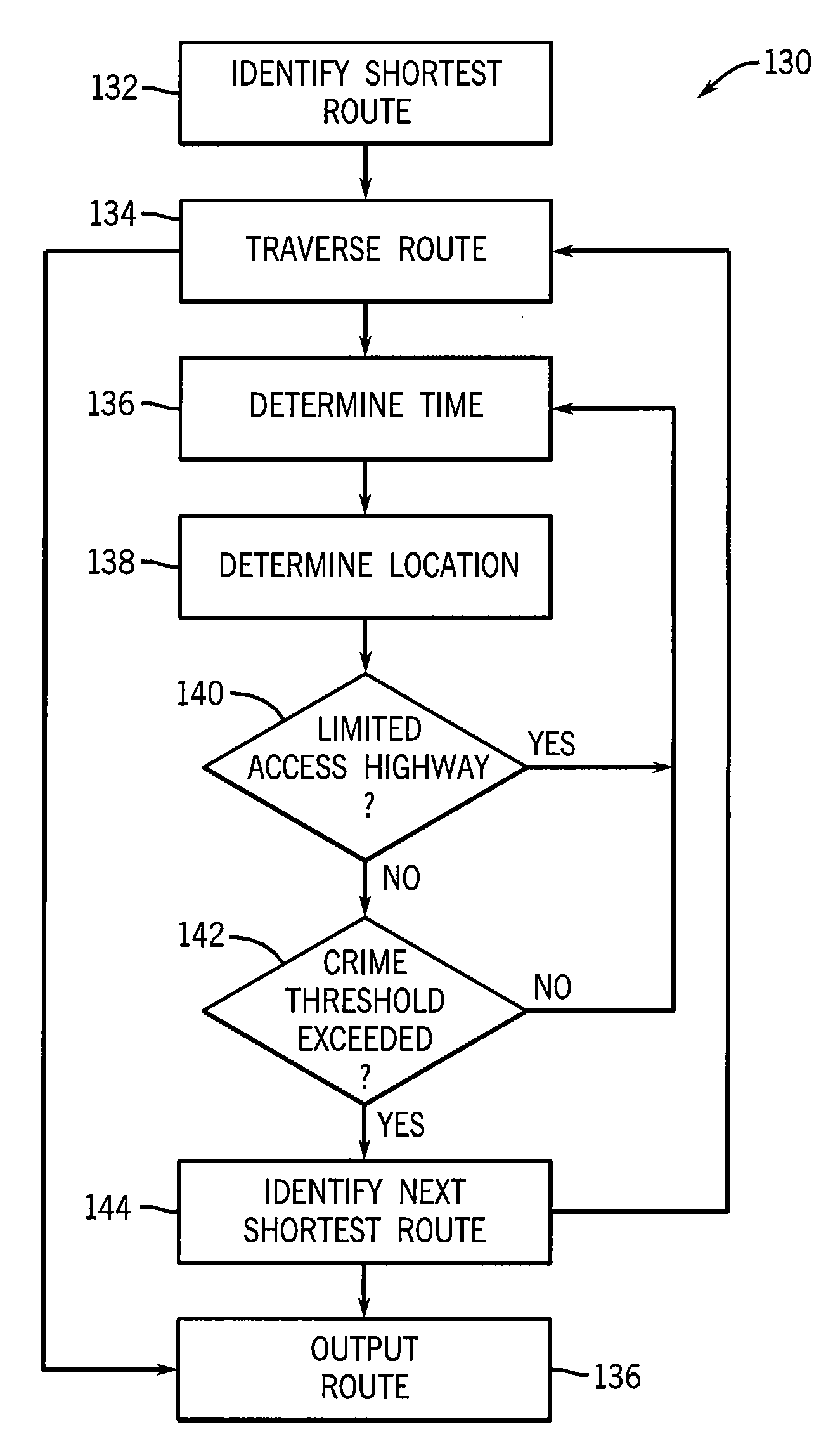
[0024]It is thus an object of the invention to reflect the lower risks to a traveler of traveling along a limited access highway to a high crime zone.

Problems solved by technology

A traveler with a GPS system and an updated map, however, may have a false sense of security based on a knowledge of their location on the map but an ignorance about the safety of that location.

Method used


Image

  • Mobile Navigation System with Graphic Crime-Risk Display
  • Mobile Navigation System with Graphic Crime-Risk Display
  • Mobile Navigation System with Graphic Crime-Risk Display

Examples


Embodiment Construction

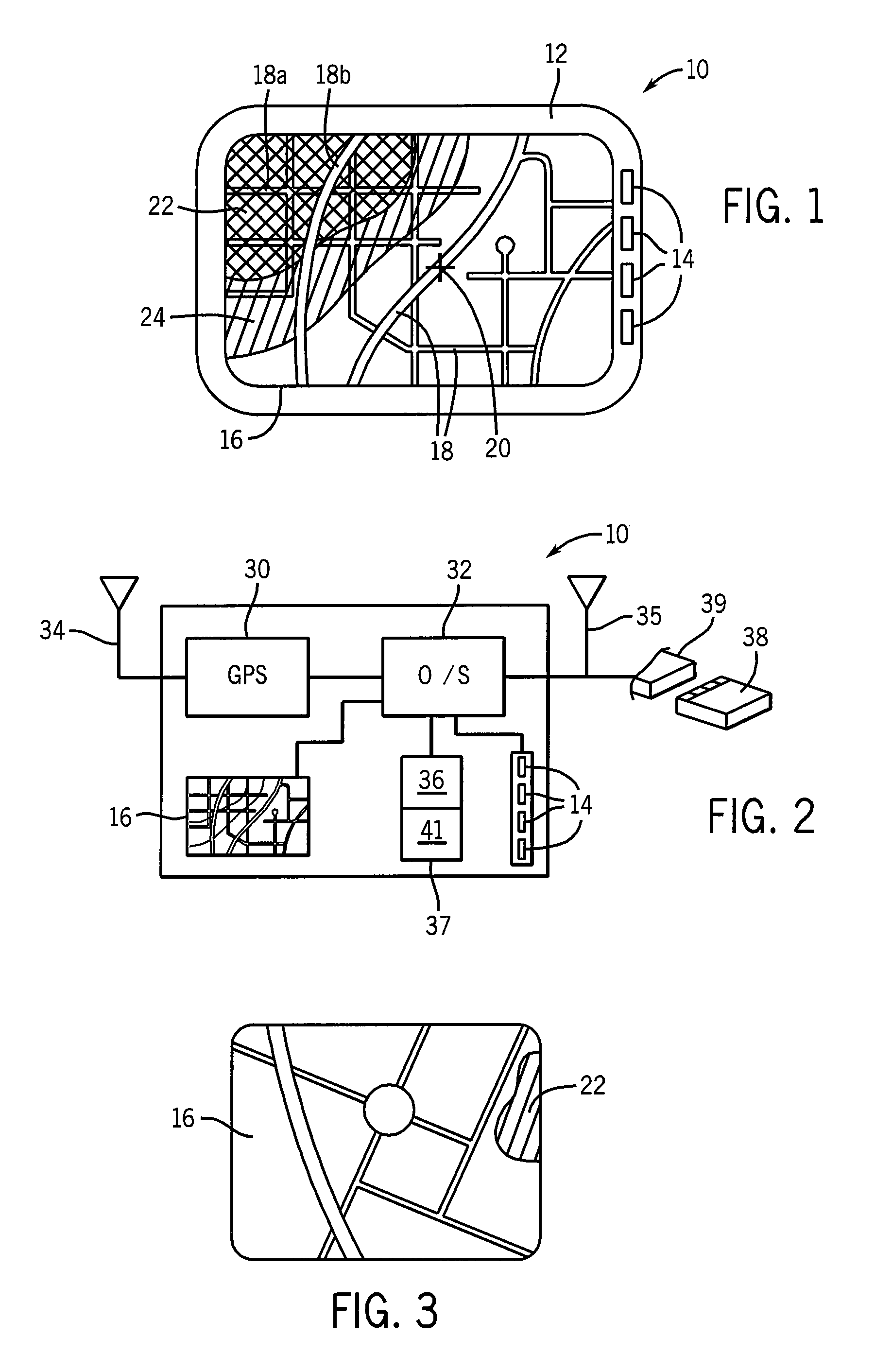
[0041]Referring now to FIG. 1, a mobile navigation device 10 of a type that may be mounted in a car or the like may provide a housing 12 supporting one or more user controllable buttons 14 on the side of a color graphic display 16. As is generally understood in the art, the display 16 may depict a map showing streets 18 and a cursor 20 showing the location of the vehicle. The orientation of the streets may change to show the direction of travel of the vehicle according to standard conventions, for example, the direction of travel being vertical on the display 16.

[0042]The present invention may further provide for a first and second zone of shading 22 and 24 superimposed on the map and depicting a measure of the crime in the vicinity of the cursor 20. The shading may be different brightnesses, colors, or highlighting, a density of points (either randomly placed or each indicating a crime), or simply boundary markings according to techniques well known in the art and may cover particu...


PUM


Abstract

A navigation system for mobile use includes street map data used for creating a dynamic map display tracking movement of the vehicle and includes crime data used to provide an overlay on the dynamic display indicating a risk of crime to the vehicle's occupants from the surrounding area. Crime data may be harvested from police websites and / or generated using statistical correlation techniques from other proxy information. Presented crime data indicate crime risk, type of crime, crime date or time of occurrence, and linkage to environmental conditions such as type of weather, temperature, and moonlight.

Description

CROSS REFERENCE TO RELATED APPLICATION[0001]This application claims the benefit of U.S. provisional application 60 / 913,894 filed Apr. 25, 2007, the U.S. provisional application 60 / 990,113 filed Nov. 26, 2007, and PCT Application PCT / US2008 / 061482 filed Apr. 25, 2008, all hereby incorporated by reference.BACKGROUND OF THE INVENTION[0002]The present invention relates to navigation devices for use by travelers and in particular to a navigation system which provides the user with a graphic representation of the crime risk in the immediate environment.[0003]GPS and other navigation systems for portable use may contain digital maps of specific areas and may superimpose a user's location determined by the GPS on a graphical representation of the map. While the maps used in GPS systems currently are relatively static, it is also known to provide an ability to download updated or new maps with the GPS system to keep the loaded map system current, to load new maps for new areas or use wireles...

Claims


Application Information

Patent Timeline
IPC IPC(8): G01C21/36G06F17/30
CPCG01C21/367
Inventor TRINKO, THOMASHAGER, PAULBAXTER, KEITH
Owner RIO SISA IDEA FARM
Learn More