

Automated landing zone site surveying
a landing zone and site surveying technology, applied in traffic control systems, instruments, and reradiation, etc., can solve problems such as visibility reduction and acute problems
- Summary
- Abstract
- Description
- Claims
- Application Information
AI Technical Summary
Problems solved by technology
Method used
Image

Examples
Embodiment Construction
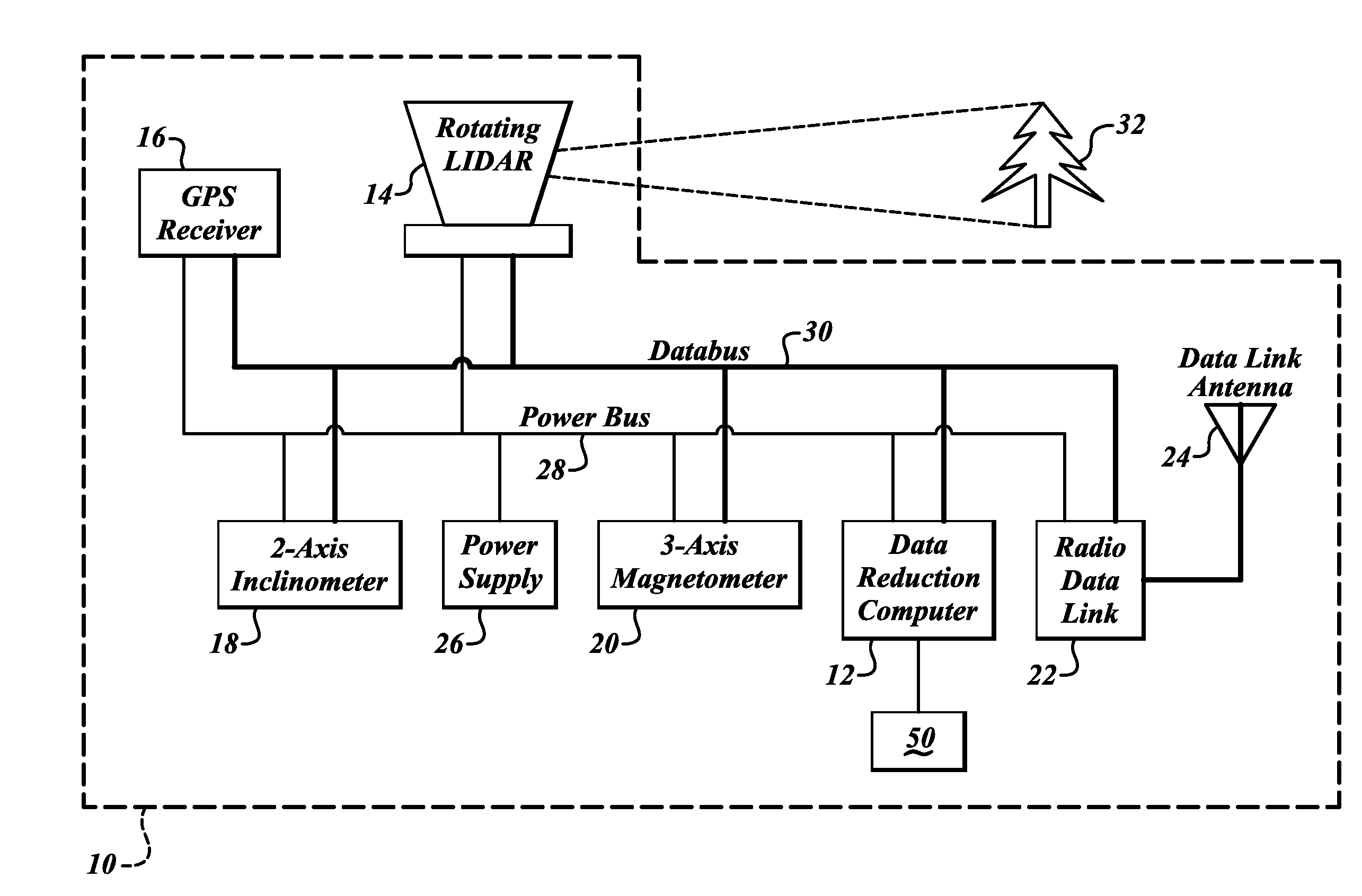
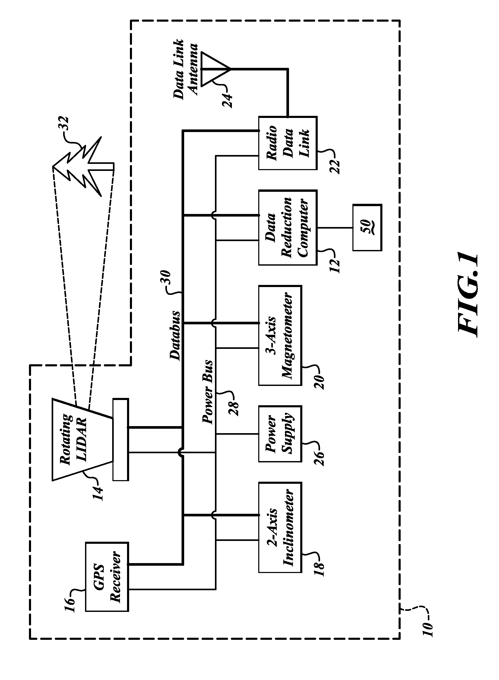
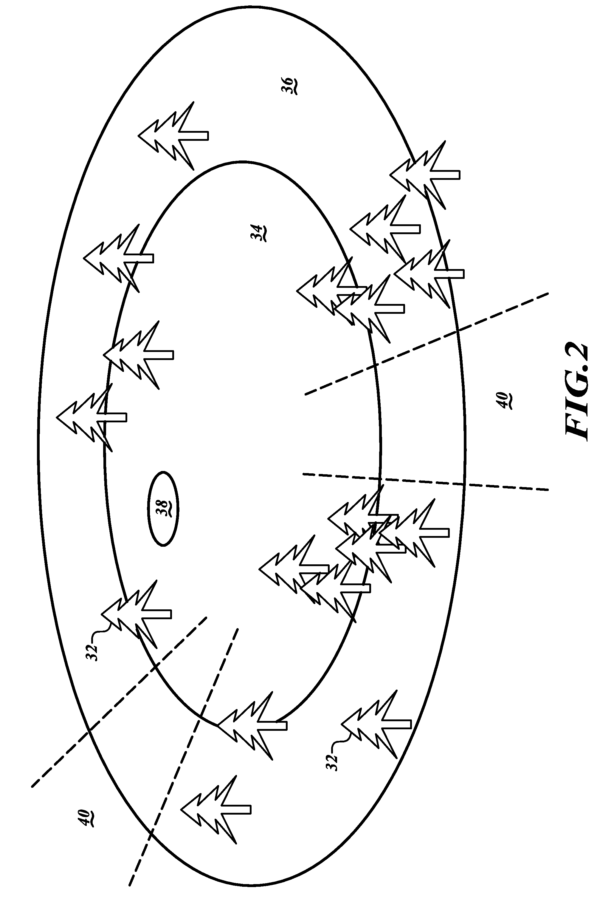
[0006]An embodiment of the invention automatically surveys the terrain of a target landing zone for dimensions and locations of potential obstacles to landing therein. This survey information is corrected for inclination of the surveying system of the embodiment and oriented to true north. The resultant data is processed to produce a three-dimensional image or map of approaches to the landing zone, as well as the landing zone itself This data and / or the 3-D image can be transmitted to the flight crews of one or more aircraft desiring to enter the landing zone. Using this data, the flight crews can plot a safe approach to the landing zone through a virtual image of the obstacles. Alternatively, the survey data can be used to calculate safe approach paths consisting of directions and altitudes, and the safe approaches and this information can be transmitted to the flight crews of one or more aircraft desiring to enter the landing zone. An embodiment may be mounted to, or otherwise car...
PUM
 Abstract
Description
Claims
Application Information