Mesh estimation of terrain

Active Publication Date: 2011-10-20
CATERPILLAR INC
View PDF1 Cites 43 Cited by
  • Summary
  • Abstract
  • Description
  • Claims
  • Application Information

AI Technical Summary

Problems solved by technology

Processing the three-dimensional problem generally consumes a considerable amount of computing resources.
This work does not

Method used


Image

  • Mesh estimation of terrain
  • Mesh estimation of terrain
  • Mesh estimation of terrain

Examples


Embodiment Construction

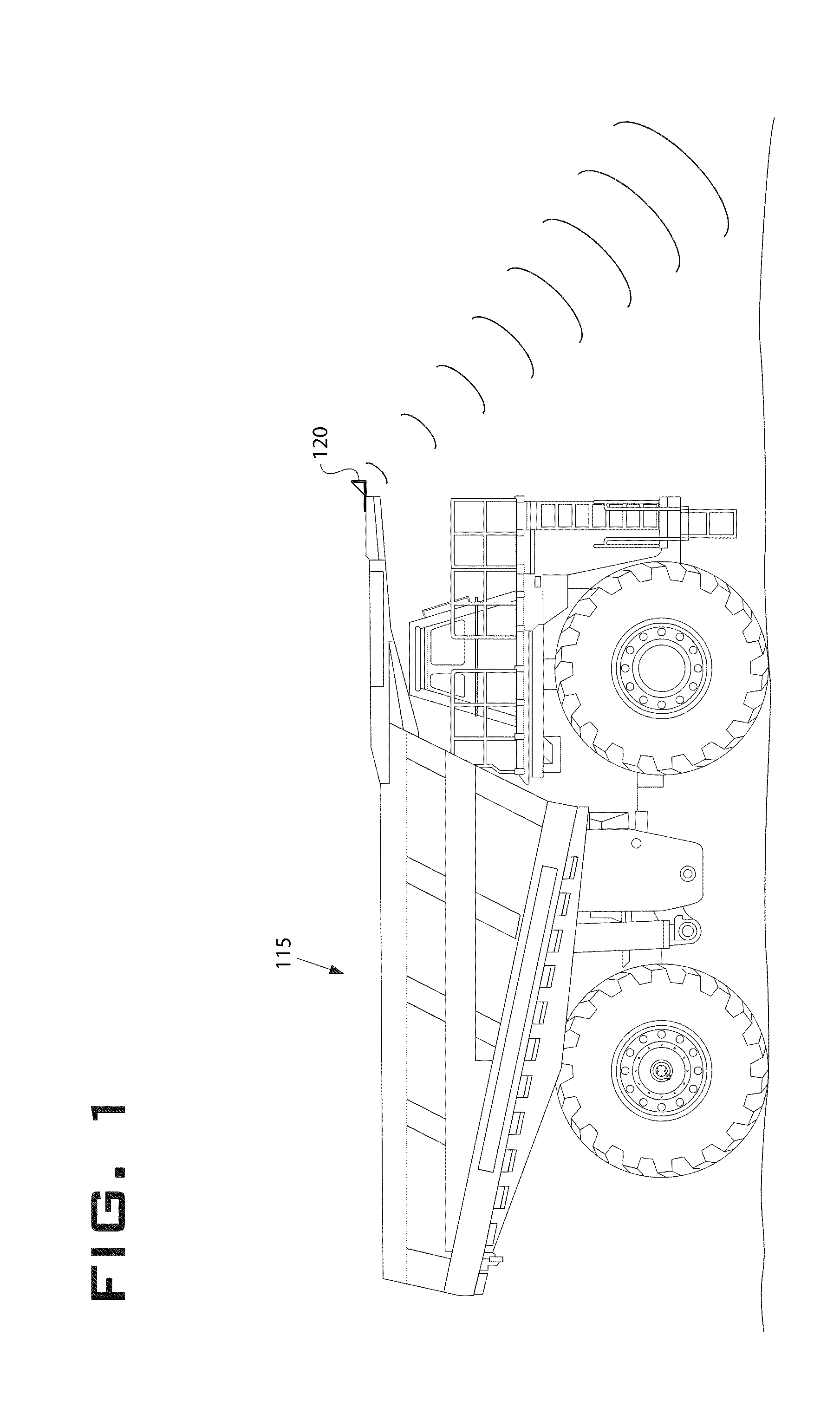
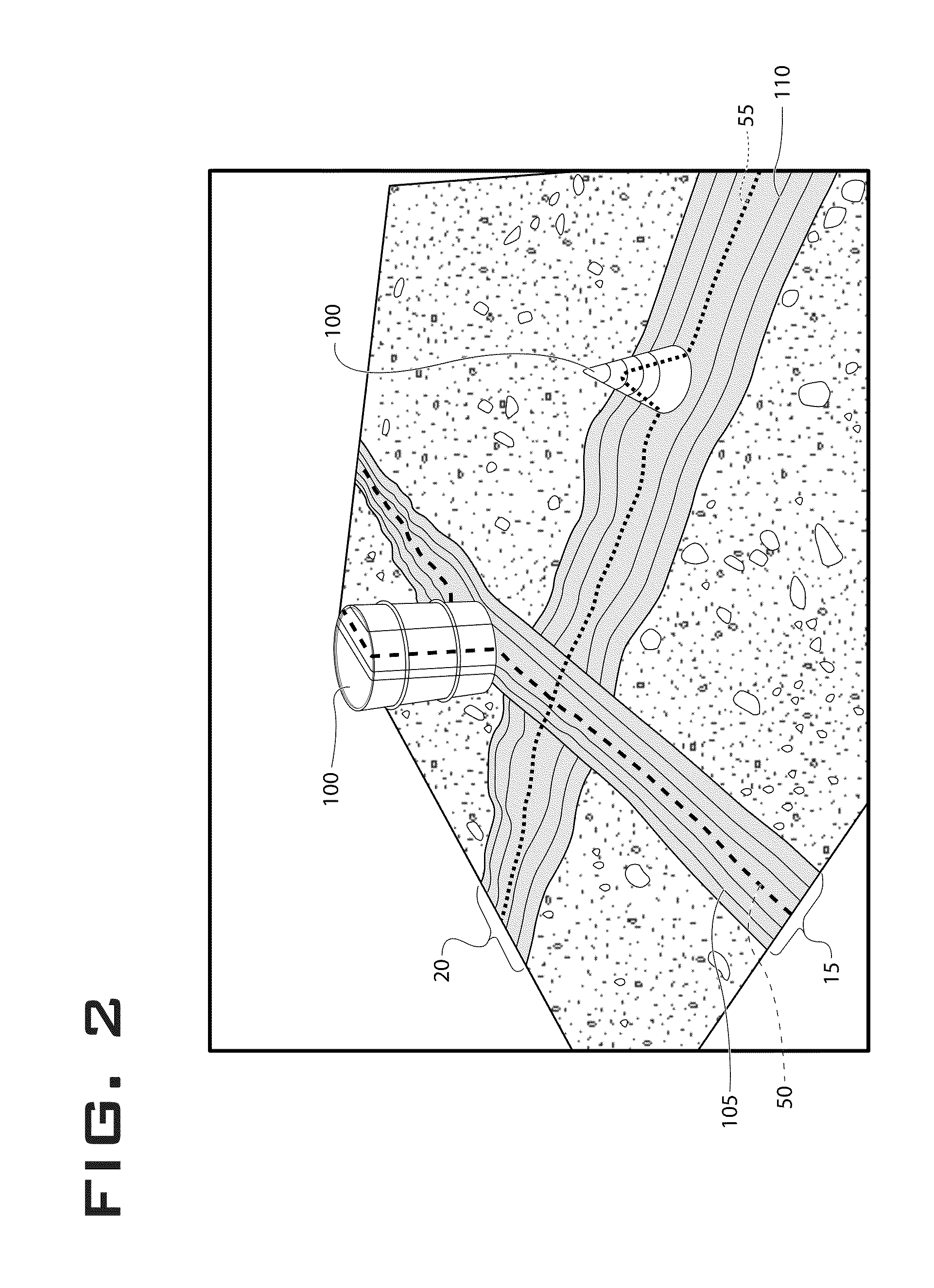
[0023]The current disclosed method involves processing 3D point cloud data 10 and providing an estimate of terrain 5. The 3D point cloud 10 may be obtained from a sensor 120 mounted on a vehicle 115. The sensor could use LIDAR, RADAR, stereo vision, or other well-known technology. The data could also be generated from a source other than a vehicle-mounted sensor, such as satellite data or surveying data.

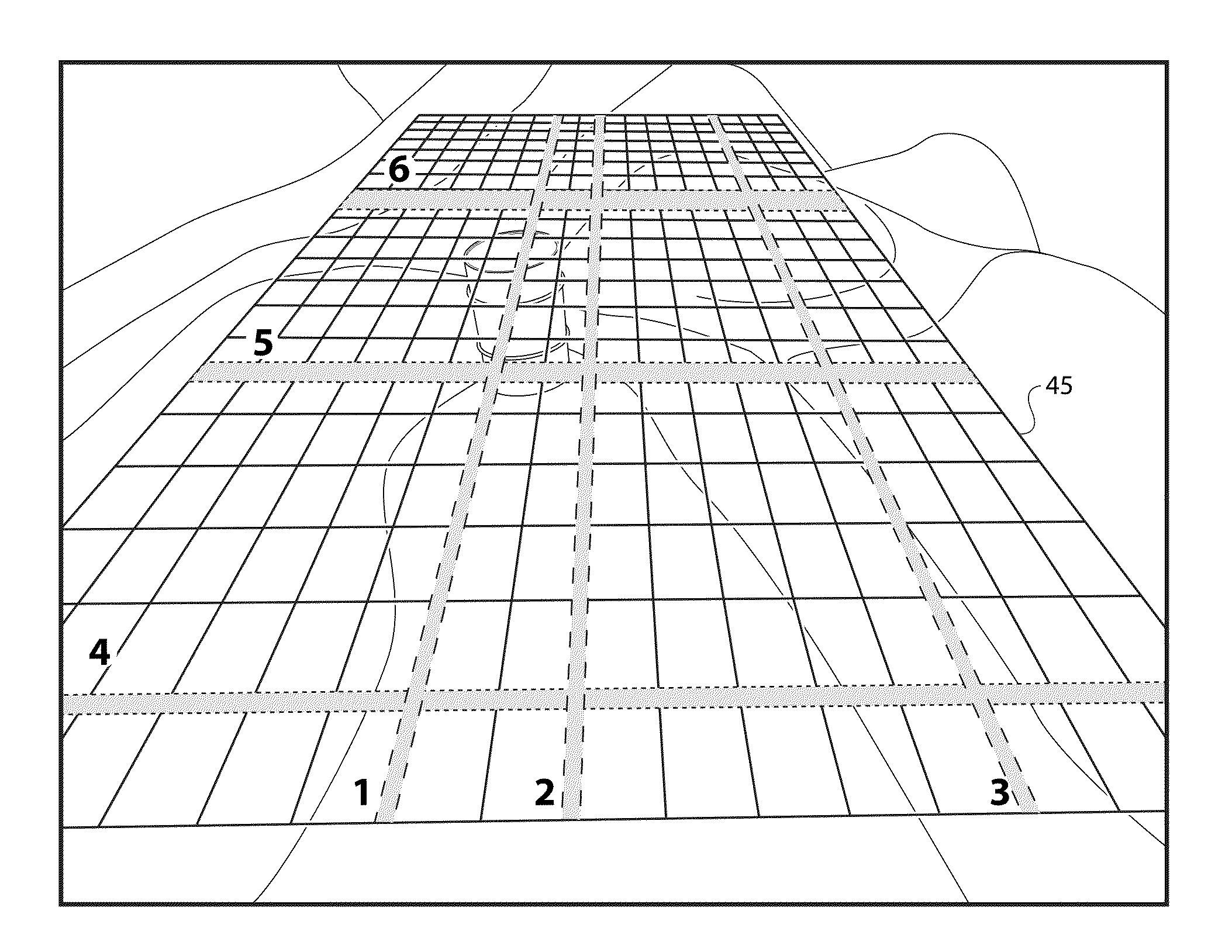
[0024]The method described takes advantage of both local and global analysis and fitting. A set of two-dimensional (hereon referred to as 2D) orthogonal models replaces the three-dimensional (hereon referred to as 3D) global model. In one implementation, longitudinal 75 and lateral 80 models replace the 3D global model. Alternatively, radial and concentric models or another orthogonal model may be employed. This greatly reduces the computational complexity of the problem. Each of these models represents the projection of a 3D point lying of a world “slice” with a given width. The loc...


PUM


Abstract

A method for generating a three dimensional grid of terrain includes receiving data representing a three-dimensional point cloud and generating a plurality of slices of the data. The method evaluates the slices using a swarm intelligence algorithm. The method is able to identify both terrain and objects. The terrain can also be identified as traversable terrain.

Description

RELATED APPLICATIONS[0001]This application is based upon and claims the benefit of priority from U.S. Provisional Application No. 61 / 325,503 by Andrea Cappalunga et al., filed Apr. 19, 2010, the contents of which are expressly incorporated herein by reference.TECHNICAL FIELD[0002]The present disclosure relates generally to a method for generating a map, and more specifically to a method for generating a three-dimensional map of terrain.BACKGROUND[0003]Analysis of three-dimensional data sets in order to obtain terrain maps has been explored for some time. Processing the three-dimensional problem generally consumes a considerable amount of computing resources. Dividing the larger three-dimensional problem into smaller three-dimensional and two-dimensional problems, and applying swarm intelligence methods can provide efficiency improvements. The need also exists for identifying objects contained within the three-dimensional data set.[0004]One example is disclosed by Raed Abu-zitar et. ...

Claims


Application Information

Patent Timeline
IPC IPC(8): G06T15/00G16B45/00
CPCG06T17/05G06T19/00G06T15/00
Inventor MCDANIEL, MICHAEL S.CAPPALUNGA, ANDREADUTTA, SUSMITABROGGI, ALBERTOCATTANI, STEFANO
Owner CATERPILLAR INC
Why Eureka
Try Eureka