System and method of reference position determination

a reference position and system technology, applied in the field of system and method of reference position determination, can solve the problem of taking a long time for the base station to calculate an accurate new reference position

Inactive Publication Date: 2011-12-15
LEICA GEOSYSTEMS AG
View PDF3 Cites 16 Cited by
  • Summary
  • Abstract
  • Description
  • Claims
  • Application Information

AI Technical Summary

Benefits of technology

[0032]converting two or more of the components of a coordinate set of a stored reference position stored in a memory to binary string format;
[0033]converting two or more of the components of a coordinate set of a current estimate position determined by a GNSS receiver to binary s

Problems solved by technology

The GNSS measurement errors which are corrected via differential techniques come about mostly due to atmospheric factors such as the amount of water vapour in the troposphere, or distur

Method used


Image

  • System and method of reference position determination
  • System and method of reference position determination
  • System and method of reference position determination

Examples


Embodiment Construction

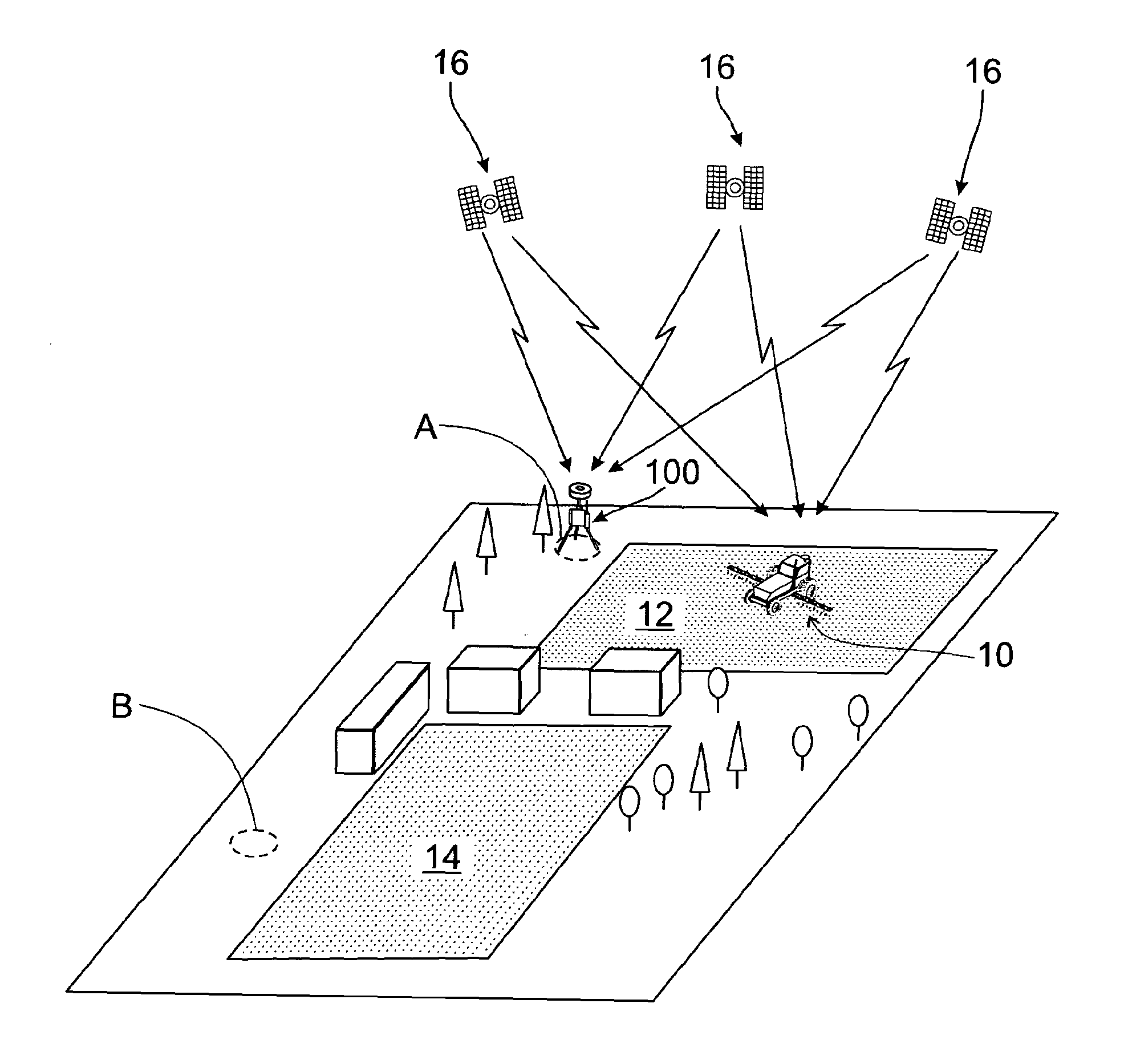
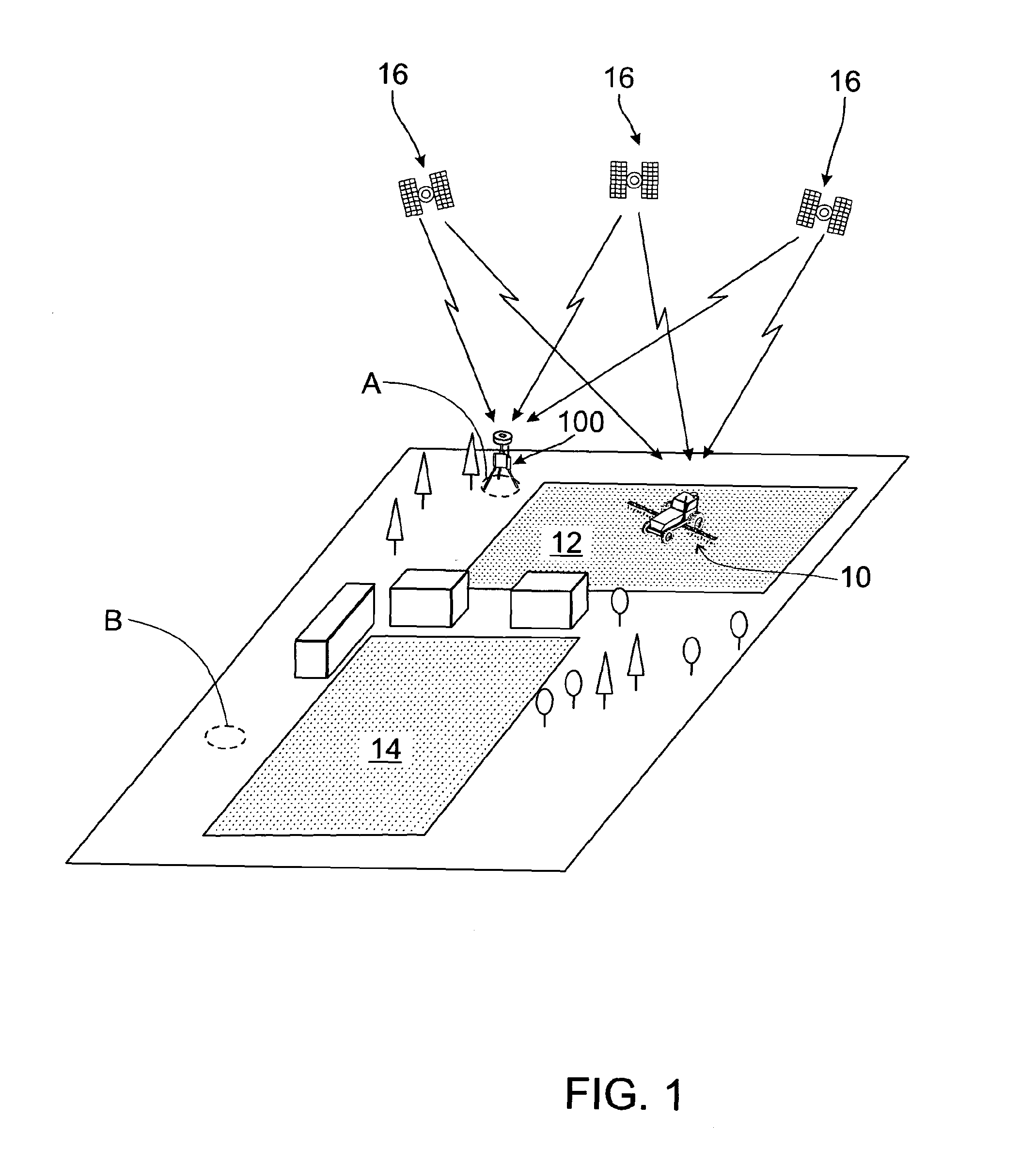
[0045]The invention will be described with reference to a DGPS for guidance of an agricultural vehicle, but is similarly applicable to any DGNSS system. The reference position determination system and method of the invention determines a reference position for a portable DGPS base station and assigns the reference position to the base station.

[0046]FIG. 1 shows one embodiment of an agricultural vehicle 10 utilizing a DGPS to navigate a tract of land 12. A portable base station 100 of the DGPS is located at a reference position “A” adjacent the tract of land 12. Another tract of land 14, which was previously worked by the vehicle 10, has a reference position “B” where the base station 100 was located when the tract of land 14 was worked.

[0047]The DGPS includes GPS satellites 16 which send GPS signals to both the base station 100 and a roving receiver of the vehicle 10.

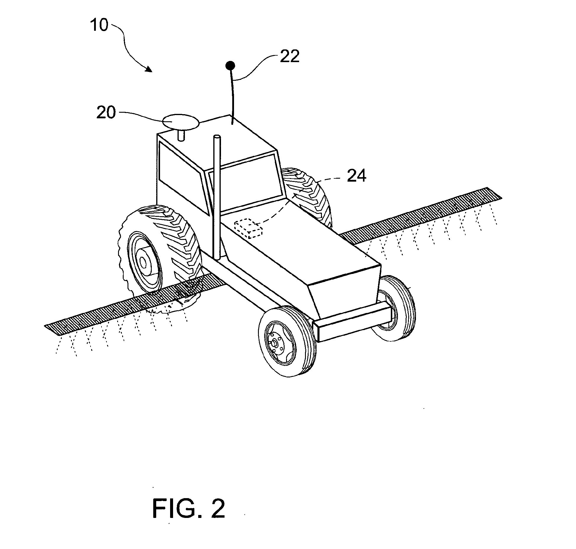
[0048]FIG. 2 shows the vehicle 10 including a GPS antenna 20 and a radio antenna 22. A roving GPS receiver 24 of the ...


PUM


Abstract

A method of reference position determination for a DGNSS base station. The base station comprises a memory, a logic controller and a GNSS receiver. Stored reference positions are stored in the memory as coordinate sets comprising components. The GNSS receiver determines a current estimate position of the base station as a coordinate set comprising components. The logic controller retrieves a stored reference position, converts the components of the stored reference position and the current estimate position to binary string format. The current estimate position is matched to the stored reference position by matching the binary string format components of the current estimate position with the binary string format components of the stored reference position. If the stored reference position is matched to the current estimate position, the base station is assigned the stored reference position as its reference position.

Description

FIELD OF THE INVENTION[0001]The present invention relates to a system and method of reference position determination. In particular, the invention relates to a system and method of reference position determination for use with Differential Global Navigation Satellite Systems (DGNSS) such as Differential Global Positioning Systems (DGPS)BACKGROUND TO THE INVENTION[0002]Many applications use methods and systems for position determination, e.g. a geodetic instrument, a vehicle or the like, which are based on global positioning systems, such as, for example, GPS, GLONASS or the European Galileo system. These Global Navigation Satellite Systems (GNSS) are based on the reception of satellite signals.[0003]DGNSS are satellite positioning systems in which differential correction data is determined using a base station at a precisely known location (the reference position), which differential correction data is then transmitted to a roving GNSS receiver to improve the accuracy of the roving ...

Claims


Application Information

Patent Timeline
IPC IPC(8): H04B1/00
CPCG01S19/50G01S19/07G01S19/071
Inventor MCMANUS, IAN
Owner LEICA GEOSYSTEMS AG
Why Eureka
Try Eureka