

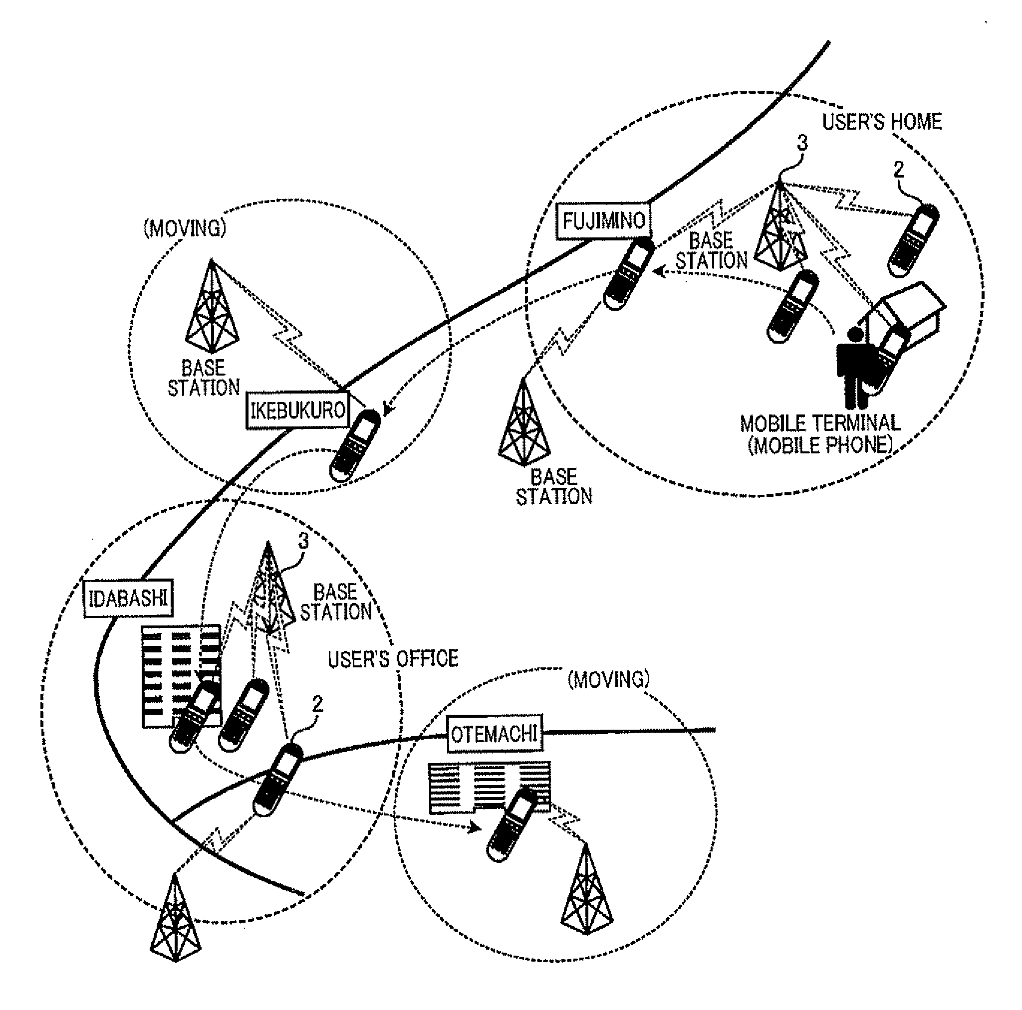
Estimation of significant places visited by mobile-terminal user based on communications log to base stations
a mobile terminal and communication log technology, applied in the field of mobile terminal user estimation based on communications log to base stations, can solve the problems of shortened increased quantity of data packets sent from the mobile terminal, and calculation velocity of the mobile terminal can have a substantial amount of error from the actual velocity, so as to reduce the accuracy of estimation, reduce the number of data packets sent, and shorten the battery life of the mobile terminal
- Summary
- Abstract
- Description
- Claims
- Application Information
AI Technical Summary
Benefits of technology
Problems solved by technology
Method used
Image

Examples
Embodiment Construction
[0060]According to the invention, the following modes are provided as illustrative embodiments of the invention.
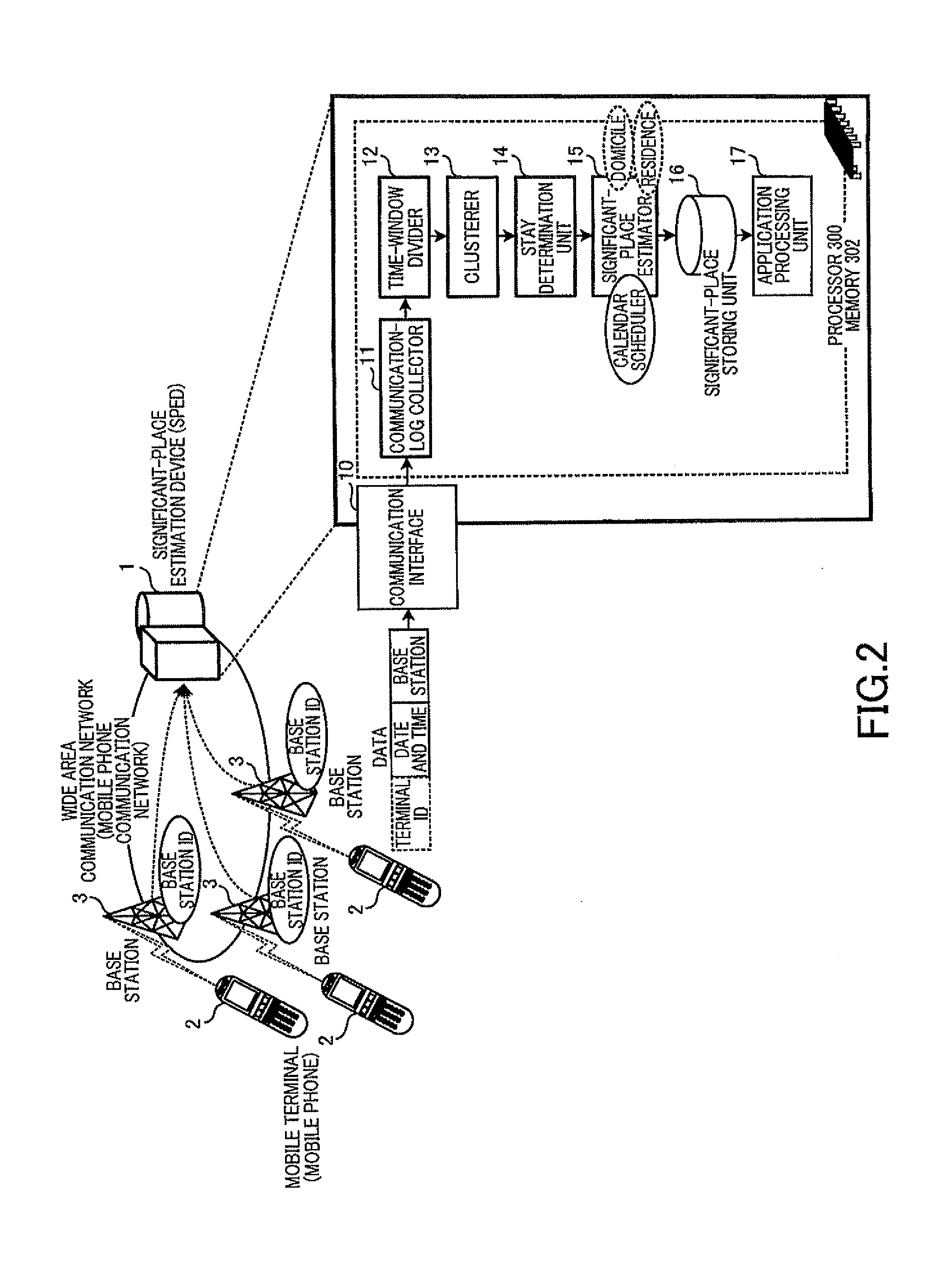
[0061]According to a first mode of the invention, there is provided the apparatus according to the first aspect of the invention, wherein the clusterer is further configured to generate a plurality of clusters each of which includes the sub-set of BS IDs, based on a probability distribution with which the plurality of BS IDs appear in each time-windowed segment, to thereby assign at least one of the clusters which represents each time-windowed segment, as the representing cluster, to each time-windowed segment.
[0062]According to a second mode of the invention, there is provided the apparatus according to the first mode, wherein the sub-set of communication events belonging to each time-windowed segment are denoted as a frequency vector, the frequency vector having a plurality of elements allocated to the plurality of BS IDs, respectively, each element of the frequency vect...
PUM
 Abstract
Description
Claims
Application Information