

Systems and methods for generating electronic map displays with points-of-interest information
a technology of electronic map and information, applied in the field of computer processing and electronic map display, can solve the problems of user unappealing, user being denied the opportunity, and not providing users that are outside the search boundary
- Summary
- Abstract
- Description
- Claims
- Application Information
AI Technical Summary
Benefits of technology
Problems solved by technology
Method used
Image

Examples
Embodiment Construction
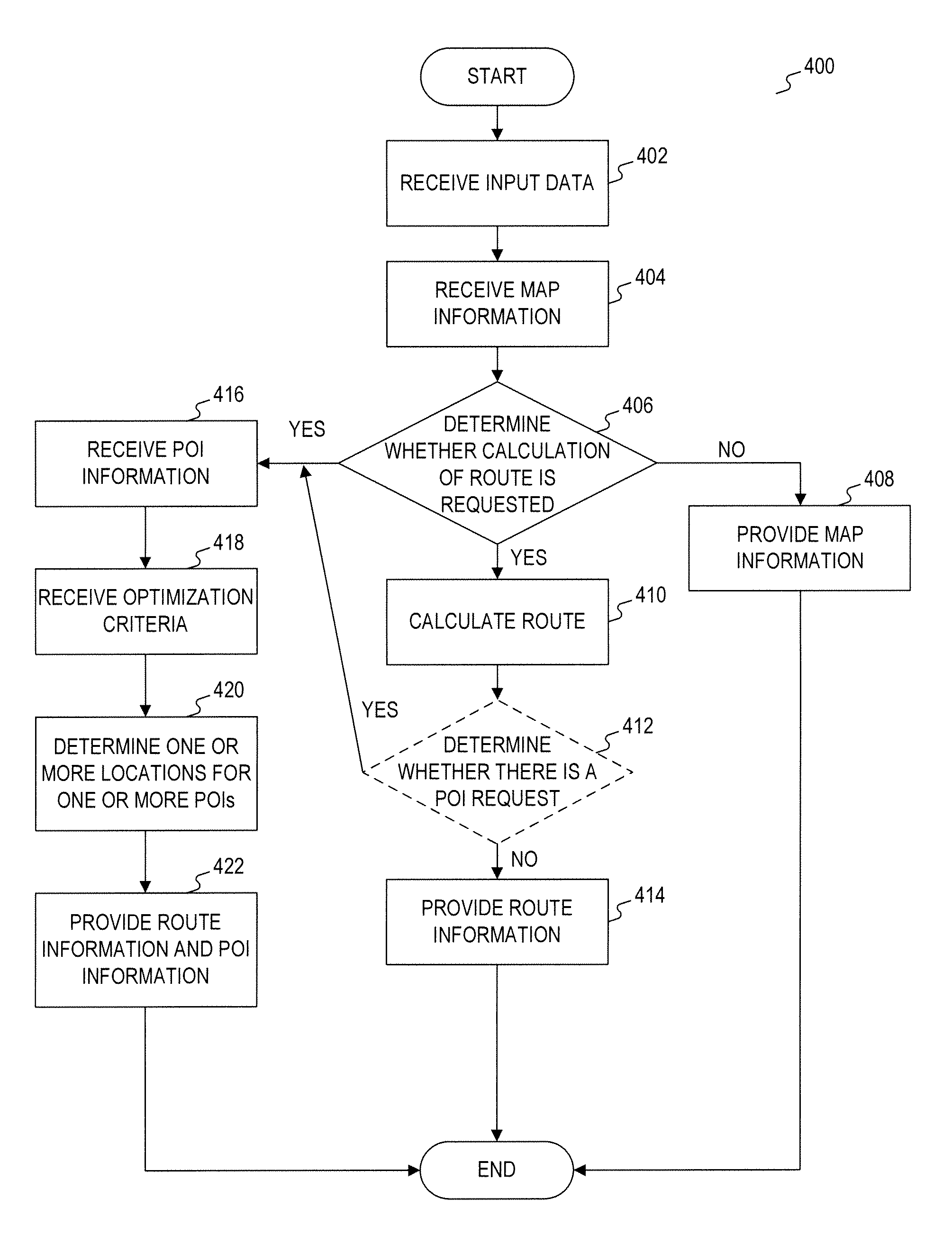
[0023]Reference will now be made in detail to exemplary embodiments of the disclosure, examples of which are illustrated in the accompanying drawings. Wherever possible, the same reference numbers will be used throughout the drawings to refer to the same or like parts.
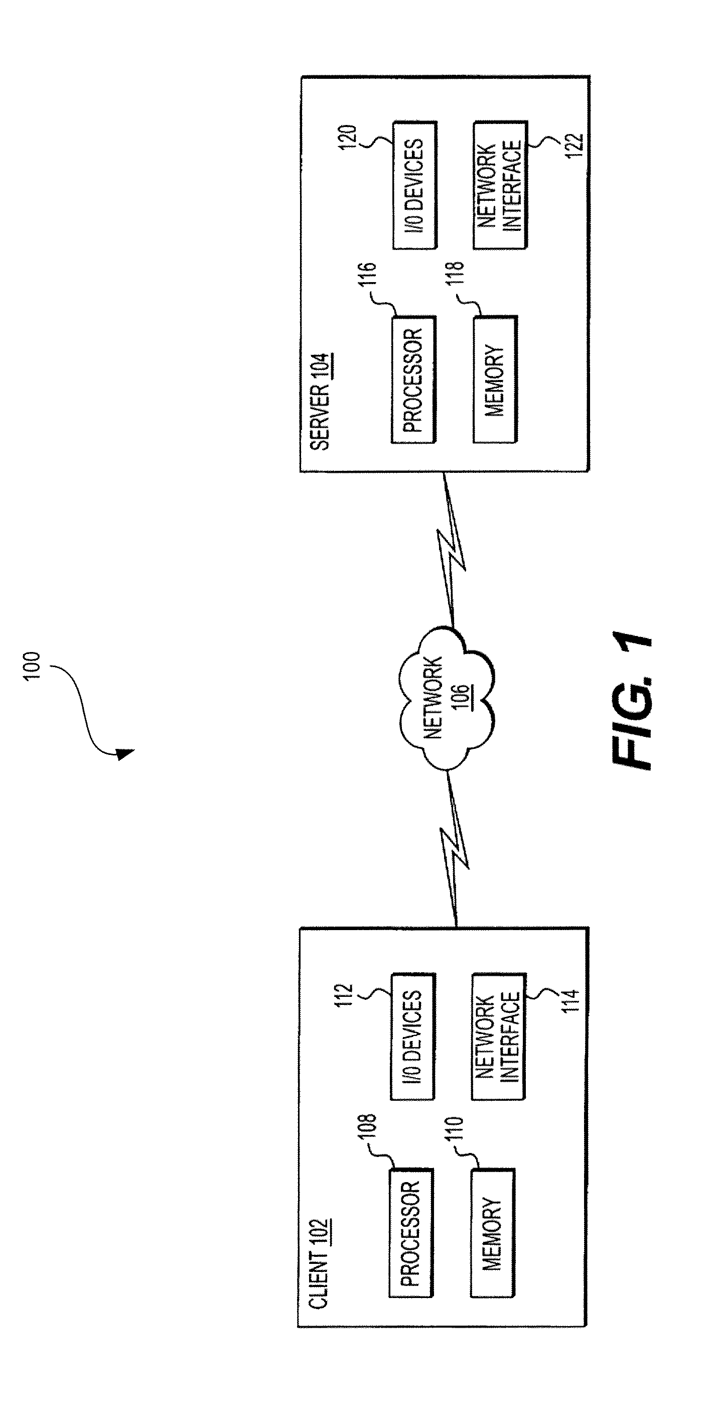
[0024]FIG. 1 is a representation of an exemplary electronic map system 100, consistent with embodiments of the present disclosure. As shown in FIG. 1, electronic map system 100 may include a client 102 and a server 104 connected via a network 106. Although only one client 102 and one server 104 are illustrated in FIG. 1, it will be appreciated that other components may be included in system 100, including a plurality of clients 102 and a plurality of servers 104, which communicate via network 106, alone and / or in combination with other networks.
[0025]By way of example, client 102 may comprise a personal computer (PC), a hand-held computer, a personal digital assistant (PDA), a portable navigation device, a mobile phone...
PUM
 Abstract
Description
Claims
Application Information