Prominence-Based Generation and Rendering of Map Features

a map feature and prominence-based technology, applied in the field of mapping systems, can solve problems such as difficulty in distinguishing map features for users

Inactive Publication Date: 2013-02-07
GOOGLE LLC
View PDF6 Cites 201 Cited by
  • Summary
  • Abstract
  • Description
  • Claims
  • Application Information

AI Technical Summary

Benefits of technology

[0007]Embodiments may be implemented using hardware, firmware, software, or a combination thereof and may be implemented in one or more computer systems or other processing systems.

Problems solved by technology

As a result, users may have difficulty distinguishing map features that may be more pertinent to their needs and search criteria when using such conventional systems.

Method used


Image

  • Prominence-Based Generation and Rendering of Map Features
  • Prominence-Based Generation and Rendering of Map Features
  • Prominence-Based Generation and Rendering of Map Features

Examples


Embodiment Construction

Introduction

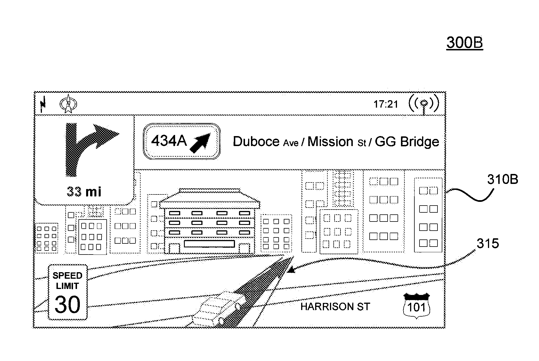
[0016]A capability for prominence-based feature generation and rendering for digital maps is provided. More specifically, embodiments relate to rendering map features such as buildings or landmarks in different rendering styles based on signals for how important a particular feature is to a search context. A search context may be, for example and without limitation, a general view of the map or a user-initiated search request for a particular point of interest or driving directions between different points of interest on the map. For example, the different rendering styles may include, but are not limited to, two-dimensional (2D) footprints, two-and-a-half-dimensional (2.5D) extruded polygons, as will be described further below, and full three-dimensional (3D) models. Furthermore, the style could include rendering scale, color, and / or visual texture. Accordingly, stylistic elements such as contrast and transparency may be adjusted based on the significance of a particula...


PUM


Abstract

A capability for prominence-based feature generation and rendering for digital maps is provided. More specifically, embodiments relate to rendering map features such as buildings or landmarks in different rendering styles based on signals for how important a particular feature is to a search context. A search context may be, for example and without limitation, a general view of the map or a user-initiated search request for a particular point of interest or driving directions between different points of interest on the map. For example, the different rendering styles may include, but are not limited to, two-dimensional (2D) footprints, two-and-a-half-dimensional (2.5D) extruded polygons, as will be described further below, and full three-dimensional (3D) models. Furthermore, the style could include color and/or visual texture.

Description

BACKGROUND[0001]1. Field[0002]Embodiments relate generally to the field of mapping systems, particularly to displaying imagery in mapping systems.[0003]2. Background[0004]Computerized mapping systems enable users to view and navigate geospatial data in an interactive digital environment. Such an interactive digital environment may be provided, for example, by a web-based mapping service accessible to a user via a web browser. Tie mapping system may also enable the user to search and view various points of interest on a digital map. Each point of interest may be geo-coded to a particular location on the map. Accordingly, information for a point of interest stored by the mapping system may include data associated with the location. Examples of such data include, but are not limited to, a name or type of business at the location (e.g., gas station, hotel, restaurant, retail store, or other business), a name or type of public place of interest at the location (e.g., public school, post ...

Claims


Application Information

Patent Timeline
Patent Type & Authority Applications(United States)
IPC IPC(8): G06T17/05G06T11/00G01C21/00
CPCG06T17/05G06T19/20G06T2210/36G06F17/30247G01C21/3638G06F17/30241G06T2219/2012G06F16/29G06F16/583
Inventor STOUT, BRYCEBREWINGTON, BRIANJONES, JONAHSAVVOPOULOS, CHRISTOS
Owner GOOGLE LLC
Why Eureka
Try Eureka