Multiple data sources pedestrian navigation system

a pedestrian navigation and data source technology, applied in the field of pedestrian navigation systems, can solve problems such as inability to reliably operate, increase the error of position fix with time, and become unreliable in obstructed

Inactive Publication Date: 2013-09-12
ELBIT SYST LTD
View PDF19 Cites 4 Cited by
  • Summary
  • Abstract
  • Description
  • Claims
  • Application Information

AI Technical Summary

Problems solved by technology

A disadvantage of dead reckoning is that since new positions are calculated solely from previous positions, the errors of the process are cumulative, so the error in the position fix grows with time.
Two known drawbacks of GPS systems are that they become unreliable in obstructed terrain such as urban canyons and become inoperative whenever the satellite cove...

Method used


Image

  • Multiple data sources pedestrian navigation system
  • Multiple data sources pedestrian navigation system
  • Multiple data sources pedestrian navigation system

Examples


Embodiment Construction

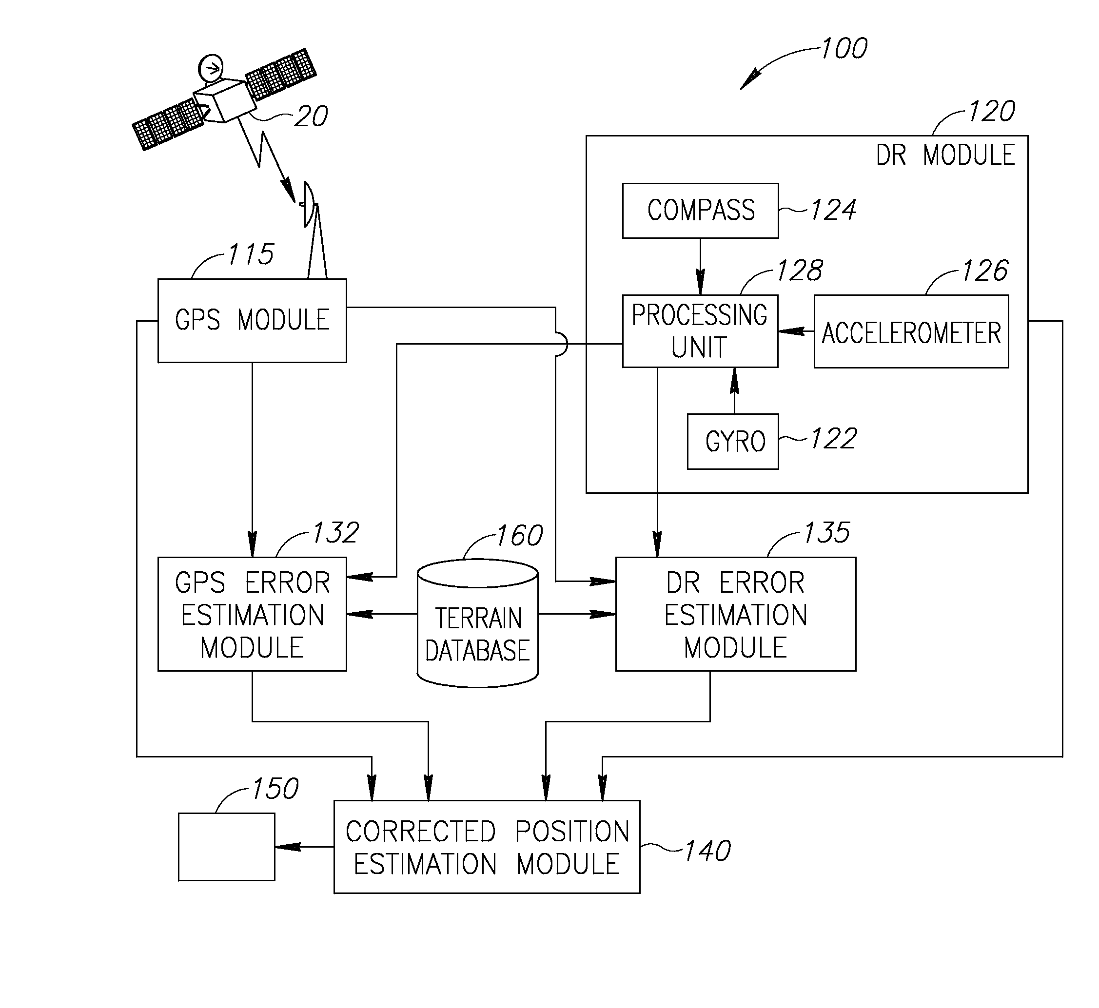
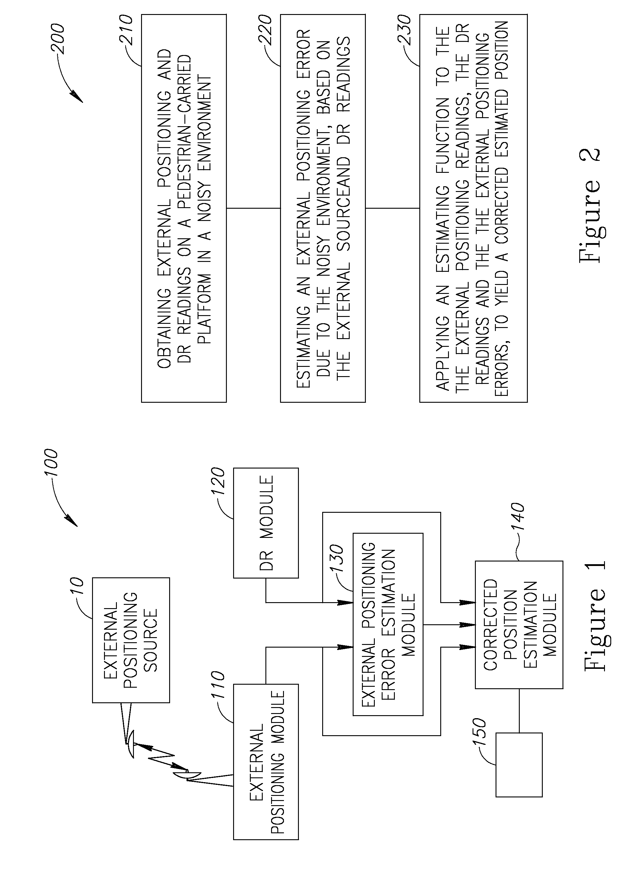
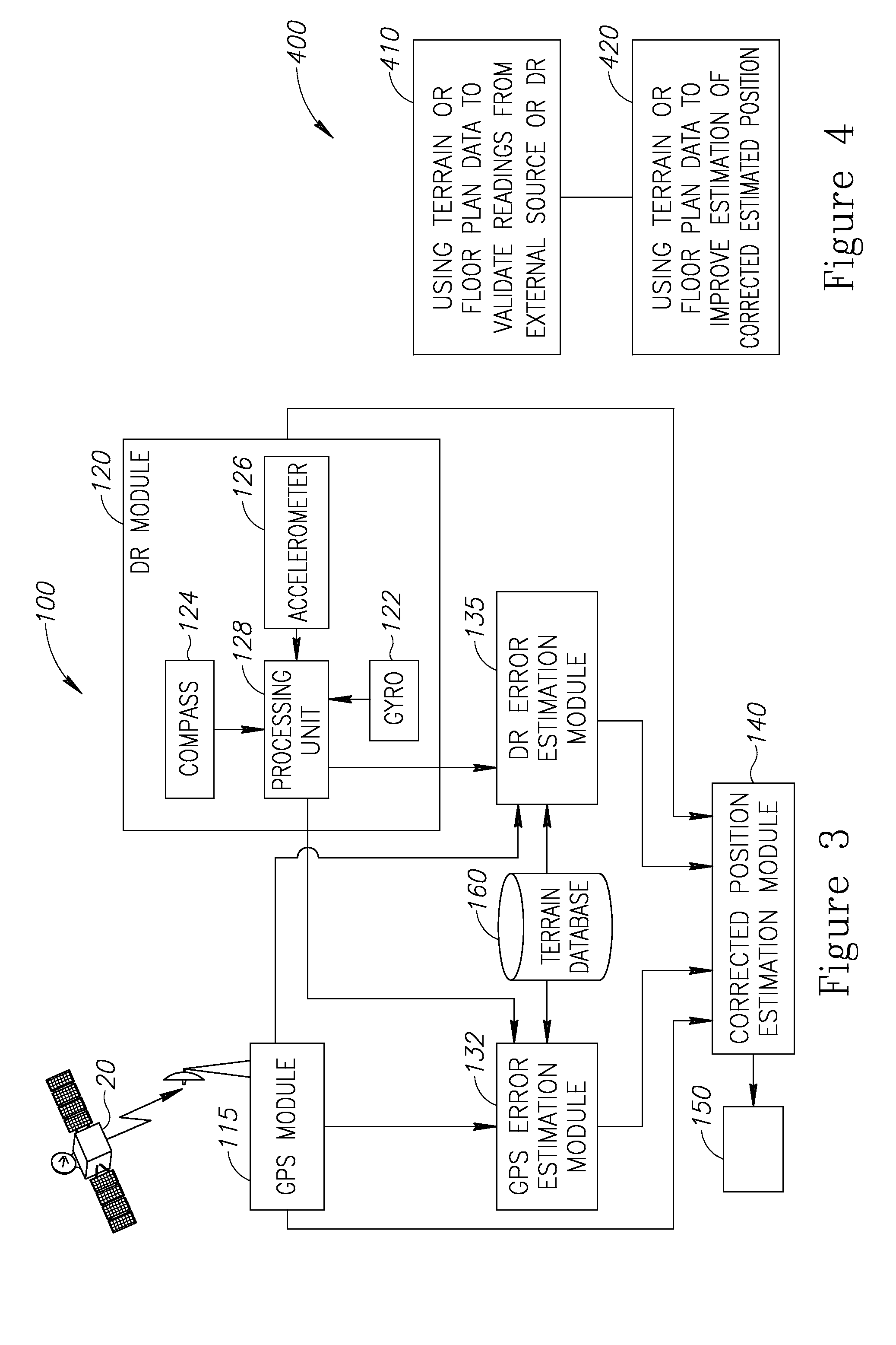
[0020]With specific reference now to the drawings in detail, it is stressed that the particulars shown are by way of example and for purposes of illustrative discussion of the preferred embodiments of the present invention only, and are presented in the cause of providing what is believed to be the most useful and readily understood description of the principles and conceptual aspects of the invention. In this regard, no attempt is made to show structural details of the invention in more detail than is necessary for a fundamental understanding of the invention, the description taken with the drawings making apparent to those skilled in the art how the several forms of the invention may be embodied in practice.

[0021]Before explaining at least one embodiment of the invention in detail, it is to be understood that the invention is not limited in its application to the details of construction and the arrangement of the components set forth in the following description or illustrated in ...


PUM


Abstract

A method of pedestrian navigation, based on an external positioning system and a Dead Reckoning (DR) system is provided herein. The method may employ the following steps: obtaining external positioning readings from an external positioning source and DR position readings from a pedestrian-carried platform; estimating an external positioning error, based at least partially on the external positioning and the DR position readings; and applying an estimation function to the external position readings, the DR position readings, and the external positioning errors, to yield a corrected estimated position.

Description

BACKGROUND[0001]1. Technical Field[0002]The present invention relates to pedestrian navigating systems and more particularly, to navigating systems employing more than one data source.[0003]2. Discussion of the Related Art[0004]Two main navigation techniques form some of the related art for the present application. One navigation technique is the “Global Positioning System” or “GPS” being a U.S. space-based global navigation satellite system. In order to provide positioning, navigation, and timing services to worldwide users on a continuous basis, GPS requires an unobstructed view of four or more GPS satellites. GPS satellites broadcast signals from space that GPS receivers use to provide three-dimensional location (latitude, longitude, and altitude), velocity, and precise time. GPS has become a widely used aid to navigation worldwide, and a useful tool for map-making, land surveying, commerce, scientific uses, tracking and surveillance.[0005]Another navigation technique is “Dead re...

Claims


Application Information

Patent Timeline
IPC IPC(8): G01C21/12
CPCG01C21/165G01C21/12G01S19/49G01C25/005G01C21/1654
Inventor ABRAMSON LIANI, ARIEFRAT, ILANLEIZERSON, ILYA
Owner ELBIT SYST LTD
Why Eureka
Try Eureka