Dynamic city zoning for understanding passenger travel demand

a dynamic city and demand technology, applied in the field of transportation arts, data analysis, tracking arts, etc., can solve the problems of confusing aggregation of od matrices by fixed administrative zones, difficult visualization of clustering based on traffic matrix, and inability to understand automatic collection travel data

Inactive Publication Date: 2014-03-27
XEROX CORP
View PDF4 Cites 74 Cited by
  • Summary
  • Abstract
  • Description
  • Claims
  • Application Information

AI Technical Summary

Benefits of technology

[0018]One or more of the computing of the geo-distance function, computing of the destination-distance function, forming of the aggregated affinity matri

Problems solved by technology

OD matrices based on automatically collected travel data, however, are not readily comprehensible to human reviewers, particularly when massive and detailed traffic data permits different levels of granularity, with fine-grained OD matrices for all stations, often for different days of the week or d

Method used


Image

  • Dynamic city zoning for understanding passenger travel demand
  • Dynamic city zoning for understanding passenger travel demand
  • Dynamic city zoning for understanding passenger travel demand

Examples


example 1

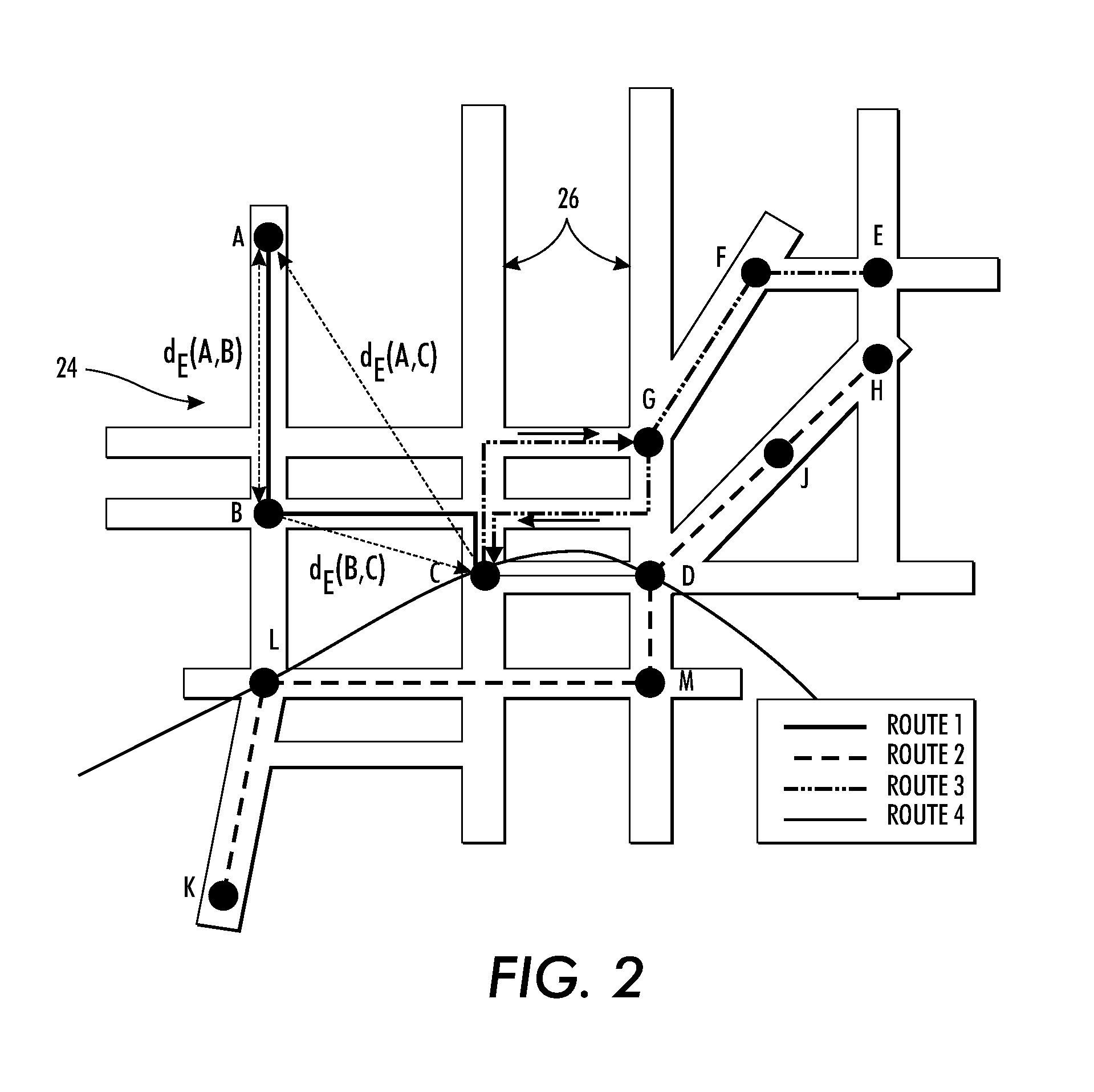
[0130]FIG. 6 illustrates the travel demand based on the OD matrices for two close stops in the Nancy transportation network. Their most significant destination demands in the city are shown by the dashed and solid lines, respectively. The close location of these two stations, combined with the highly similar destination demands, would favor placing these two stops in the same zone. In FIG. 7, the two stations illustrated are geographically close but have very different destination demands, making it much less likely they will be assigned to the same zone.

[0131]Some of the results of the dynamic zoning method discussed above are visualized for OD data in FIGS. 8-11. In all tests, the Euclidean distance function was used as the geo-distance function and σ=σ1=1. Two-view spectral clustering of the n points was performed. FIGS. 8-11 shows the dynamic zone solutions by multi-view spectral clustering, where the number of zones is 5, 10, 20, and 30, respectively.

example 2

[0132]In another example, a determination of how sensitive the zoning is to small changes in the travel demand. In this test, Algorithm 1 was run ten times, each time altering the travel demand with a 3% random noise. A Delaunay triangulation of the network was performed and all triangulation facets plotted with a color indicating the sensitivity to the noise. A triangle is in red if all three support points share the same zone in all runs. Inversely, light blue color indicates a transition place where support points belong to different zones. In FIG. 12, these are indicated with different shading rather than color, with Level 1 (red) being the lowest sensitivity and Level 6 (light blue) being the highest sensitivity to noise.

example 3

[0133]Zone querying is illustrated in FIG. 13. While different shadings are again shown for ease of illustration, these would be displayed as different colors. In this example, one of zones is queried for travel demand toward other zones. FIG. 13 shows an example of such querying for the case of four of the 10 zones (k=10) in the Nancy city plot shown in FIG. 9. In any of presented plots, a query zone is shown with a predetermined color and, for all other zones, destination estimations are aggregated by zones and presented with different colors, where red may be used to indicate high demand and blue color to indicate a low demand. A user can click on one of the zones to have the appropriate one of the maps displayed.


PUM


Abstract

A system and method for dynamic zoning are provided. Travel demand data is received for a network which includes a set of points. The travel demand data includes values representing demand from each point to each of other point. Destination-distance values are computed which reflect the similarity between points in a respective pair, based on the travel demand data. For each pair of the points, a geo-distance value is generated which reflects the distance between locations of the points in the pair. An aggregated affinity matrix is formed by aggregating the computed geo-distance values and destination-distance values. The aggregated affinity matrix is used by a clustering algorithm to assign each of the points in the set to a respective one of a set of clusters. A representation of the clusters can be generated in which each of a set of zones encompasses the points assigned to its respective cluster.

Description

BACKGROUND[0001]The following relates to the transportation arts, data processing arts, data analysis, tracking arts, and the like, and finds particular application in the visualization of variable zones of a city, each zone having a different travel demand on a transportation network.[0002]Public transportation systems generally include multiple vehicles, routes, and services that are utilized by a large number of users, which may include automatic ticketing validation systems that collect validation information for travelers. To aid management and planning of transportation systems, it would be desirable to be able to identify zones of a city in which the travel patterns of travelers originating or ending their journeys in the zone are similar. By identifying these regions, administrators would be able to build and maintain more efficient transportation systems, such as by adding additional routes, increasing the number of buses or trains on a route, increasing the size of facilit...

Claims


Application Information

Patent Timeline
IPC IPC(8): G06Q10/06
CPCG06Q10/047G06Q10/06G06Q10/06315G06Q50/30
Inventor CHIDLOVSKII, BORIS
Owner XEROX CORP
Why Eureka
Try Eureka