System and method for lane boundary estimation and host vehicle position and orientation

a technology of host vehicle and lane boundary, which is applied in vehicle position/course/altitude control, process and machine control, instruments, etc., can solve the problems of difficult detection and tracking of all lane boundaries using a vision system, and achieve the effect of saving a vision system cos

Active Publication Date: 2014-12-04
HARMAN INT IND INC
View PDF5 Cites 60 Cited by
  • Summary
  • Abstract
  • Description
  • Claims
  • Application Information

AI Technical Summary

Benefits of technology

[0009]3—V2V active safety systems / ADAS are for vehicle to vehicle threat type, and not intended for road attribute threat type, such as drifting away in your lane, as in LDW system. Therefore, having such system using V2V only may save a vision system cost for lane boundary detection and / or LDW.

Problems solved by technology

1—In an automated system, it will be very difficult to detect and track all lane boundaries using a vision system, due to multiple reasons: limited Field of View (FOV) coverage, difficulty seeing lane marking in high traffic scenario, or challenges facing vision system in different environment conditions (poor lane marking, challenging weather, such as ice, snow, or leaves, challenging lighting conditions, upcoming curves at nights, or the like).

Method used


Image

  • System and method for lane boundary estimation and host vehicle position and orientation
  • System and method for lane boundary estimation and host vehicle position and orientation
  • System and method for lane boundary estimation and host vehicle position and orientation

Examples


Embodiment Construction

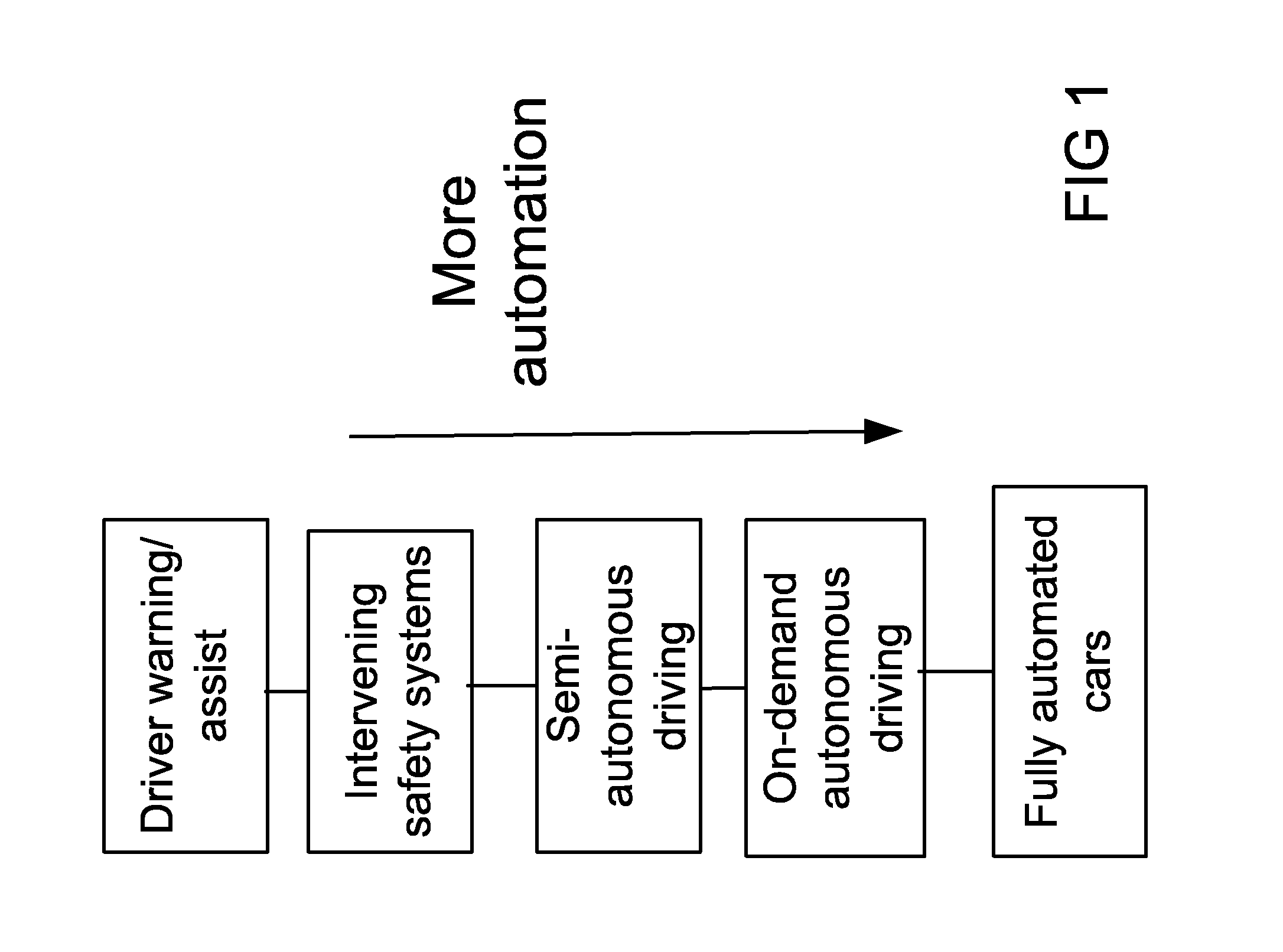
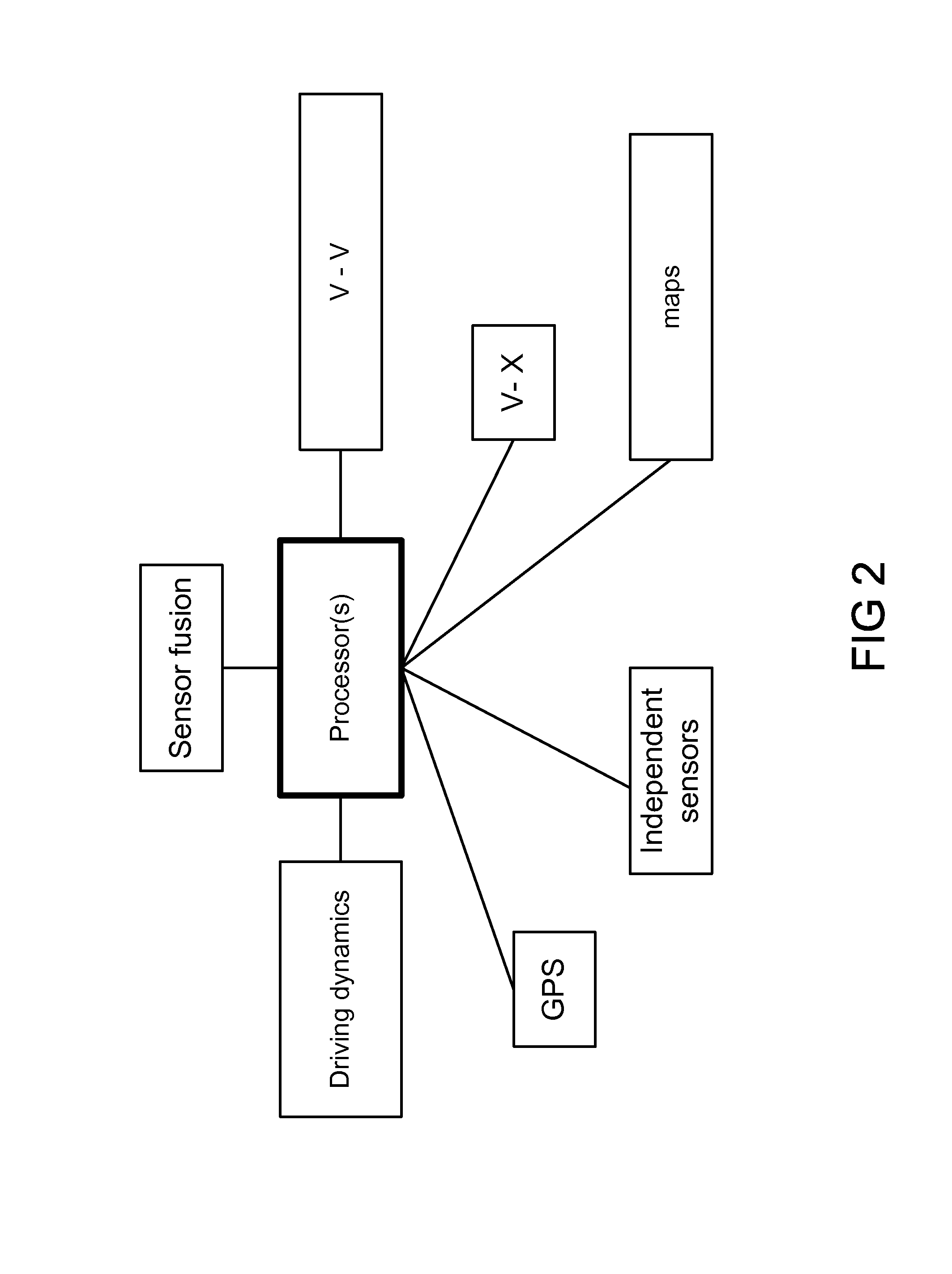
[0027]FIG. 1 is for one embodiment, as an example, for representation of development of fully automated vehicles, in stages, for progression toward fully automated vehicles. FIG. 2 is for one embodiment of the invention, for a system for automated vehicles, using GPS, independent sensors, and maps, for vehicle interactions, driving dynamics, and sensor fusions and integrations.

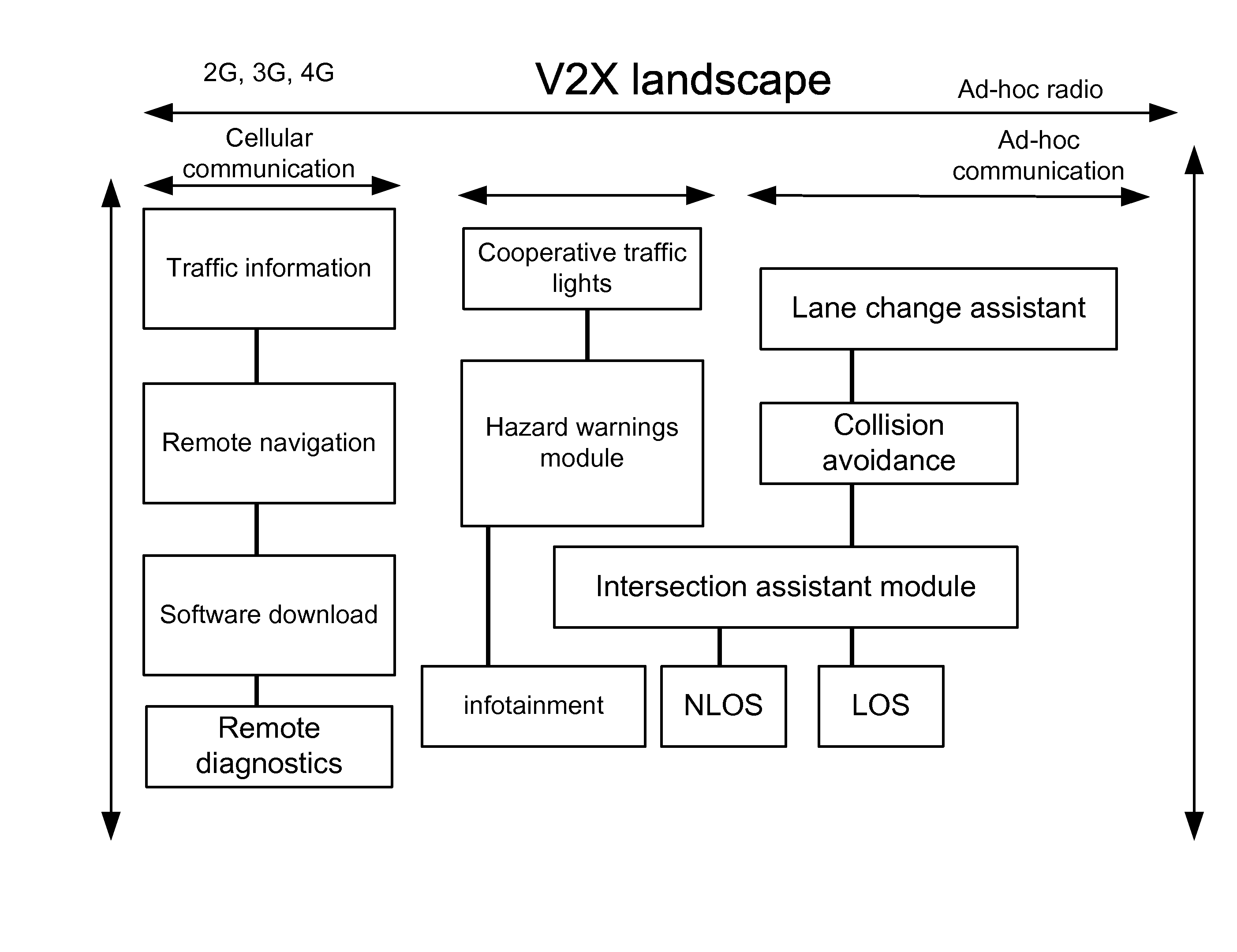
[0028]FIG. 3 is for one embodiment of the invention, for a system for automated vehicles, with different measurement devices, e.g., LIDAR (using laser, scanner / optics, photodetectors / sensors, and GPS / position / navigation systems, for measuring the distances, based on travel time for light), radar, GPS, traffic data, sensors data, or video, to measure or find positions, coordinates, and distances. The government agencies may impose restrictions on security and encryption of the communications and data for modules and devices within the system, as the minimum requirements, as the hackers or terrorists may try to ...


PUM


Abstract

Lane Boundary Estimation and Host Vehicle Position and Orientation, within the host lane estimation, using V2V (vehicle to vehicle) system, are discussed here. Lane boundary detection and tracking is essential for many active safety/ADAS application. The lane boundary position enables the tracking of the host vehicle position and orientation inside the lane. It also enables classifying in-lane, adjacent lanes, and other lanes vehicles. These two functionalities (lane boundary estimation and vehicle lane classifications) enable active safety applications (such as LDW, FCW, ACC, or BSD). It also enables the lateral control of the vehicle for lane keeping assist system, or for full lateral control for automated vehicle (automated for one or multiple lane changes).

Description

RELATED APPLICATION[0001]We have filed another related application earlier, titled “System and method for node adaptive filtering and congestion control for safety and mobility applications toward automated vehicles system”, copending now at the USPTO, with the same inventor(s) and assignee, and a related subject matter. We incorporate all the teaching of the prior application above, by reference, including any Appendix or figures.BACKGROUND OF THE INVENTION[0002]The present invention relates to a system that uses the Vehicle to Vehicle and / or the Vehicle to infrastructure communication for safety and mobility applications. The invention provides methods for lane boundary estimation and even some LDW functionality using V2V and / or V2I systems.[0003]Dedicated Short Range Communication (DSRC) is the main enabling technology for connected vehicle applications that will reduce vehicle crashes through fully connected transportation system with integrated wireless devices and road infrast...

Claims


Application Information

Patent Timeline
Patent Type & Authority Applications(United States)
IPC IPC(8): G01S19/00
CPCG01S19/00G01S19/14G01S19/39
Inventor IBRAHIM, FAROOG
Owner HARMAN INT IND INC
Why Eureka
Try Eureka