Corridor capture

a technology of corridors and cameras, applied in the field of corridor capture, can solve problems such as sub-optimal traditional area-based aerial surveying techniques

Active Publication Date: 2016-08-11
NEARMAP AUSTRALIA PTY LTD
View PDF3 Cites 15 Cited by
  • Summary
  • Abstract
  • Description
  • Claims
  • Application Information

AI Technical Summary

Benefits of technology

[0011]The aircraft may be flown along a turn between each secondary flight line segment and its successor, the turn having an angle less than 90 degrees.

Problems solved by technology

However, traditional area-based aerial surveying techniques are sub-optimal for capturing corridors.

Method used


Image

  • Corridor capture
  • Corridor capture
  • Corridor capture

Examples


Embodiment Construction

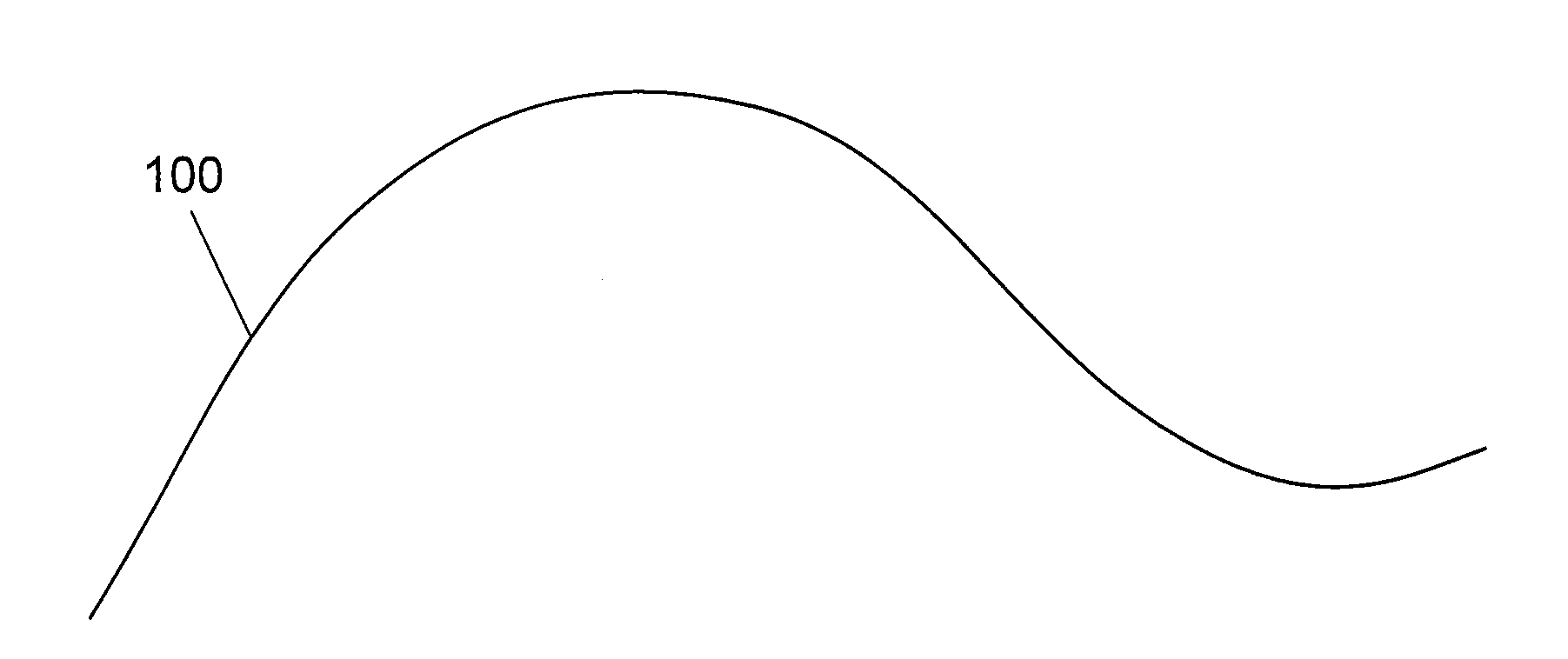
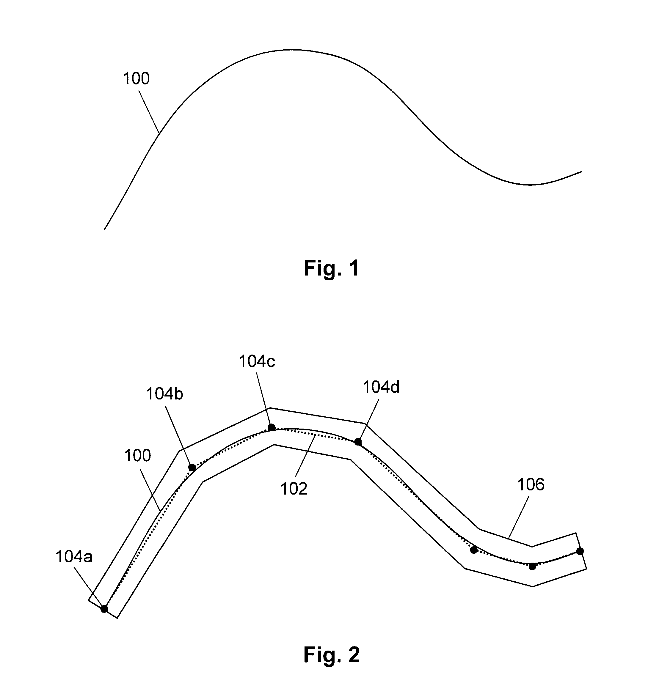
[0099]A corridor area of interest (simply “corridor” hereafter) typically consists of a strip of land along an arbitrary path 100, as shown in FIG. 1. The corridor may follow a physical structure, such as a railway line or river. The length of the corridor is typically much longer than the width of the corridor.

[0100]The width of the corridor may, in general, vary along the path, but for many corridors a fixed width applies. For illustrative purposes in this specification only fixed-width corridors are generally shown.

[0101]The corridor may be continuous or discontinuous, and the corridor may comprise multiple smaller paths such as loops or forks. For illustrative purposes in this specification only continuous unforked corridors are shown.

[0102]As shown in FIG. 2, the corridor path may be approximated by a polyline 102, consisting of a sequence of straight-line segments between successive vertices 104. The polyline is constructed so that the maximum perpendicular distance from the p...


PUM


Abstract

A method of creating a orthomosaic of a corridor area, the corridor area at least partially described by a corridor path, the method comprising flying an aircraft along a primary flight line approximating the corridor path and capturing a sequence of primary images; flying the aircraft along a secondary flight line substantially parallel to the corridor path and capturing a sequence of secondary images; identifying, in the primary images and secondary images, common features corresponding to common ground points; estimating, via bundle adjustment and from the common ground points, an exterior orientation associated with each primary image and a three-dimensional position associated with each ground point; orthorectifying, using at least some of the exterior orientations and at least some of the three-dimensional ground point positions, at least some of the primary images; and merging the orthorectified primary images to create the orthomosaic.

Description

FIELD OF THE INVENTION[0001]The present invention relates to the efficient and accurate creation of corridor orthomosaics.BACKGROUND OF THE INVENTION[0002]Accurately georeferenced mosaics of orthophotos, referred to as orthomosaics, are becoming popular alternatives to traditional pictorial maps because they can be created automatically from aerial photos, and because they show actual useful detail on the ground.[0003]The creation of accurate orthomosaics from aerial photos is well described in the literature. See, for example, Elements of Photogrammetry with Application in GIS, Fourth Edition (Wolf et al.), and the Manual of Photogrammetry, Sixth Edition (American Society for Photogrammetry and Remote Sensing (ASPRS)).[0004]The creation of an orthomosaic requires the systematic capture of overlapping aerial photos of the area of interest, both to ensure complete coverage of the area of interest, and to ensure that there is sufficient redundancy in the imagery to allow accurate bund...

Claims


Application Information

Patent Timeline
Patent Type & Authority Applications(United States)
IPC IPC(8): B64D47/08G06K9/00G06K9/46G06T11/20G06T11/60H04N7/18G06T7/00G06V20/13
CPCB64D47/08H04N7/183G06K9/0063G06T7/0079G06T2207/10032G06T11/60G06K9/4604G06T2207/10016G06T11/203G06T3/4038G06T2207/30184G06T2207/30244G06T7/73G01C11/06G03B15/006G06V20/647G06V20/13G01C21/3826G01C21/3852
Inventor MILLIN, ANDREWROGERS, RUSSELL ALANLAPSTUN, PAUL
Owner NEARMAP AUSTRALIA PTY LTD
Why Eureka
Try Eureka