
Detecting and following terrain height autonomously along a flight path

a technology of autonomous detection and terrain height, applied in vehicle position/course/altitude control, process and machine control, instruments, etc., can solve the problems of long time-consuming attention, labor-intensive, and manual harvesting of crops

Active Publication Date: 2018-11-01
SUZHOU EAVISION ROBOTIC TECH CO LTD
View PDF2 Cites 16 Cited by
  • Summary
  • Abstract
  • Description
  • Claims
  • Application Information

AI Technical Summary

Benefits of technology

The invention is about a system and method for controlling UAVs to apply pesticides and fertilizers to crops. The technical effects of the invention include reducing labor-intensive activities, minimizing waste, and ensuring efficient and complete coverage of the crops. The UAVs need to be able to fly at low constant heights above the target crops to achieve these goals. The invention also includes a height estimation and control system, a process for estimating the relative heights of terrain features, and a computer program product embodied on a computer readable storage medium. The invention can be implemented in various ways and the order of the steps in the process can be altered.

Problems solved by technology

Harvesting crops manually is a labor-intensive activity, in particular, the application of pesticides / fertilizers.
Employing operators to remotely control UAVs, however, is labor-intensive and requires long periods of high-concentration to attention.
Flying too high above the crop results in large amounts of pesticides / fertilizers being lost into the open air.
This not only poses a health and environmental hazard, but also fails to deliver the necessary pesticides / fertilizers to the crops.
On the other hand, flying too close to the crops limits the coverage of the spray, increases the danger of colliding with crops, and poses a risk to the UAVs should the terrain rise.

Method used


Image

  • Detecting and following terrain height autonomously along a flight path
  • Detecting and following terrain height autonomously along a flight path
  • Detecting and following terrain height autonomously along a flight path

Examples


Embodiment Construction

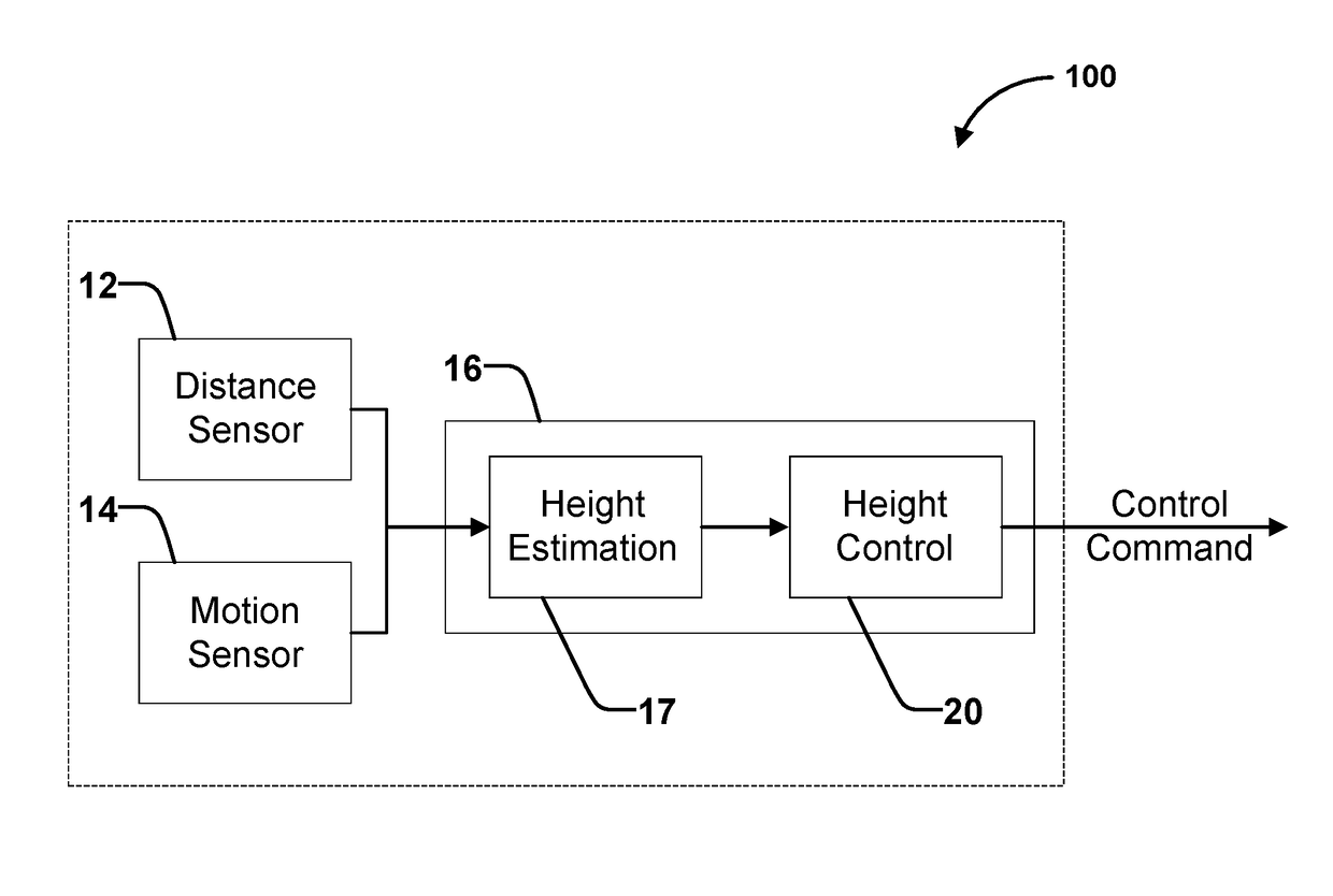
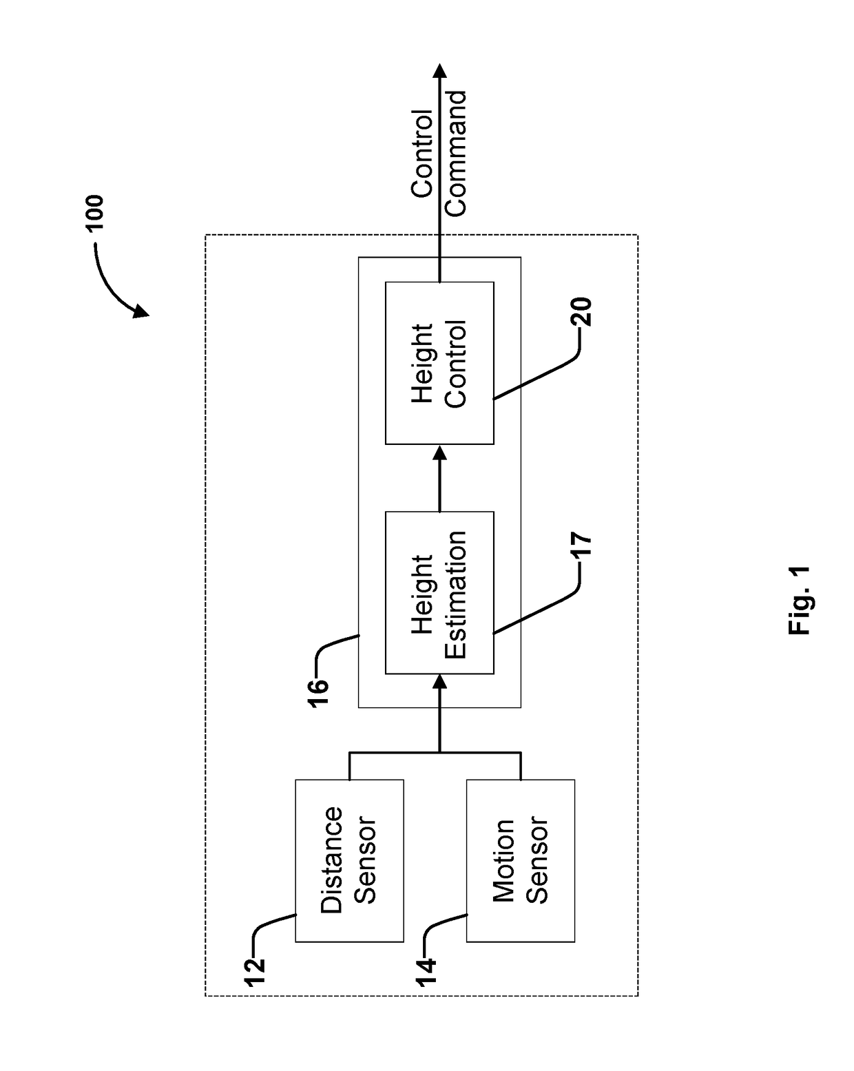
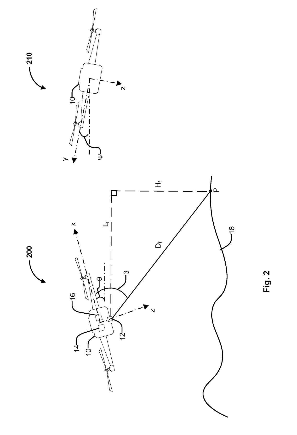
[0017]The invention can be implemented in numerous ways, including as a process; an apparatus; a system; a composition of matter; a computer program product embodied on a computer readable storage medium; and / or a processor, such as a processor configured to execute instructions stored on and / or provided by a memory coupled to the processor. In this specification, these implementations, or any other form that the invention may take, may be referred to as techniques. In general, the order of the steps of disclosed processes may be altered within the scope of the invention. Unless stated otherwise, a component such as a processor or a memory described as being configured to perform a task may be implemented as a general component that is temporarily configured to perform the task at a given time or a specific component that is manufactured to perform the task. As used herein, the term ‘processor’ refers to one or more devices, circuits, and / or processing cores configured to process da...


PUM


Abstract

A distance from an aerial vehicle to a terrain feature located forward and lower with respect to the aerial vehicle is measured. A current orientation of the aerial vehicle with respect to a reference orientation is detected. At least the measured distance and the current orientation is utilized to determine a relative vertical difference between a vertical location of the aerial vehicle and a vertical location of the terrain feature is det. The determined vertical difference is utilized to automatically adjust a flight altitude of the aerial vehicle.

Description

BACKGROUND OF THE INVENTION[0001]Harvesting crops manually is a labor-intensive activity, in particular, the application of pesticides / fertilizers. Due to public concern in regards to the release of chemicals into the environment and human exposure to chemicals, the unmanned aerial vehicles (UAVs) may be utilized in aerial application of spray material (e.g., spraying pesticide / fertilizer). Employing operators to remotely control UAVs, however, is labor-intensive and requires long periods of high-concentration to attention.[0002]For UAVs aiming to deliver pesticides / fertilizers directly to crops, an important requirement is that they must be able to fly at low constant heights above the target crops to ensure efficiency, minimal waste, as well as complete and even coverage. Flying too high above the crop results in large amounts of pesticides / fertilizers being lost into the open air. This not only poses a health and environmental hazard, but also fails to deliver the necessary pesti...

Claims


Application Information

Patent Timeline
IPC IPC(8): G05D1/06G05D1/08B64C39/02B64D1/18G08G5/00
CPCG05D1/0646G05D1/0808B64C2201/12B64D1/18G08G5/0086B64C39/024G08G5/0021G08G5/0052B64U2101/45
Inventor TAN, HAN-SHUEHUANG, JIHUA
Owner SUZHOU EAVISION ROBOTIC TECH CO LTD
Learn More