Systems and methods for mapping emerged plants

a technology of emerged plants and mapping systems, applied in the field of systems and methods for mapping emerged plants, can solve the problems of no longer accurately indicating the layout, plant death shortly after germination, and farmer making at least some inefficient crop management decisions

Active Publication Date: 2019-08-22
PRECISION HAWK USA INC
View PDF4 Cites 12 Cited by
  • Summary
  • Abstract
  • Description
  • Claims
  • Application Information

AI Technical Summary

Problems solved by technology

Although such an as-planted map accurately reflects the crop layout of a field at the time of planting, conditions of the crop may change over time such that the as-planted map no longer accurately indicates the layout of crops in certain areas of the field.
As an example, some of the seeds may never germinate to form an emerged plant (e.g., a region of

Method used


Image

  • Systems and methods for mapping emerged plants
  • Systems and methods for mapping emerged plants
  • Systems and methods for mapping emerged plants

Examples


Embodiment Construction

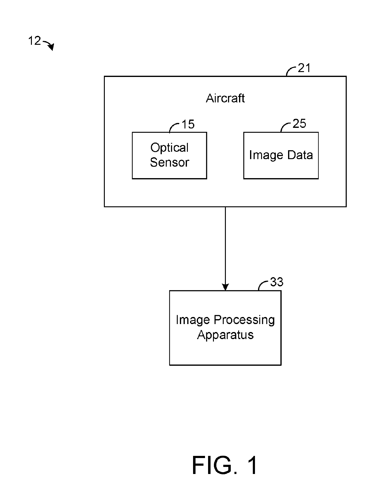
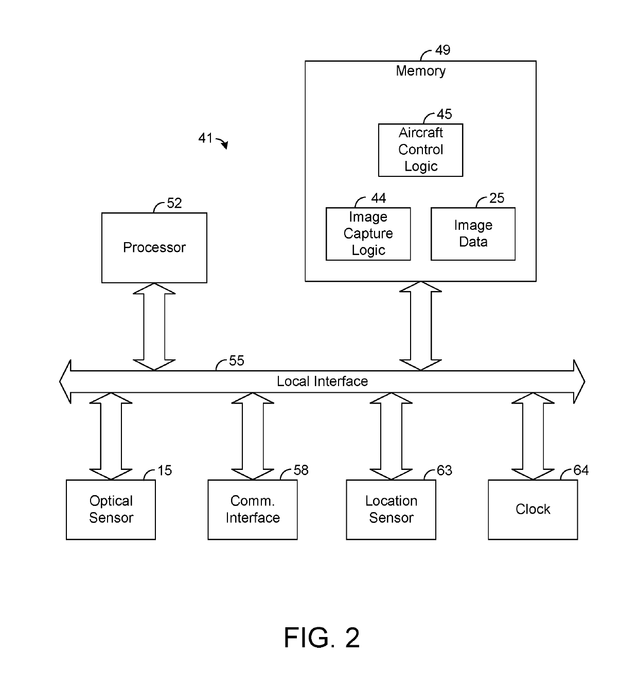
[0015]The present disclosure generally pertains to systems and methods for mapping emerged plants. A system in accordance with one embodiment of the present disclosure comprises an optical sensor that configured to capture at least one image of a field of emerged plants. As an example, the optical sensor may be coupled to an unmanned aerial vehicle (UAV) that is controlled to fly over a field as the optical sensor captures images of the field. In some cases, multiple images of the field are combined (e.g., stitched) in order to form a composite image that can be analyzed to determine the number and locations of emerged plants in the field. In this regard, an image processing apparatus receives image data from the optical sensor and detects areas of vegetation within an image of the field. Based on detected patterns of vegetation within the image, the image processing apparatus identifies emerged plants and creates at least one map indicating the location of each emerged plant identi...


PUM


Abstract

A system uses an optical sensor and an image processing apparatus to map emerged plants in a field. The optical sensor collects at least one image of a field of emerged plants. The image processing apparatus analyzes the image to detect areas of vegetation and creates a vegetation map indicative of the detected areas. The image processing element then analyzes the vegetation map to identify emerged plants within the image and creates at least map indicating locations of the emerged plants in the field. Such map may be used to make efficient crop management decisions based on the actual layout of emerged plants in the field.

Description

RELATED ART[0001]Detailed information about planted crops helps farmers to make efficient and cost-effective management decisions. To assist farmers in gathering more information about crops, systems have been developed to automatically determine and record the locations where seeds are planted. For example, as a farmer is using a tractor to plant seeds in a field, an on-board controller may determine when a seed has been planted and then use a global positioning system (GPS) or other type of sensor to determine the approximate location of the planted seed. Using such information collected at the time of planting, the controller can generate an as-planted map that indicates the number of seeds planted in various regions of the field.[0002]Having access to the as-planted map provides a farmer with various advantages. As an example, a farmer may use the as-planted map to efficiently determine the amount of fertilizer or water to be applied to a certain region of the field. If one regi...

Claims


Application Information

Patent Timeline
IPC IPC(8): G06K9/00A01C21/00A01G25/16G06T3/40
CPCG06K9/00657A01C21/005A01G25/16G06T3/4038G06Q10/063G06Q50/02G05B15/02G06T2207/20221A01B79/005A01B49/06G06V20/188
Inventor BAYNES, JEREMYPUNJANI, ALILOBATON, EDGARSAN SOUCI, JASONHAUN, THOMASLOHMAN, PATSLATER, ANDREWMEAD, MATT
Owner PRECISION HAWK USA INC
Why Eureka
Try Eureka