Method and system for vector-raster overlay analysis of ground surface image area based on edge clipping

Active Publication Date: 2020-10-29
WUHAN UNIV
View PDF0 Cites 3 Cited by
  • Summary
  • Abstract
  • Description
  • Claims
  • Application Information

AI Technical Summary

Benefits of technology

[0059]1. The method and system for vector-raster overlay analysis of the ground surface image area based on edge clipping according to the disclosure can accurately calculate the ground surface image area without drastically increasing the calculation amount through cropping the edge vector polygon of the ground surface image

Problems solved by technology

However, although the method has high accuracy, a large amount of calculation resources is required.
However, converting the vector data into the raster data will inevitably cost the loss of accuracy.
That is, if the pixel attribute is determined by adopting methods such as the pixel center point attribution

Method used


Image

  • Method and system for vector-raster overlay analysis of ground surface image area based on edge clipping
  • Method and system for vector-raster overlay analysis of ground surface image area based on edge clipping
  • Method and system for vector-raster overlay analysis of ground surface image area based on edge clipping

Examples


Example

[0071]The disclosure will be further described in detail below with reference to the accompanying drawings and specific embodiments.

[0072]In the embodiments of the disclosure, the Shennongjia Forestry District is used as the research area and raster data of a ground surface image of the research area and a vector polygon data of the forest pattern are used as data sources. Overlay analysis is performed on the raster data and the vector polygon data of the forest pattern to extract the area of the forest pattern terrain, wherein the collection of the raster data is a raster dataset A of the ground surface image of the research area and the collection of the vector polygon data of the forest pattern is a vector dataset B of the ground surface image of the research area.

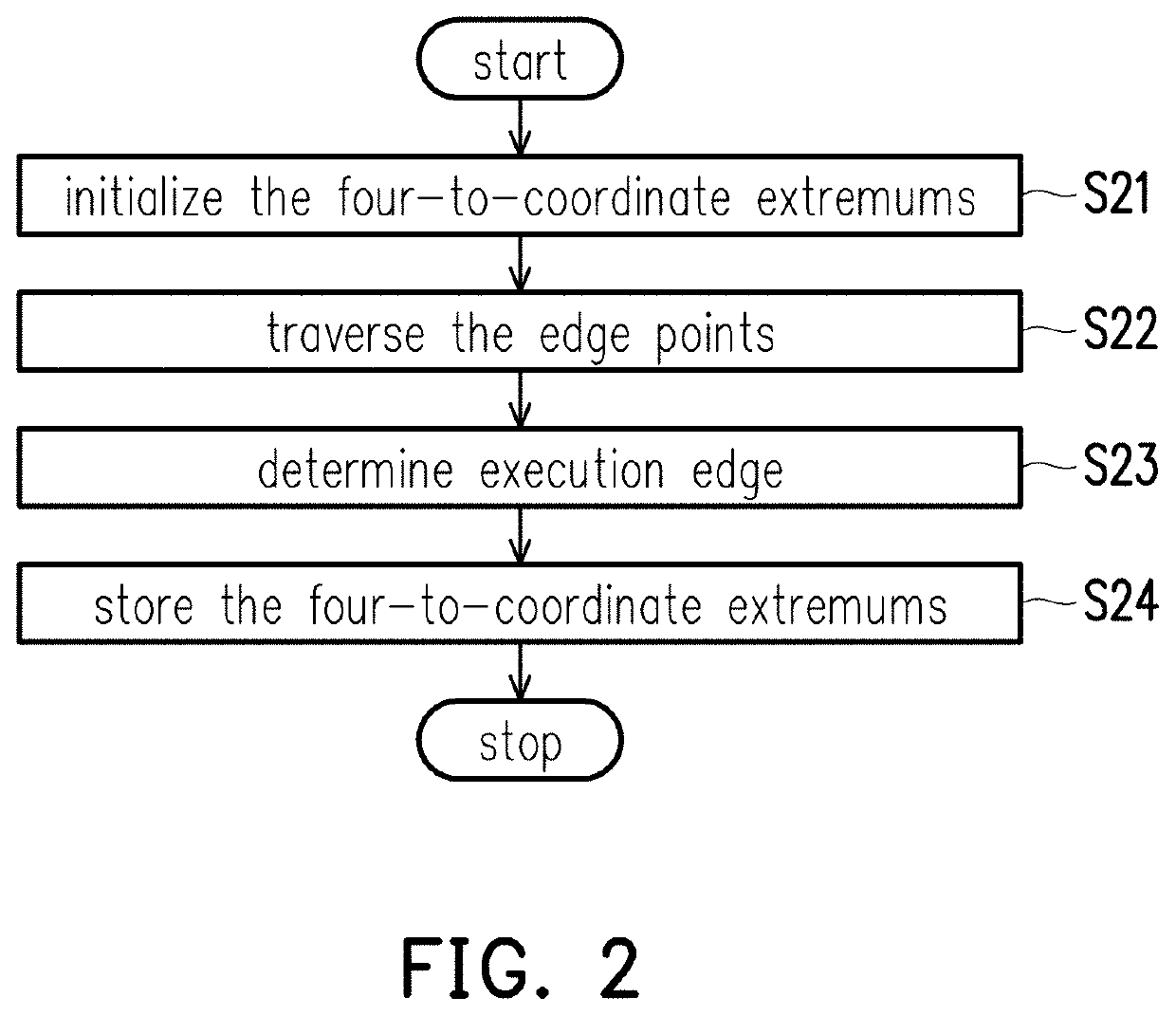
[0073]Referring to FIG. 1, a method for vector-raster overlay analysis of a ground surface image based on edge clipping according to the disclosure includes the following steps.

[0074]Step S1: obtain a ground surface ima...


PUM


Abstract

A method and a system for vector-raster overlay analysis of a ground surface image area based on edge clipping are provided. A large amount of computing resources is required during the calculation of extracting a ground surface image area using the vector-raster overlay analysis and a loss of accuracy is resulted when vector data is converted into raster data, thereby leading to the issue of calculation error of a polygon surface area. The disclosure adopts the vector-raster overlay analysis method while cropping an edge vector polygon of the ground surface image to be measured and allocating an attribute value of the image according to a pixel, so as to accurately calculate the ground surface image area without drastically increasing the amount of calculation, thereby achieving the function of improving the accuracy and efficiency of calculating the ground surface image area.

Description

CROSS-REFERENCE TO RELATED APPLICATION[0001]This application claims the priority benefit of China application serial no. 201910354073.3, filed on Apr. 29, 2019. The entirety of the above-mentioned patent application is hereby incorporated by reference herein and made a part of this specification.BACKGROUNDTechnical Field[0002]The disclosure relates to the technical field of ground surface image extraction, and particularly relates to a method and a system for vector-raster overlay analysis of a ground surface image area based on edge clipping.Description of Related Art[0003]After a ground surface image is extracted through geographic information system (GIS), analysis and processing need to be performed. Spatial overlay analysis is a basic spatial analysis function commonly used in GIS. Spatial overlay analysis algorithm for the same type of data structure (that is, between vector data and between raster data) has been widely used in various geographic information system analysis so...

Claims


Application Information

Patent Timeline
IPC IPC(8): G06T15/10G06T7/12G06F9/30G06T15/00
CPCG06F9/30036G06T15/10G06T7/12G06T15/005G06T17/05G06T7/62G06T2210/22G06T2200/04G06T11/40
Inventor LIU, YAOLINXIE, PENGWANG, YIHENGLIU, YANFANGLI, JINGZHONG
Owner WUHAN UNIV
Why Eureka
Try Eureka