Automatic registration of images in digital terrain elevation data

Inactive Publication Date: 2005-02-08
ATLANTIC INERTIAL SYST
View PDF14 Cites 84 Cited by
  • Summary
  • Abstract
  • Description
  • Claims
  • Application Information

AI Technical Summary

Benefits of technology

Specific implementations according to the present invention provide a novel system configuration of prior art equipment, combined with relat

Problems solved by technology

However, the final registration of the two sets of data together and confirmat

Method used


Image

  • Automatic registration of images in digital terrain elevation data
  • Automatic registration of images in digital terrain elevation data
  • Automatic registration of images in digital terrain elevation data

Examples


Embodiment Construction

There will now be described by way of example the best mode contemplated by the inventors for carrying out the invention. In the following description numerous specific details are set forth in order to provide a thorough understanding of the present invention. It will be apparent however, to one skilled in the art, that the present invention may be practiced without limitation to these specific details. In other instances, well known methods and structures have not been described in detail so as not to unnecessarily obscure the present invention.

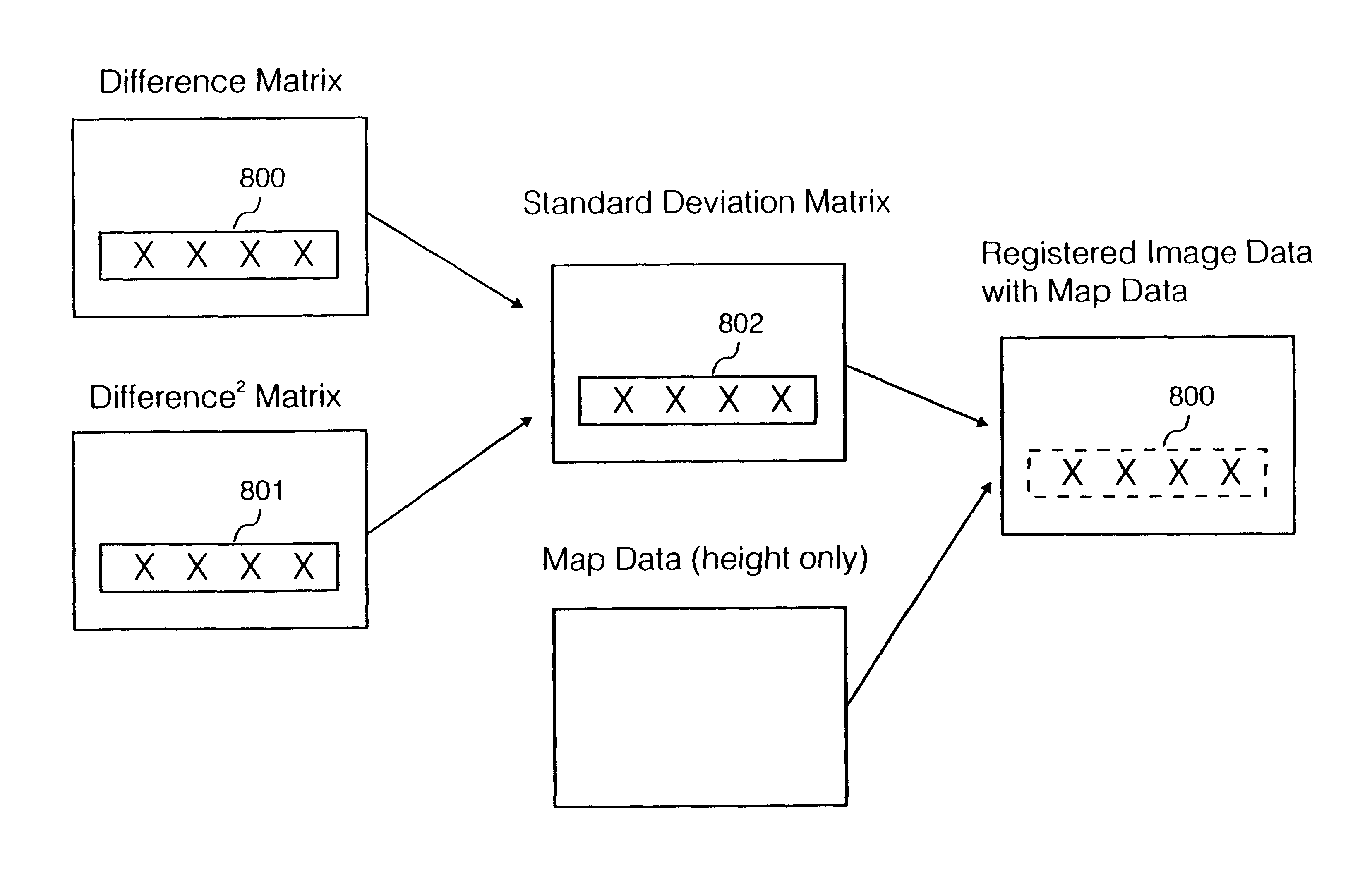
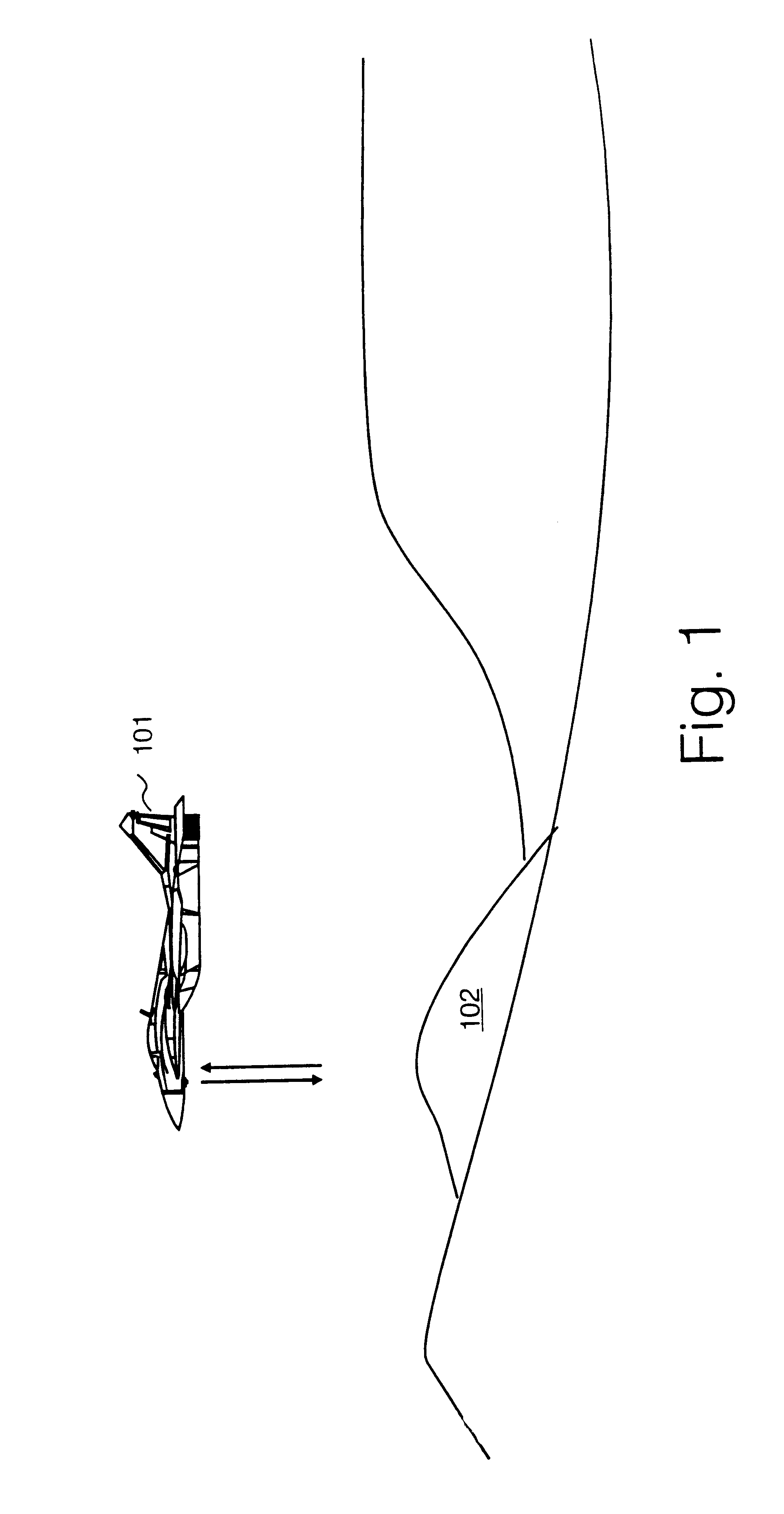
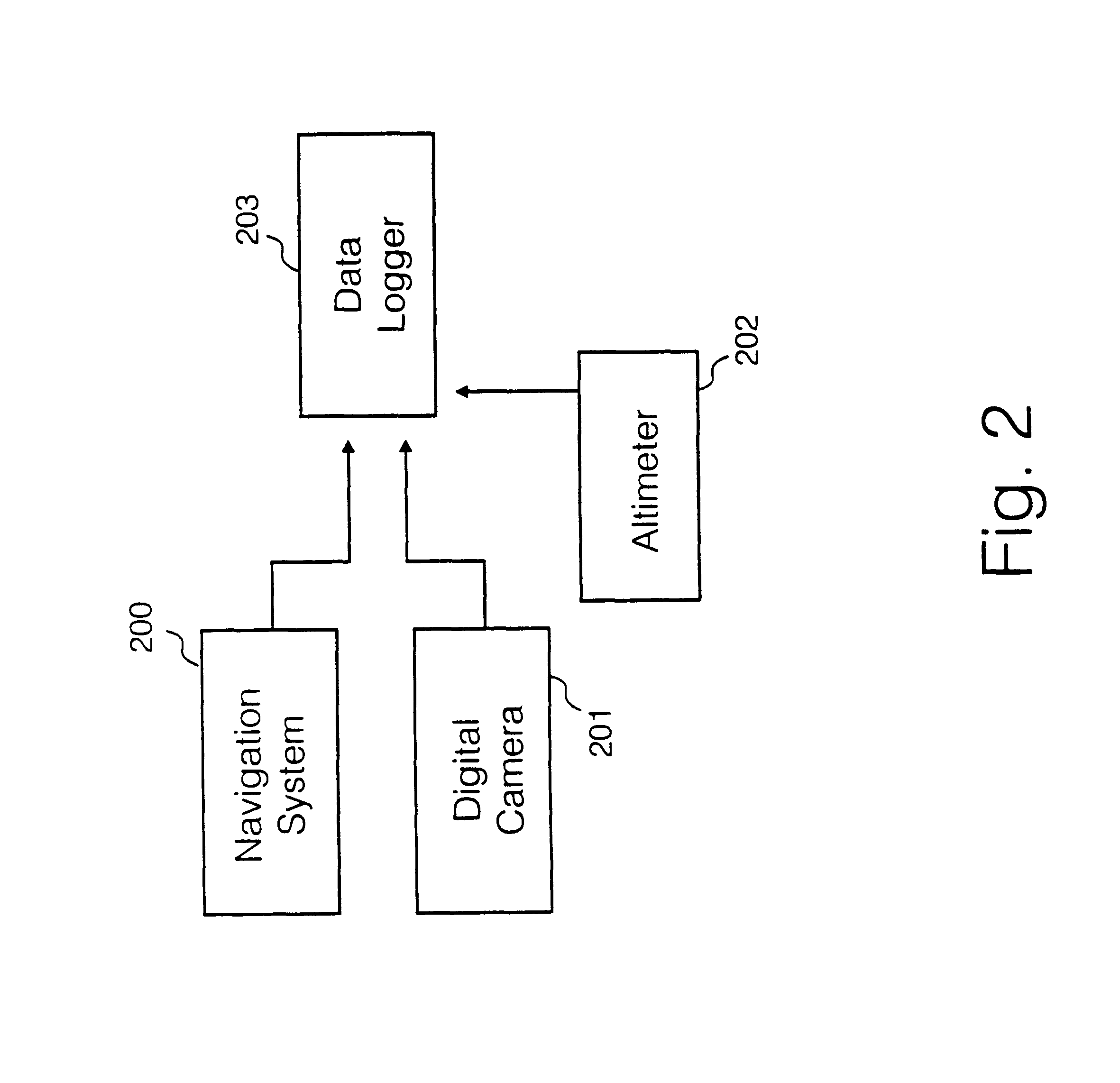
An overall process for registration of image data with digital terrain elevation data includes two stages as follows:Firstly, airborne or above earth data collection by a reconnaissance vehicle in which image data and digital terrain elevation data is recorded; andsecondly, registration of the collected image data and elevation data with a digital map data to precisely register the image data with the map data.

The second stage may be carrie...


PUM


Abstract

A method of registering reconnaissance image data with map data is disclosed, comprising recording image data at a plurality of positions, together with the role, pitch and height above mean sea level data from an airborne navigation system and imaging system, and recording altitude of a reconnaissance craft from an altimeter; obtaining a difference between said recorded altitude data, and an altitude calculated from said navigation system data and a map data; selecting a difference data having a lowest standard deviation, and at a position of said selected difference data generating a three dimensional surface data using a bi-quadratic equation; generating a bi-quadratic surface of each of a plurality of positions for which data is recorded; generating a difference data between said bi-quadratic surface data, and height data obtained from said map, and minimising an error between bi-quadratic surface data and said height data by translating said position data relative to said map data, until minimum error is achieved; registering said image data with said map data after applying a said translation of said image data.

Description

FIELD OF THE INVENTIONThe present invention relates to the field of processing of reconnaissance data.BACKGROUND TO THE INVENTIONCurrently, terrestrial reconnaissance data is collected as a set of image data, for example taken by digital camera mounted to an aircraft, and a set of three dimensional map data, for example ordinance survey map data.Conventionally, the image data and digital map data are registered with each other to provide a composite data. Production of the composite data requires the identification of individual features which appear in both the image data and the digital map data. There are known feature extraction algorithms, which can identify roads or other features which appear in both sets of data. However, the final registration of the two sets of data together and confirmation that that registration is correct, remains a labour intensive manual task.SUMMARY OF THE INVENTIONSpecific implementations according to the present invention provide a novel system con...

Claims


Application Information

Patent Timeline
IPC IPC(8): G01C5/00G01C21/00G01S3/78G01S3/786G01S13/00G01S13/88G01S19/14G01S19/19G06T17/05
CPCG01C5/005G01C21/005G01S3/7864G06T17/05G06T7/0024G01S19/14G01S13/882G06T7/30
Inventor BROOKES, TOM M
Owner ATLANTIC INERTIAL SYST
Why Eureka
Try Eureka