Orthorectifying stitched oblique imagery to a nadir view, and applications thereof

a technology of oblique imagery and orthorectification, applied in the field of displaying oblique imagery, can solve the problems of difficult navigation between images, limiting the capture of nadir photographs, and limiting the capture of steep perspectiv

Active Publication Date: 2012-04-17
GOOGLE LLC
View PDF3 Cites 11 Cited by
  • Summary
  • Abstract
  • Description
  • Claims
  • Application Information

AI Technical Summary

Problems solved by technology

While nadir photographs offer advantages, their steep perspective limits what they capture.
For example, nadir photographs often fail to capture the sides of buildings, primarily capturing their roofs.
First, because images can only be shown one at a time, navigation between images is difficult.
Similarly, the BING maps service does not allow a user to zoom out to an area covered by more than one image.
Second, overlaying map data, such as roads, is difficult, because the map data must be positioned in the coordinate space of each image.
This requires a great deal of additional processing time and storage.

Method used


Image

  • Orthorectifying stitched oblique imagery to a nadir view, and applications thereof
  • Orthorectifying stitched oblique imagery to a nadir view, and applications thereof
  • Orthorectifying stitched oblique imagery to a nadir view, and applications thereof

Examples


Embodiment Construction

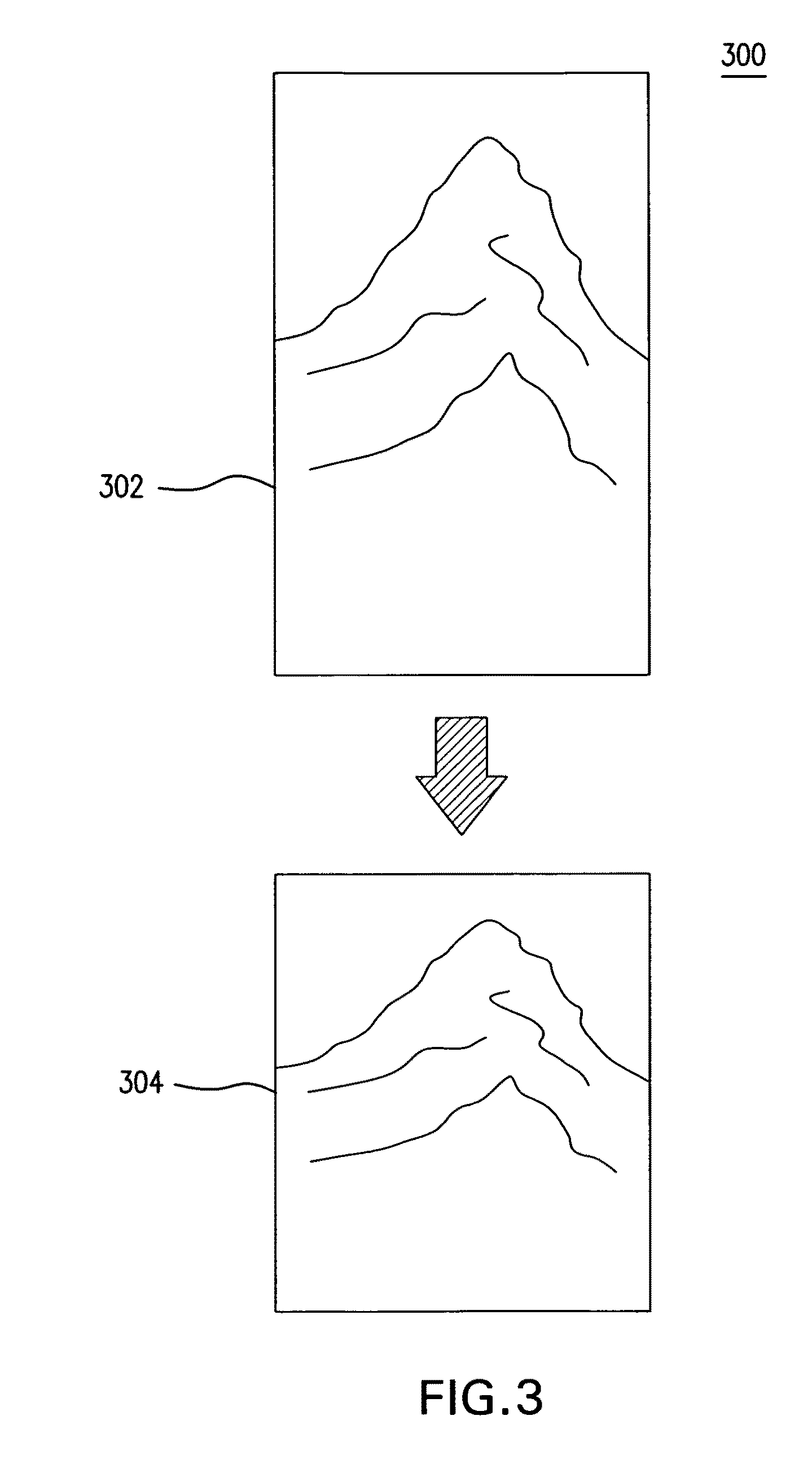
[0024]In general, embodiments of this invention relate to processing oblique imagery to display with map data. This Detailed Description is divided into sections. The first section describes orthorectifying oblique images according to an embodiment. The second section describes foreshortening and smoothing to correct distortions caused by the orthorectification. The third section describes assembling the corrected, orthorectified images into a mosaic and overlaying map data. The fourth section describes a system for orthorectifying stitched oblique imagery to a nadir view according to an embodiment. Finally, the fifth section describes a method for orthorectifying stitched oblique imagery to a nadir view according to an embodiment.

Orthorectification

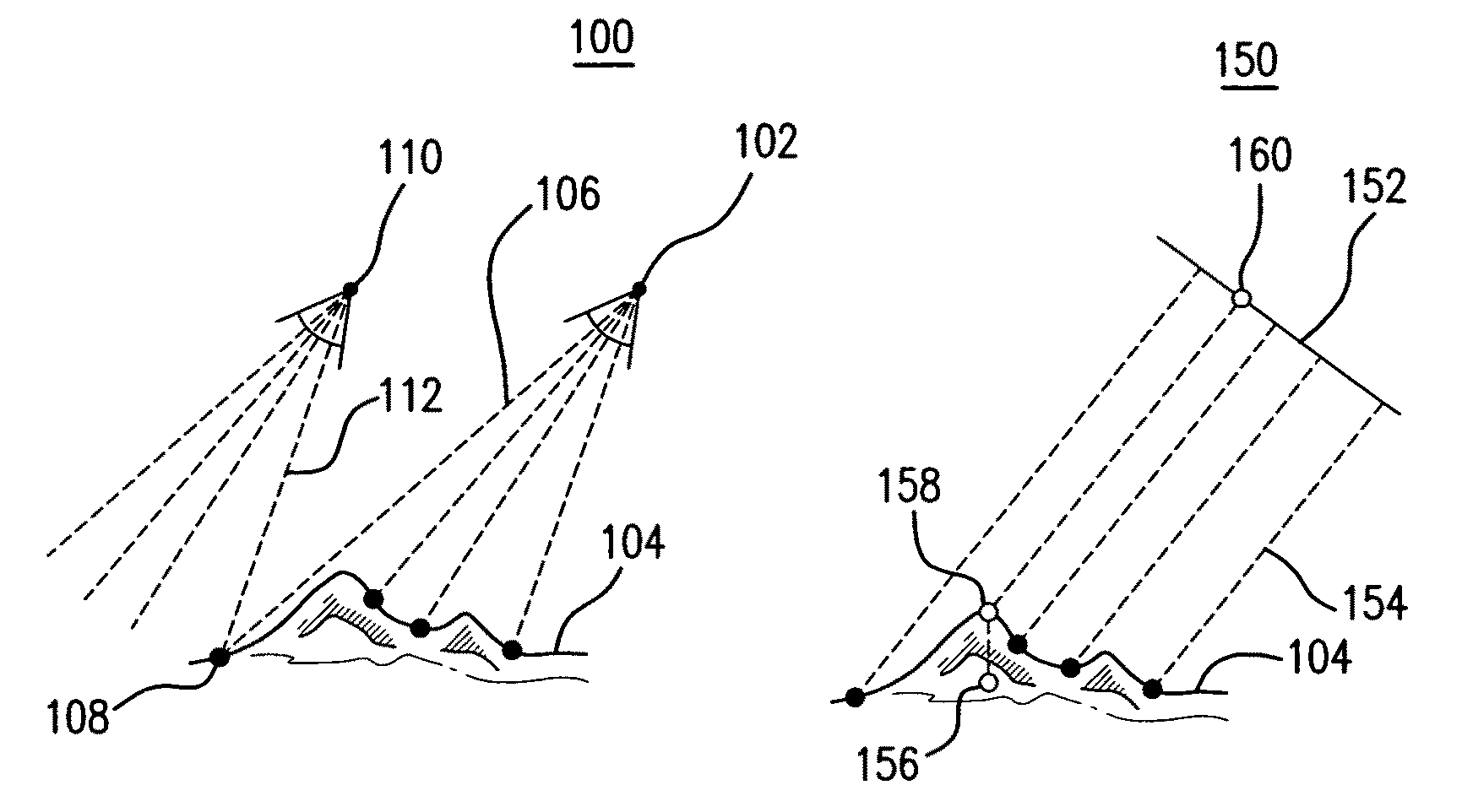
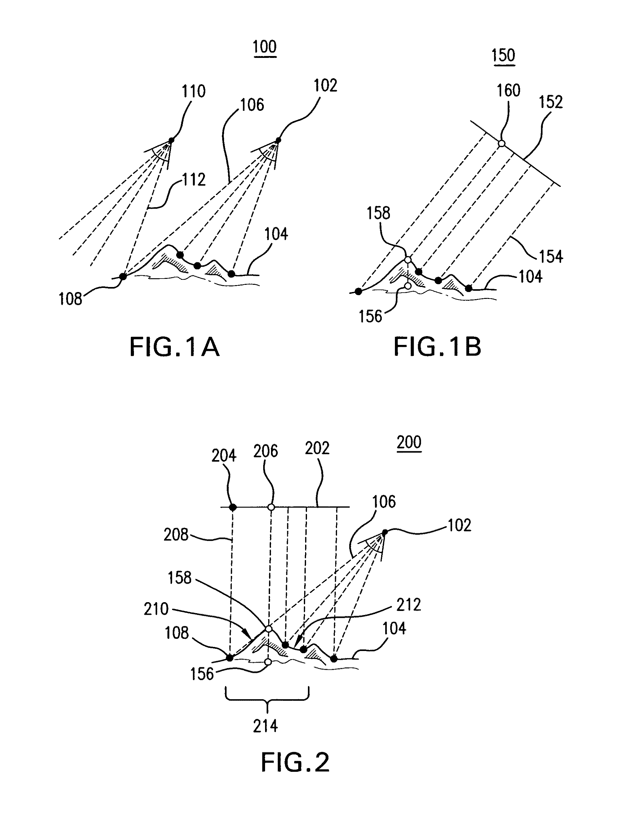
[0025]FIG. 1A is a diagram 100 illustrating cameras 102 and 110 positioned to capture oblique photographs of a terrain 104. An oblique photograph is a photograph taken with a camera inclined between the horizontal and the vertical directi...


PUM


Abstract

An oblique photographic image is projected onto a three-dimensional model of terrain. Points are sampled from the projected photographic image at the intersection of the three-dimensional model of terrain and parallel rays extended from a virtual viewport having a nadir perspective. The sampled points are assembled into an orthorectified image. Finally, the orthorectified image or the sampled points are adjusted approximately according to a difference in tilt angle between a camera that captured the oblique photographic image and the viewport having the nadir perspective to generate a foreshortened orthorectified image. Each location in the foreshortened orthorectified image corresponds linearly to a corresponding location in a two-dimensional map.

Description

BACKGROUND[0001]1. Field of the Invention[0002]Embodiments of this invention generally relate to displaying oblique imagery.[0003]2. Related Art[0004]Photographers often take images of the Earth from altitude, such as from an aircraft. Such aerial photographs can be taken from different perspectives. For example, nadir photographs are taken from a camera oriented straight down towards the Earth. While nadir photographs offer advantages, their steep perspective limits what they capture. For example, nadir photographs often fail to capture the sides of buildings, primarily capturing their roofs.[0005]Oblique photographs, on the other hand, are taken with cameras tilted relative to the surface of the Earth. Often, oblique photographs are tilted by approximately 45 degrees. In contrast to nadir images, oblique photographs capture the sides of buildings. For this reason, oblique photographs are often used, for example, in real estate applications.[0006]In one example, oblique images are ...

Claims


Application Information

Patent Timeline
Patent Type & Authority Patents(United States)
IPC IPC(8): H04N15/00
CPCG01C11/02G06T3/005
Inventor WILSON, RANDALLRHODES, CHARLES C.KIRMSE, ANDREWZELINKA, STEPHEN D.
Owner GOOGLE LLC
Why Eureka
Try Eureka