
Runtime optimization of spatiotemporal events processing

a spatiotemporal and event processing technology, applied in the field of data processing, can solve problems such as lack of embedded spatial processing capabilities

Active Publication Date: 2015-01-20
INT BUSINESS MASCH CORP
View PDF22 Cites 11 Cited by
  • Summary
  • Abstract
  • Description
  • Claims
  • Application Information

AI Technical Summary

Problems solved by technology

However, these systems lack embedded spatial processing capabilities therefore they process spatial events using “hard coded” solutions for each specific instance, without defining any common used patterns.

Method used


Image

  • Runtime optimization of spatiotemporal events processing
  • Runtime optimization of spatiotemporal events processing
  • Runtime optimization of spatiotemporal events processing

Examples


Embodiment Construction

[0020]Prior to setting forth the detailed description, it may be helpful to set forth definitions of certain terms that will be used hereinafter.

[0021]The term “EP” or event processing as used herein in this application refers to processing multiple events happening across all the layers of an organization, deriving events as function of the processed events to detect significant situations within the event cloud, analyzing their impact, and taking subsequent action in real time. The events may be time-dependent (temporal) space-dependent (spatial) or a combination thereof (spatiotemporal).

[0022]The term “GIS” or geographic information system as used herein in this application refers to any information system that integrates, stores, edits, analyzes, shares, and displays geographic information. In a more generic sense, GIS applications are tools that allow users to create interactive queries (user-created searches), analyze spatial information, edit data, maps, and present the resul...


PUM


Abstract

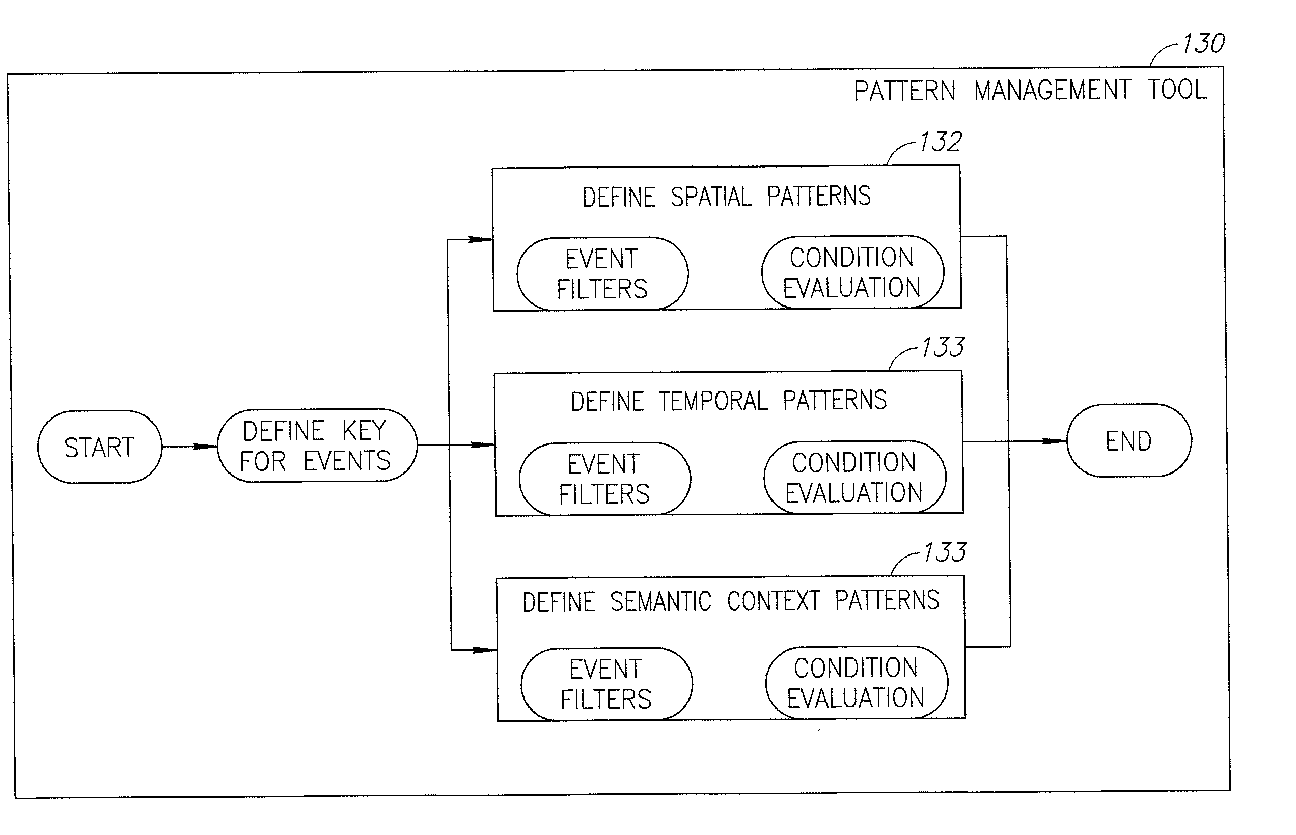
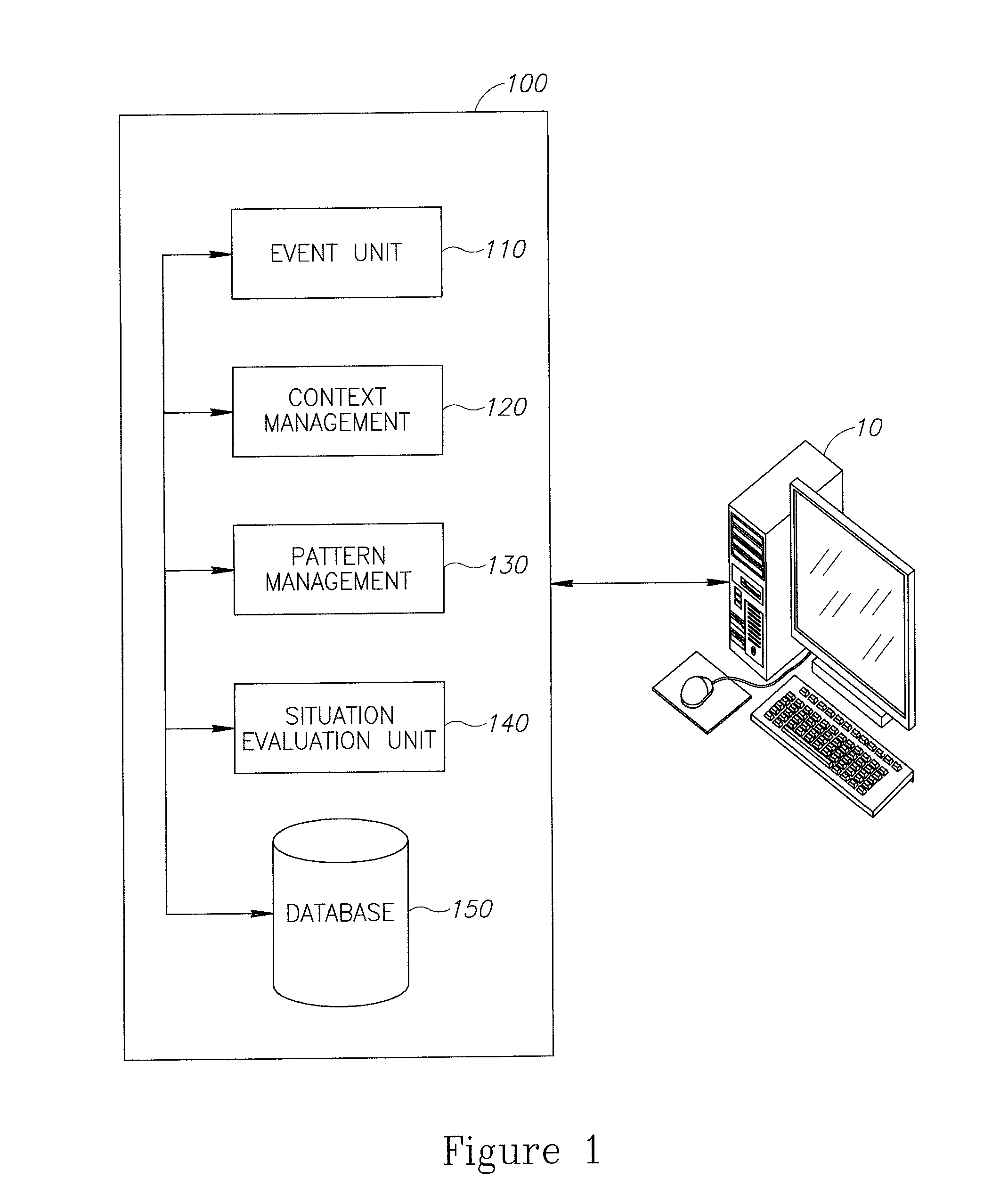
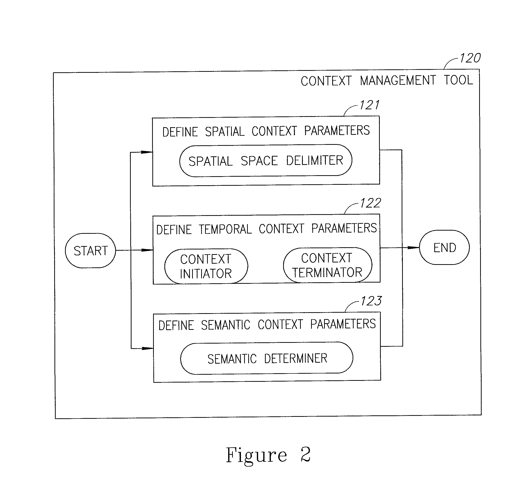
A method of optimizing runtime spatiotemporal events processing is provided. The method includes the following stages: defining a plurality of spatial contexts or spatiotemporal contexts; specifying a plurality of spatial patterns or spatiotemporal patterns being relationships between events complying with specified policies within the defined spatial contexts and spatiotemporal contexts respectively; identifying events of specified properties out of a stream of incoming events, based on the defined spatial contexts or the defined spatiotemporal contexts; detecting event patterns of specified properties out of the stream of incoming events by grouping the incoming events and applying a pattern matching process based on the specified spatial patterns or spatiotemporal patterns; adaptively generating a spatial evaluation plan that defines an order of processing such that event processing is optimized, based on off-line and runtime data; and processing the incoming events based on the order defined in the spatial evaluation plan.

Description

BACKGROUND[0001]1. Technical Field[0002]The present invention relates to data processing and more particularly, to event processing of both spatial and temporal events.[0003]2. Discussion of the Related Art[0004]The processing of geo-spatial events becomes more and more important in constructing enterprise applications that can immediately react to business critical events. Geo-spatial event processing is useful, for example, when location-based aspects of events are important for business decisions and operations.[0005]Currently available data processing systems configured to process spatial data, for example GIS systems, operate with static queries on relational databases without any event processing capabilities. In addition, other available existing event processing systems may detect patterns on events. However, these systems lack embedded spatial processing capabilities therefore they process spatial events using “hard coded” solutions for each specific instance, without defin...

Claims


Application Information

Patent Timeline
Patent Type & Authority Patents(United States)
IPC IPC(8): G06F17/30G06F9/54
CPCG06F17/30241G06F9/542G06F16/29
Inventor ETZION, OPHERZOLOTOREVSKY, NIR
Owner INT BUSINESS MASCH CORP
Learn More