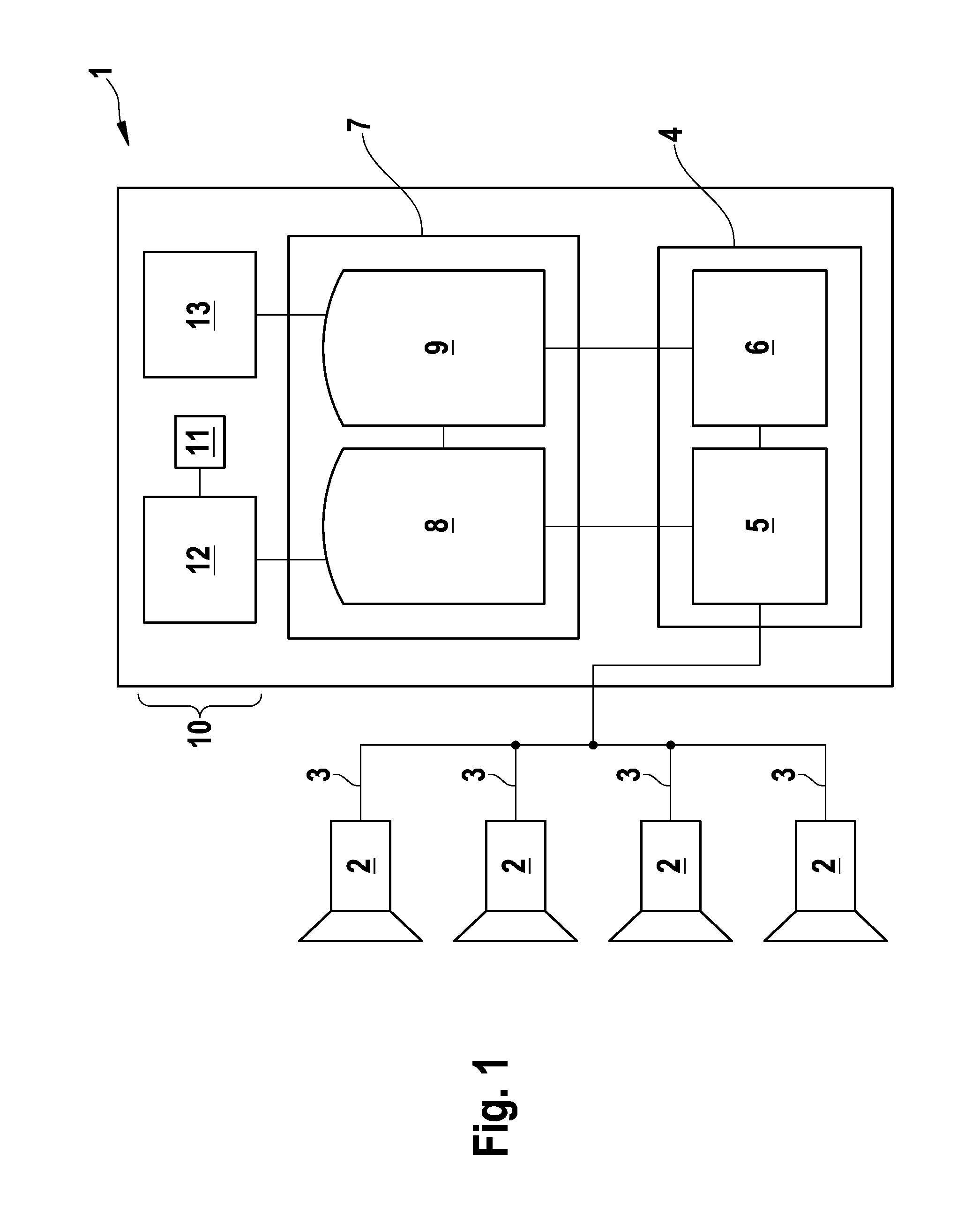
[0012]The advantage of the invention is that the user has a very good overview of the surroundings under surveillance and is able to interpret returning results faster in the light of the graphical overall description compared to other surveillance systems known in the art. In a further embodiment the graphical overall description is realized as a virtual and / or real 3-D model of the monitored surroundings.
[0013]In a preferred embodiment the querying means comprises a graphical user interface which is embodied to enable a user to formulate the trajectory-specific query graphically and / or schematically and / or interactively on the graphical overall description. Preferably user-friendly tools for functions like zoom, rotate, translate, etc. of the graphical overall description are implemented.
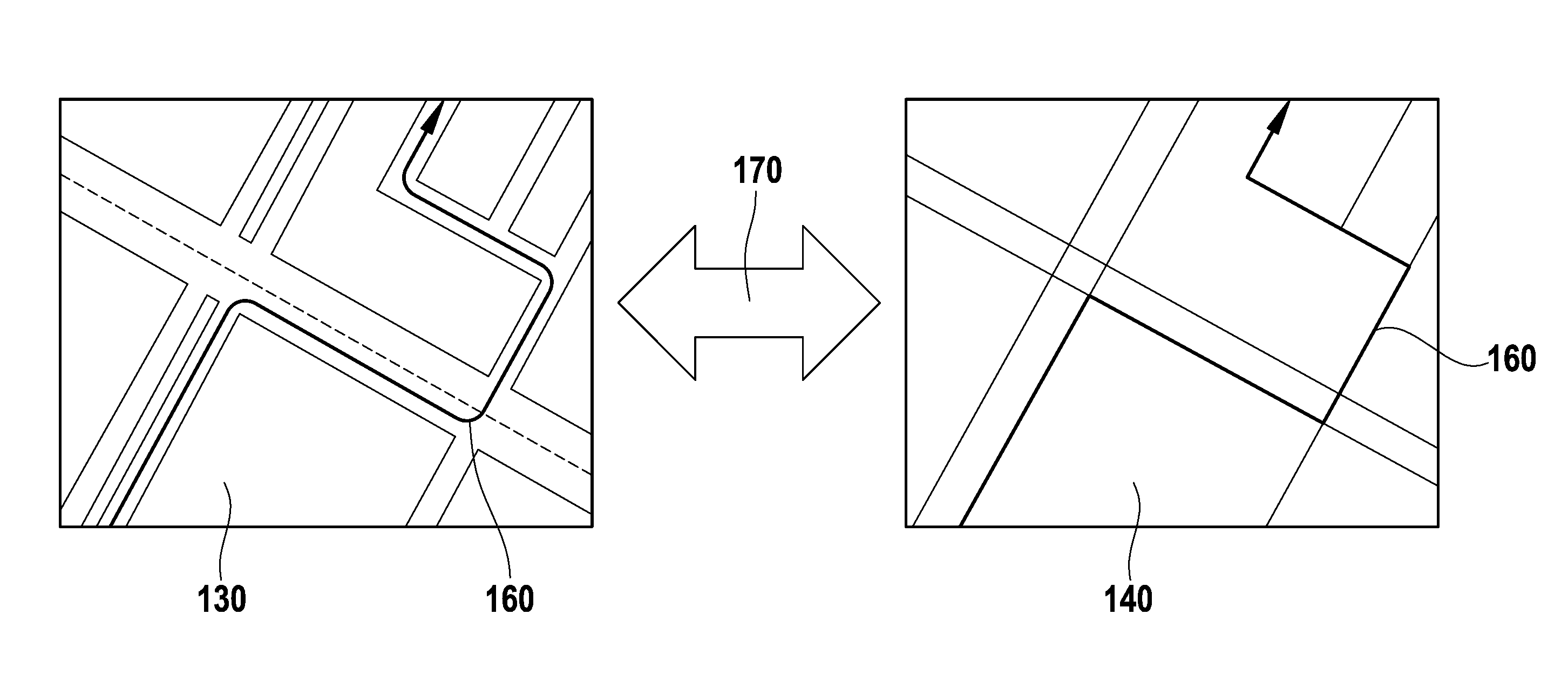
[0014]Preferably the graphical user interface allows and / or enables the user to draw lines and / or curves and / or circles etc. on the graphical overall description for formulating search queries, for example sketch, line crossing or area-of-interest queries. In case of a sketch-query, the user draws a sketch of a trajectory or part of a trajectory, for example a hand-drawn line or a spline generated by a plurality of single interpolation points, on the overall description. As a possible result of a sketch-query object-identifications (IDs) of all objects having a trajectory similar and / or identical to the sketch are returned. The ID is preferably defined as a unique reference to a unique object in a data-base. In the case of a line-crossing, the user draws a line preferably perpendicular to the extension of a street or the like. As a possible result of a line-crossing-query, object-identifications (IDs) of all objects having passed the line are returned. In an area-of interest-query, the user draws a borderline of an area on the overall description. As a possible result object-identifications (IDs) of objects passing through, staying in or leaving the area are returned.
[0015]In a further preferred embodiment the graphical user interface is a man-machine-interface (MMI), which is realized as a typical peripheral user input device, for example a computer-mouse or computer-pen, keyboard, remote control, touch-pad, joystick, touch-screen, microphone for voice control etc.
[0016]Optionally the trajectory-specific queries are combined with further conditions like orientation conditions restricting the results for example to objects and / or trajectories moving along the sketched line or passing the line in a defined direction and / or object property conditions restricting the results for example to objects and / or trajectories, whereby the objects have a defined color, size, velocity, acceleration or the like and / or time conditions restricting the results to objects and / or trajectories, whereby the objects have a defined temporal behavior, like objects with a defined stop time for parking or the like. Further more such a condition could refer to the type (for example pedestrian, car bus) of the object.
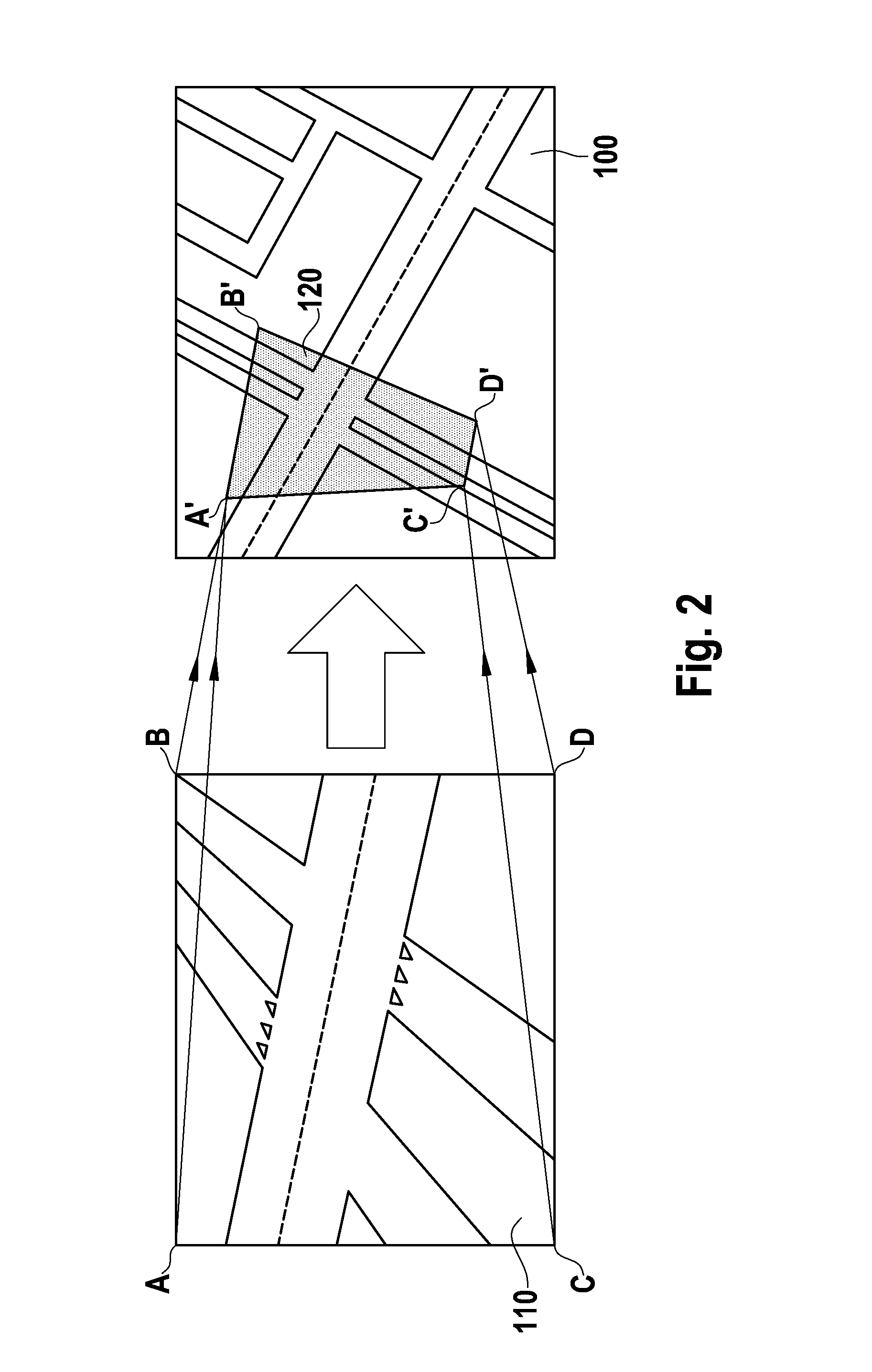
[0017]The graphical overall description is preferably realized as a context aware map comprising and / or consisting of images from the plurality of cameras. The context aware map is advantageously generated by a perspective-corrected accumulation and / or addition of the images of the multiple cameras, preferably of synchronized images, which are referring to the same time. The perspective-corrected addition can be carried out as a four-point approximation, whereby only the edge points of each image are perspective-corrected positioned and the remaining points are arranged linearly displaced in respect to the edge points. Alternatively all image points (pixels) are perspective-corrected, which results in a higher processing time but in a distortion-reduced representation of the context aware map. “White” areas, which are areas temporarily or permanently not monitored by the cameras, are preferably supplemented by other information sources, for example CAD-data or map material. For a realization of a context aware map reference is made for example to the Hall-paper as discussed above, which is incorporated by reference in its entirety, especially concerning the context aware map. Alternatively the graphical overall description is realized as an overview representation of the monitored surrounding, especially a schematic map and / or a road map and / or an overview image, for example a satellite image and / or satellite imagery and / or a combination thereof.