Space data fuzzy evidence weight analysis method

A technology of weight analysis and spatial data, applied in the field of spatial information, which can solve problems such as difficulties

Inactive Publication Date: 2007-10-17
CHINA UNIV OF GEOSCIENCES (WUHAN) +2
View PDF0 Cites 19 Cited by
  • Summary
  • Abstract
  • Description
  • Claims
  • Application Information

AI Technical Summary

Problems solved by technology

In actual work, it is more difficult to ensure that information is not lost during the conversion process if the continuous attribute values ​​are converted into discrete binary or ternary patterns.

Method used


Image

  • Space data fuzzy evidence weight analysis method
  • Space data fuzzy evidence weight analysis method
  • Space data fuzzy evidence weight analysis method

Examples


Embodiment Construction

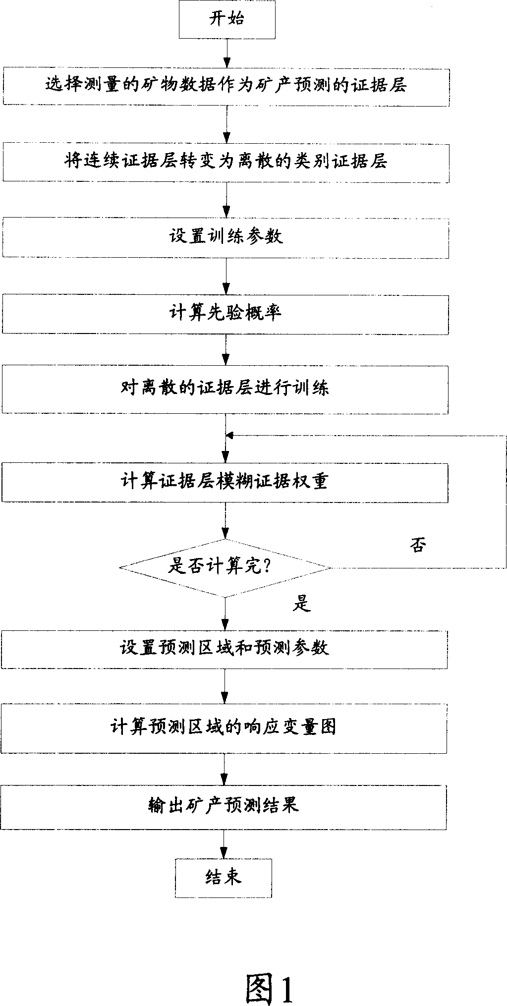
[0039] The specific implementation manners of the present invention will be described below in conjunction with the accompanying drawings.

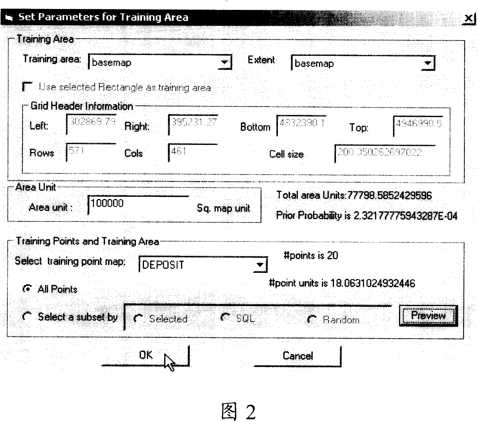
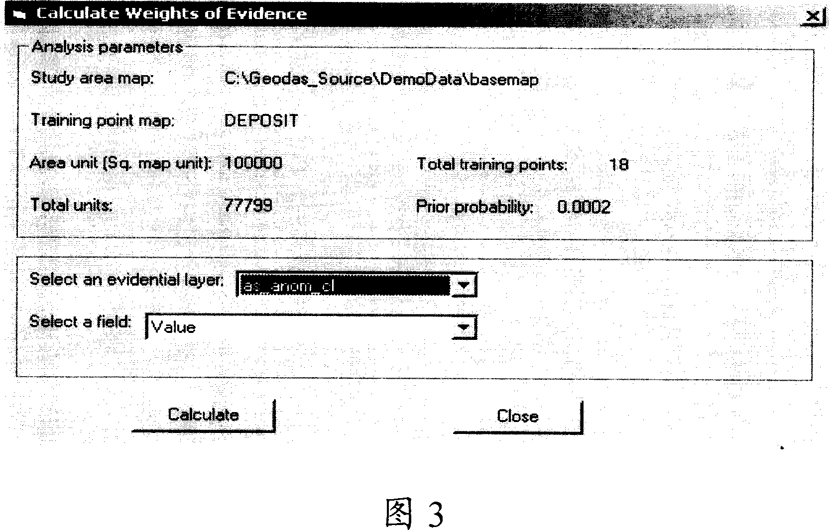
[0040] The calculation method of the fuzzy weight adopted by the present invention is as follows: it is assumed that the evidence X is connected with the hypothesis of "appearance" of a certain mine D. X = {xi, x2, . . . , xn}. In mineral resource evaluation, xi can be rock category, singular value category, etc. In the usual discrete statistical methods, X is used to construct binary and ternary variables. The steps are as follows: a binary pattern consists of two subsets, A and A (not A), and A∪ A=X; A∩ A=0, that is, A and A are mutually exclusive. A binary variable that falls into set A has a value of 1, and a binary variable that does not fall into set A or falls into set A has a value of 0. If a single binary pattern is not sufficient, more binary patterns can be generated from X. Unlike traditional weight-of-evidence methods, fu...


PUM


Abstract

The invention provides a fuzzy evidence weight analytical method and technology for mineral forecasting, mineral resource assessment as well as environmental assessment. The forecasting for the minerals resource is completed by constructing multivariate space multivariate spatial information database, forming the spatial information evidence picture layer of minerals forecasting through data processing and information extraction, obtaining the forecasting weight of evidence picture layer through calculation, drawing the probability picture of minerals resource prediction through comprehensive multilayer evidence picture layer. The invention has the advantages of broad practicality and less information loss, high forecasting precision, and is suitable for multisource geological data, for example geological data, mineral data, geochemistry data, geophysics data and remote sensing data or the like, to carry out the precasting process such as information extracting, data integration, mineral resource assessment, mineral detection, environmental contamination assessment, natural calamity, risk assessment, ect.

Description

technical field [0001] The invention belongs to the technical field of space information, and specifically relates to a fuzzy evidence weight analysis method and technology of space data for mineral resource prediction, environmental pollution evaluation and geological disaster early warning. The processed multi-source spatial data may include various types of geological data (geological maps), geochemical data, geophysical data, geographic data (numerical topographic maps), mineral data and remote sensing data. This method realizes the potential prediction of mineral resources, environmental pollution assessment, and natural disaster risk assessment through spatial data processing, spatial information acquisition, and multi-source spatial information synthesis. technical background [0002] Spatial data processing and information synthesis are important technical means of contemporary spatial decision support systems. Data and information-driven spatial decision support un...

Claims


Application Information

Patent Timeline
Patent Type & Authority Applications(China)
IPC IPC(8): G06Q10/00G06Q50/00G06Q50/02
Inventor 成秋明张生元葛咏
Owner CHINA UNIV OF GEOSCIENCES (WUHAN)
Why Eureka
Try Eureka