Map road-seeking method and system

A map and wayfinding technology, applied in the field of map wayfinding methods and systems based on navigation grids, can solve problems such as affecting the efficiency of wayfinding, large space overhead, and inability to use maps, so as to reduce space-time complexity and space overhead. , the effect of improving the efficiency of pathfinding

Active Publication Date: 2008-08-13
TENCENT TECH (SHENZHEN) CO LTD
View PDF0 Cites 44 Cited by
  • Summary
  • Abstract
  • Description
  • Claims
  • Application Information

AI Technical Summary

Problems solved by technology

From the above process, it can be seen that when the map corresponding to a scene is composed of a large number of dense triangles, if the starting node is far away from the target node and the pathfinding is based on the triangles, it is necessary to store each detected or searched nodes, then a large number of expanded nodes need to be stored in the search space, and the space overhead will be particularly huge, and many of the nodes are actually irrelevant nodes. In this way, it will not only take up a lot of unnecessary space overhead and cause waste; Seriously affect the efficiency of pathfinding
[0004] As for A * The second-level pathfinding method is mainly to create a low-density diamond grid on the map, and fixedly select the center point of the diamond grid as the waypoint. First, the macro pathfinding method is used to determine the rough path, and then the microscopic path is used on each path. Pathfinding, but this method uses the search node in the pathfinding process as the center point of the grid, which has certain limitations in the scope of application. It can only deal with two-dimensional maps with regular shapes, and cannot be used for two-dimensional or 3D Irregularly Shaped Map

Method used


Image

  • Map road-seeking method and system
  • Map road-seeking method and system
  • Map road-seeking method and system

Examples


Embodiment Construction
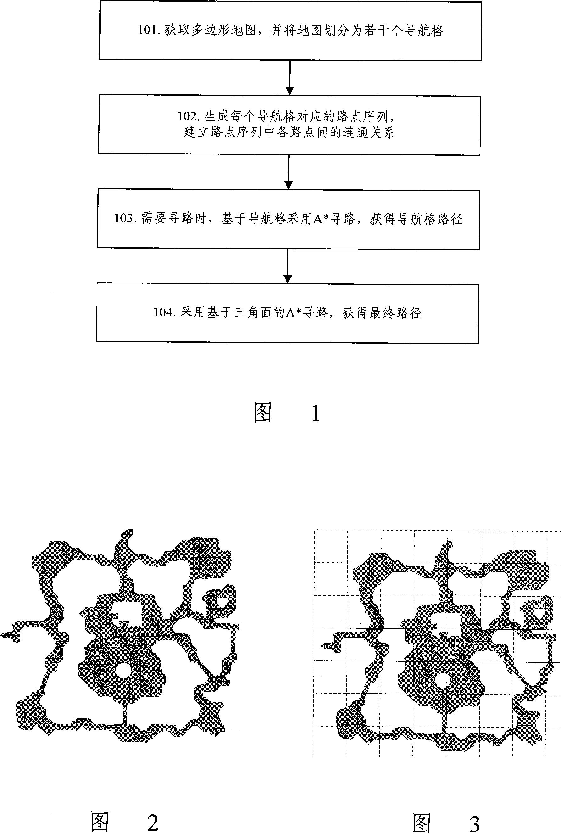
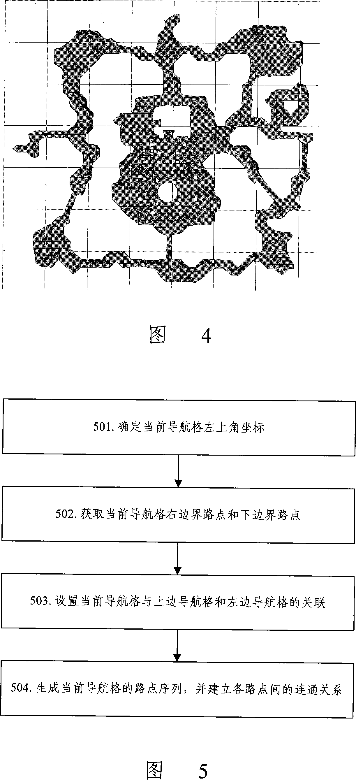
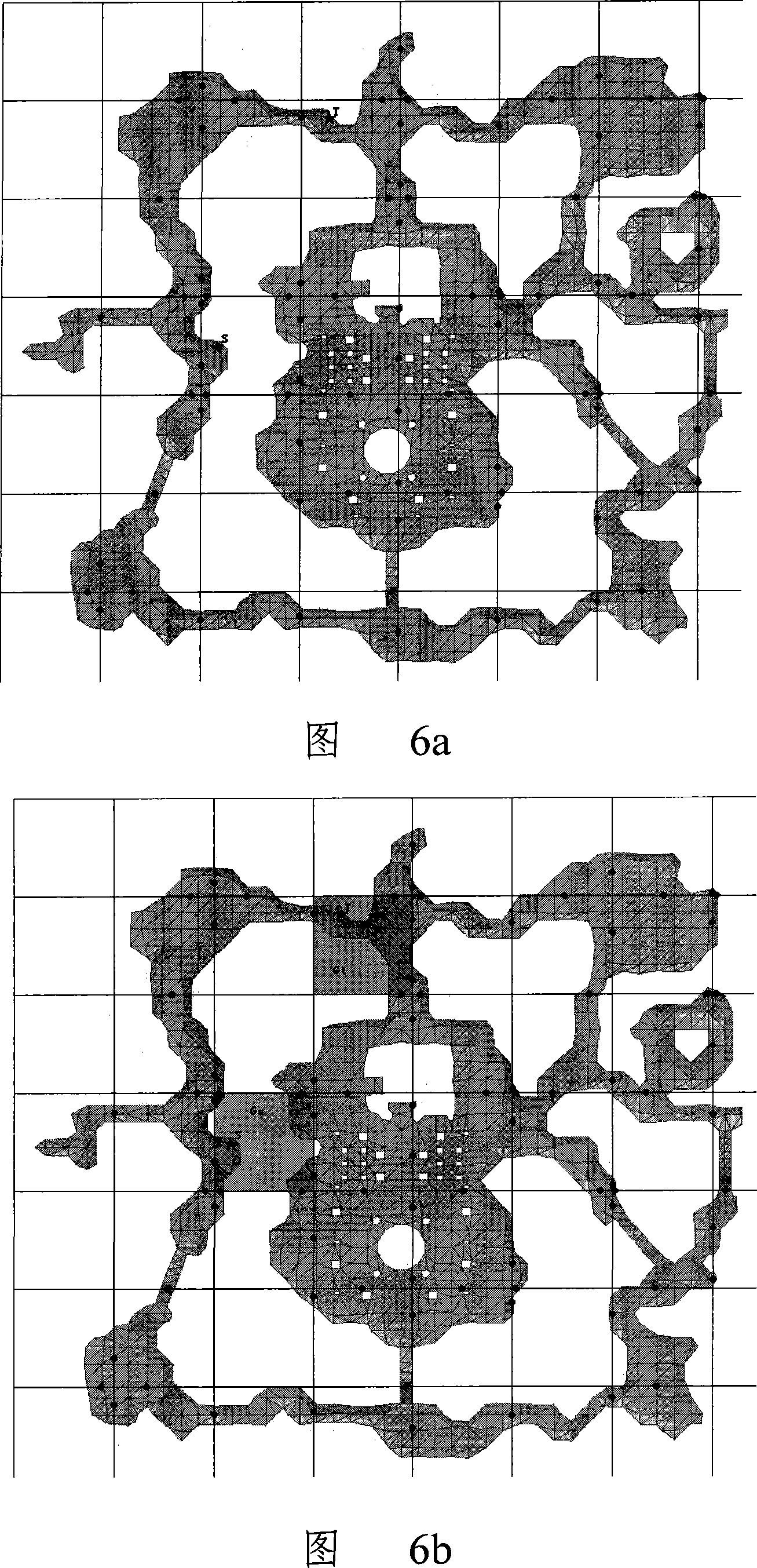
[0026] The basic idea of ​​the present invention is: divide the planar map corresponding to the scene to be processed into several areas of equal size, and generate waypoints on the boundaries of the areas; The area path from the starting point to the end point; then, based on the obtained area path, the triangular surface-based pathfinding is further used to generate the final path.

[0027] Among them, each area can be called a navigation grid. Correspondingly, the area path is to regard each navigation grid as a point, first determine all the navigation grids that pass from the navigation grid to which the starting point belongs to the navigation grid to which the end point belongs, and then according to the determined The association between the navigation grids and the entry points between the navigation grids can obtain a path from the start point to the end point composed of waypoints. The waypoint is the midpoint of the coincident line segment formed by each side of th...


PUM


Abstract

The present invention provides a map pathfinding method, dividing plane map into one or more identical area, generating waypoint on area border; when finding path, processing path find based on the area to acquire area path; then generating final path based on the triangular facet Path finding according to the acquired area path. The invention also provides a mapping road finding system, adopting method and system of the invention not only saves space occupation, but also improves road finding efficiency, also suitable for process of all kinds of maps.

Description

technical field [0001] The invention relates to map pathfinding technology, in particular to a map pathfinding method and system based on a navigation grid. Background technique [0002] With the continuous development of online games, in games based on three-dimensional (3D) scenes, it is often necessary to realize the movement of virtual objects in the scene, and the problem of pathfinding is involved in the moving process. In the field of game pathfinding, A * Pathfinding algorithm is a widely used artificial intelligence technology, A * The pathfinding algorithm is actually a heuristic search, which uses an evaluation function to evaluate the value of each decision and decide which solution to try first. Specifically, the so-called heuristic search means that when the current search node selects the next node, a heuristic function can be used to select the node with the least cost, such as the node closest to the current node, as the next search node, and Jump to the ...

Claims


Application Information

Patent Timeline
Patent Type & Authority Applications(China)
IPC IPC(8): G06F17/30G06F19/00
CPCG06Q10/047
Inventor 彭超
Owner TENCENT TECH (SHENZHEN) CO LTD
Why Eureka
Try Eureka