GIS middleware collocation and management method
A technology of configuration management and middleware, which is applied in the field of geographic information systems, can solve the problems of wasting manpower and material resources, restricting software scalability, etc., achieve strong scalability, and avoid the effect of data format conversion and information loss
- Summary
- Abstract
- Description
- Claims
- Application Information
AI Technical Summary
Problems solved by technology
Method used
Image
Examples
Embodiment Construction
[0034] specific implementation plan
[0035] The embodiments of the present invention will be further described below in conjunction with the accompanying drawings.
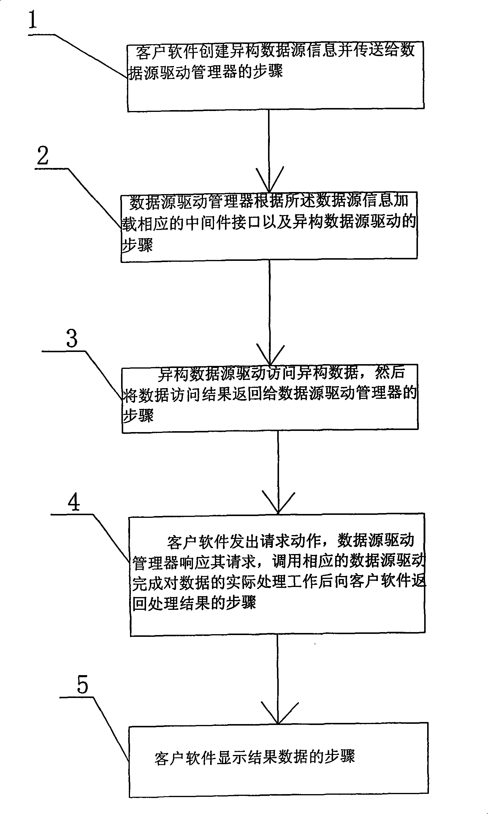
[0036] figure 1 is a flow diagram of the GIS middleware configuration management method, such as figure 1 As shown, a GIS middleware configuration management method, its steps are as follows:
[0037] 1), the client software creates heterogeneous data source information and transmits it to the data source driver manager; for example
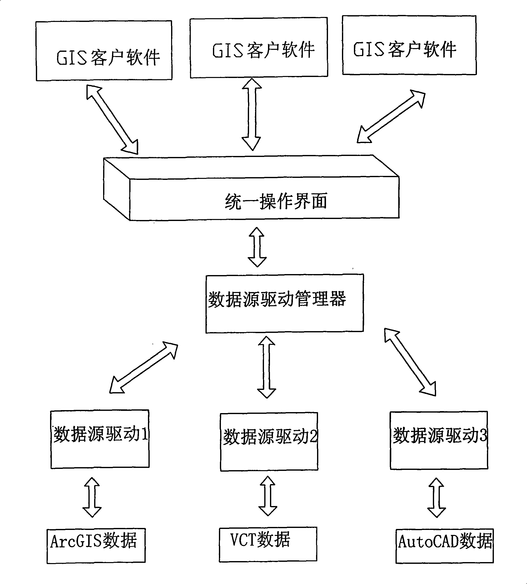
[0038] 2), the data source driver manager loads the corresponding middleware interface and the heterogeneous data source driver according to the heterogeneous data source information; for example, if the heterogeneous data source is the Shapefile file data of ArcGIS, then the heterogeneous data source object Send to Shapefile driver;
[0039] 3), the heterogeneous data source driver in the step 2) directly accesses the heterogeneous data source, and then returns the successful i...
PUM
 Abstract
Description
Claims
Application Information
 - R&D
- Intellectual Property
- Life Sciences
- Materials
- Tech Scout
- Unparalleled Data Quality
- Higher Quality Content
- 60% Fewer Hallucinations
Browse by: Latest US Patents, China's latest patents, Technical Efficacy Thesaurus, Application Domain, Technology Topic, Popular Technical Reports.
© 2025 PatSnap. All rights reserved.Legal|Privacy policy|Modern Slavery Act Transparency Statement|Sitemap|About US| Contact US: help@patsnap.com


