
Satellite navigation receiver and method for locating by utilizing satellite navigation receiver

A technology of satellite navigation and receiver, applied in the field of satellite navigation

Inactive Publication Date: 2013-08-14
MAISHI ELECTRONICS (SHANGHAI) LTD
View PDF2 Cites 1 Cited by
  • Summary
  • Abstract
  • Description
  • Claims
  • Application Information

AI Technical Summary

Problems solved by technology

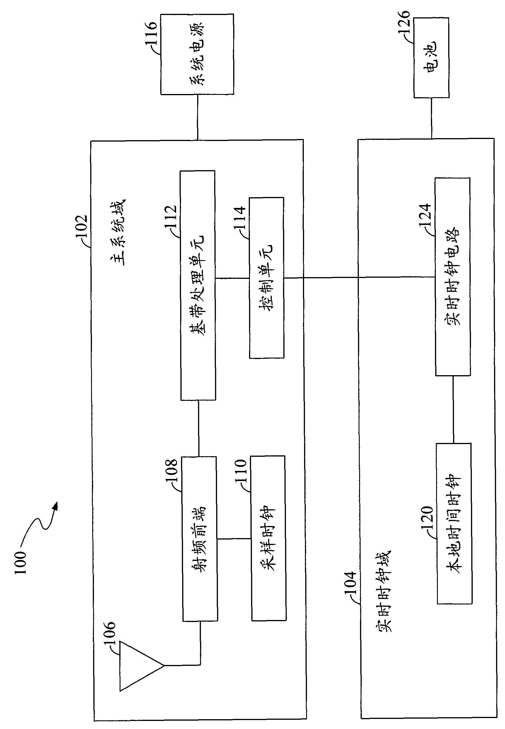
[0012] In addition, the above traditional method also requires that the signal-to-noise ratio (Signal Noise Ratio, SNR) of the received GPS satellite signal must be higher than a threshold (such as 26db-Hz)
Therefore, for GPS satellite signals with weak signal strength, the GPS receiver 100 may not be able to obtain relevant information from the navigation message, thereby increasing the time to first fix

Method used


Image

  • Satellite navigation receiver and method for locating by utilizing satellite navigation receiver
  • Satellite navigation receiver and method for locating by utilizing satellite navigation receiver
  • Satellite navigation receiver and method for locating by utilizing satellite navigation receiver

Examples


Embodiment Construction

[0050] The purpose, specific structural features and advantages of the present invention can be further understood through the description of some embodiments of the present invention in conjunction with the accompanying drawings.

[0051] Detailed reference will be given below to examples of the present invention. Although the present invention has been illustrated and described by these embodiments, it should be noted that the present invention is not limited to these embodiments. On the contrary, the invention covers all alternatives, modifications and equivalents within the spirit and scope of the invention as defined by the claims.

[0052] In addition, in order to better illustrate the present invention, numerous specific details are given in the specific embodiments below. It will be understood by those skilled in the art that the present invention may be practiced without these specific details. In other instances, well-known methods, procedures, components and circu...


PUM


Abstract

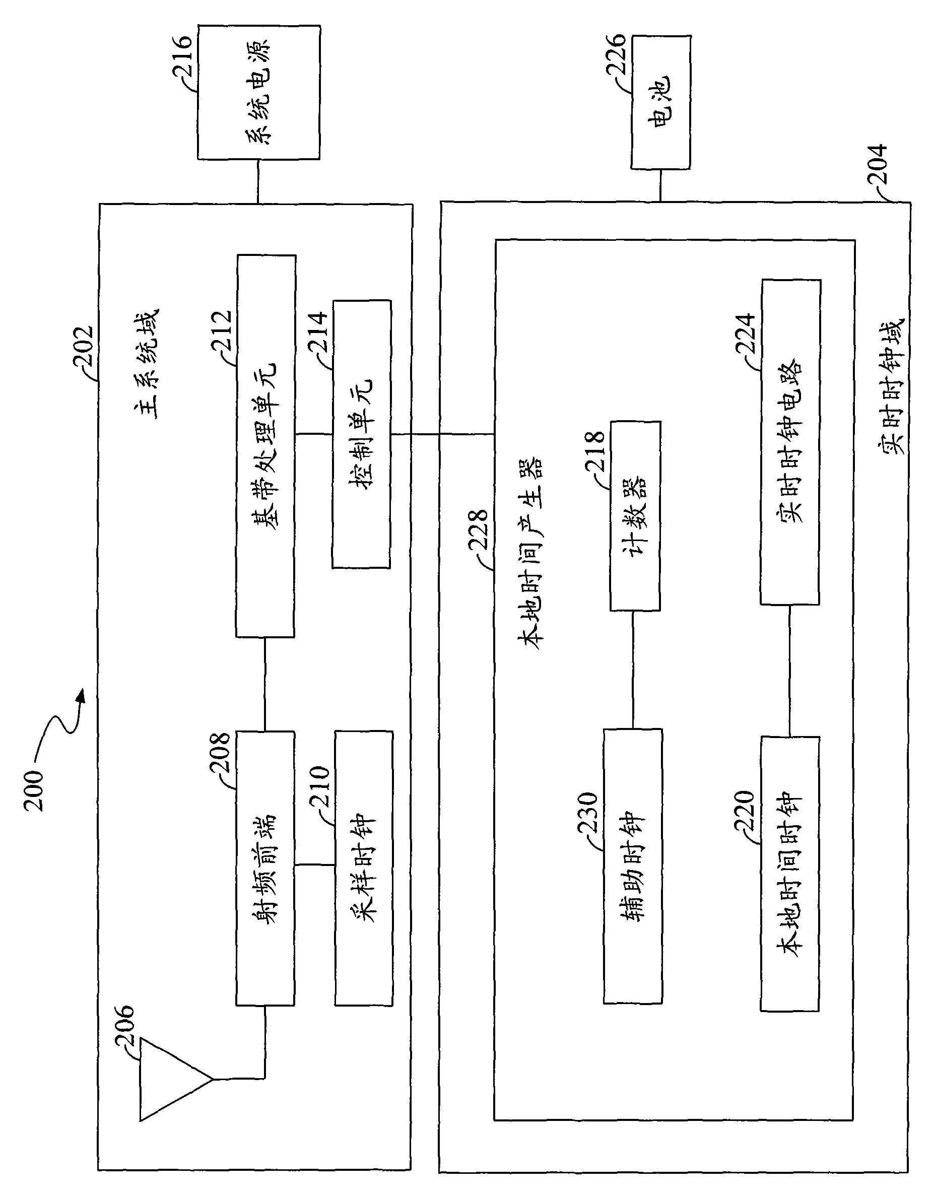
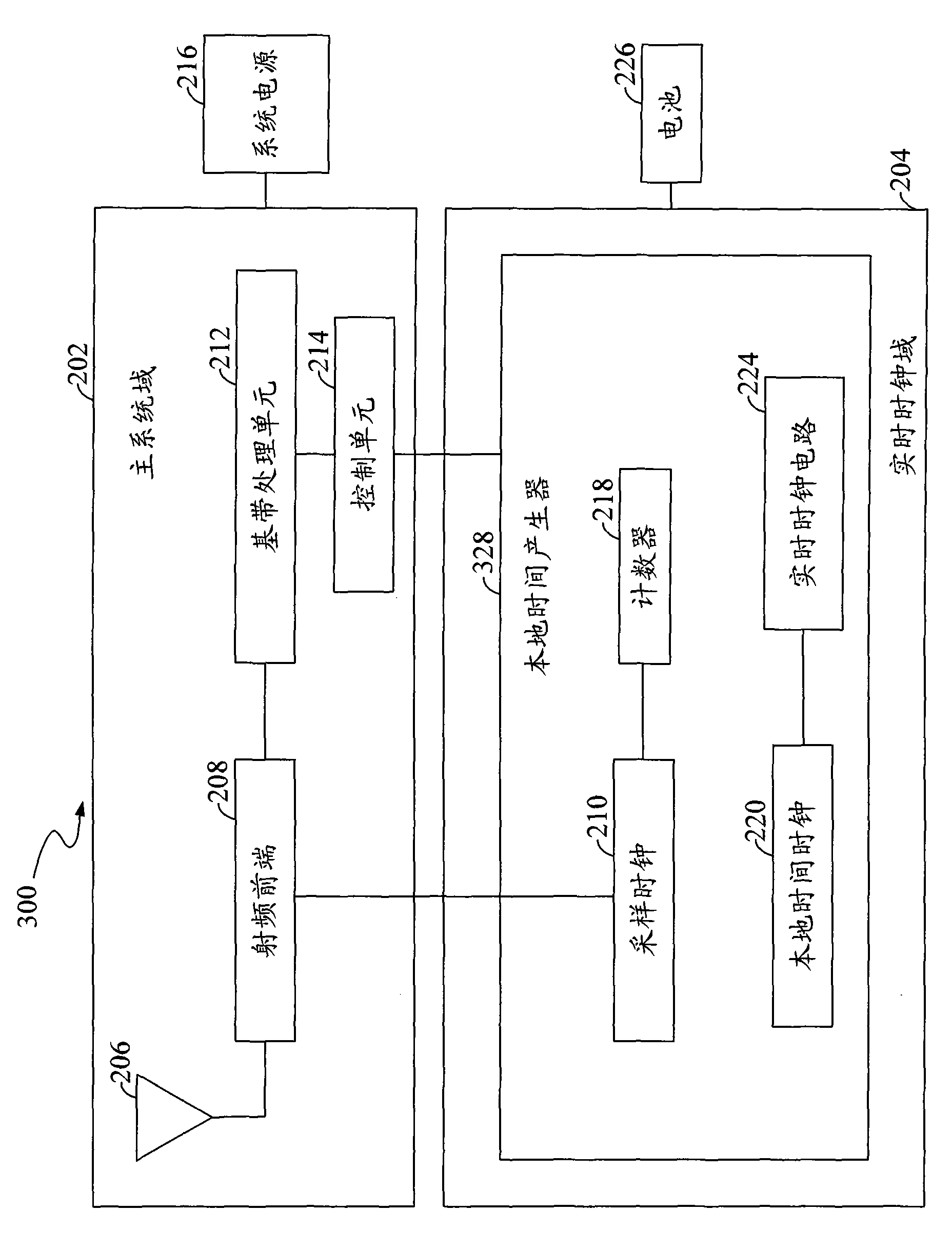
The invention discloses a satellite navigation receiver and a method for locating by utilizing the satellite navigation receiver. The satellite navigation receiver comprises a counter and a control unit, wherein the counter is driven by a reference clock signal having a reference clock frequency. The control unit calculates a correction value indicative of a corrected reference clock frequency by comparing an increment of the counter values during a time period with an increment of the navigation system time during the time period before the satellite navigation receiver is turned off and then the control unit generates a calculated navigation system time according to the correction value before the satellite navigation receiver is started again. By using the satellite navigation receiver and the method for locating by utilizing the satellite navigation receiver of the invention, the first locating time can be effectively shortened.

Description

Technical field [0001] The invention involves a satellite navigation technology, especially a satellite navigation receiver and a method of positioning with satellite navigation receiver. Background technique [0002] Global positioning system (GPS system) is a satellite system for providing location information to GPS receiver.The GPS system includes at least 24 earth satellites and several ground control stations for about 12 hours. [0003] GPS satellite broadcast data is called navigation electrical text.Navigation electronic text contains the time difference between the time of the star calendar, the calendar, the satellite time (the time of the clock on the satellite), and the time difference between the time of the Satellite time compared to the GPS system time (the standard time for reference in the entire system).The time difference between the satellite time is relatively fixed compared to the GPS system, and it is stored in the GPS receiver in advance.The GPS receiver ...

Claims


Application Information

Patent Timeline
Patent Type & Authority Patents(China)
IPC IPC(8): G01S1/02G01S5/14
Inventor 余晓光杜珣弤黄海权
Owner MAISHI ELECTRONICS (SHANGHAI) LTD
Learn More