Least square area network color-homogenizing method of aerial remote sensing image

A least-squares, aerial remote sensing technology, applied in the field of aerial remote sensing images, can solve the problems of unable to achieve ideal results, accumulation of transmission path errors, affecting the effect of image leveling processing, etc.

Active Publication Date: 2012-07-11
WUHAN UNIV
View PDF0 Cites 0 Cited by
  • Summary
  • Abstract
  • Description
  • Claims
  • Application Information

AI Technical Summary

Problems solved by technology

To deal with the problem of color difference between adjacent images (also known as uniform color processing), the method based on the combination of Wallis filter and tone reference image was proposed earlier. [1] , the effect of this method is ideal when dealing with survey areas with relatively consistent image content, but for larger survey areas, large-scale aerial photography images or low-altitude photographic images, the content of images in the survey area often differs greatly (such as figure 1 ), at this time, the desired effect cannot be achieved by...

Method used


Image

  • Least square area network color-homogenizing method of aerial remote sensing image
  • Least square area network color-homogenizing method of aerial remote sensing image
  • Least square area network color-homogenizing method of aerial remote sensing image

Examples


Embodiment Construction

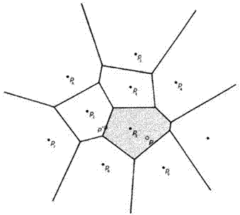
[0045] The invention adopts the least squares-based area network uniform color method to solve the problem of color difference between aerial images. The method uses the idea of ​​light beam method area network air triangulation for reference. The pixel tone information, and then construct the equations of the pixel tone information compensation parameters of each image, use the least squares adjustment method to solve the pixel tone information compensation parameters of each image, and finally adjust each image according to the tone compensation parameters obtained from the solution. The color tone information of the image.

[0046] In order to better understand the technical scheme of the present invention, the present invention will be described in further detail below in conjunction with accompanying drawing, and concrete steps of the present invention are as follows:

[0047] step 1,

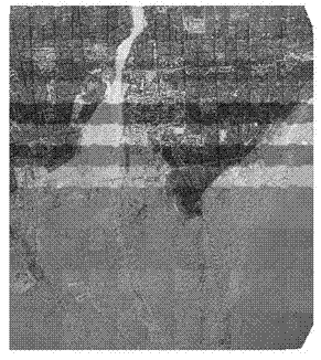
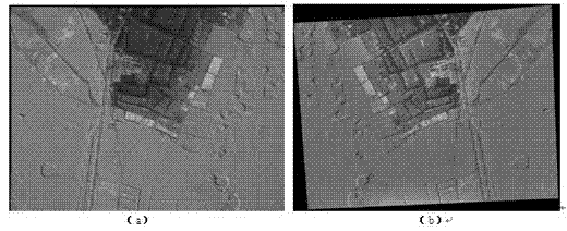
[0048] For all the p single-image ortho-rectified images to be mosaicked in the surve...


PUM


Abstract

The invention discloses a least square area network color-homogenizing method of an aerial remote sensing image. In the method provided by the invention, the idea of block aerial triangulation of a bundle method is utilized for reference. The method comprises the following steps: firstly counting the pixel hue information of the stacking area of adjacent images of single-phase orthographic correction images; then constructing an equation set of compensation parameters of the pixel hue information of each image; resolving the compensation parameters of the pixel hue information of each image by utilizing a least square adjustment method; and finally adjusting the hue information of each image based on the obtained hue compensation parameters. By utilizing the method, hue difference elimination process can be carried out on the images with relatively large difference in the image content of the large testing zone and the testing zone, and further an arbitrary position in the testing zone and an arbitrary number of images can be conveniently designated as the hue control image to control the basic hue of the entire testing zone in the process of eliminating color difference.

Description

technical field [0001] The invention belongs to the field of remote sensing image processing, in particular to a method for uniform coloring of aerial remote sensing images. Background technique [0002] In surveying and mapping production, one of the main steps in the production of digital orthophotos (DOM) is image mosaic. Image mosaic is to mosaic the adjacent images that have completed single-image orthorectification into standard orthophoto results, or to complete single-image Adjacent images such as orthorectification are mosaiced into an orthophoto of the entire survey area and then output as a standard map frame. In the process of image mosaicing, not only the problem of geometric borders between adjacent images must be dealt with, but also the overall color tone and color transition of the mosaiced images must be consistent. The color processing effect of the image is directly related to the quality of the final orthophoto image. Researching and solving the automat...

Claims


Application Information

Patent Timeline
IPC IPC(8): H04N7/26G06T5/00
Inventor 孙明伟张祖勋张剑清
Owner WUHAN UNIV
Why Eureka
Try Eureka