A fuzzy supervised classification method for multi-band remote sensing images based on non-equal weighted distance

A technology of remote sensing images and bands, applied in character and pattern recognition, instruments, calculations, etc., can solve problems such as difficulty in ensuring classification accuracy, high degree of automation, and low efficiency, and achieve improved classification efficiency, improved classification accuracy, and reduced iterations Effect

Inactive Publication Date: 2011-12-21
WUHAN UNIV
View PDF1 Cites 10 Cited by
  • Summary
  • Abstract
  • Description
  • Claims
  • Application Information

AI Technical Summary

Problems solved by technology

[0003] As an unsupervised classification method that does not require human intervention but only determines the cluster centers and classification results based on self-iteration, it has the following shortcomings when it is directly used in remote sensing image analysis [7] : First of all, the unsupervised classification method of remote sensing images is to classify the categories directly according to the similarity measure between the individuals to be divided, and then manually identify the corresponding actual ground object types. The degree of automation is high, but it is difficult to guarantee the classification accuracy [8] ; Secondly, the multi-band characteristics of remote sensing images determine that the variable input must be multivariate, which directly leads to the low efficiency of the FCM classification method that achieves the best classification results by self-iteration; finally, because the potential sample structure information is unknown , it is often impossible to obtain the corresponding classification results according to the classification purpose, so the determination of the one-to-one correspondence between each category in the results and the real ground objects is one of the difficulties in the existing classic fuzzy C-means algorithm [1]

Method used


Image

  • A fuzzy supervised classification method for multi-band remote sensing images based on non-equal weighted distance
  • A fuzzy supervised classification method for multi-band remote sensing images based on non-equal weighted distance
  • A fuzzy supervised classification method for multi-band remote sensing images based on non-equal weighted distance

Examples


Embodiment Construction

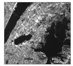
[0046] The traditional FCM classification method is an unsupervised classification method for remote sensing images. This method uses iteration to divide each pixel into different categories, so that the objective function minimum, among them, u jk Indicates the degree to which the jth object belongs to the kth class; d jk Indicates the distance between the j-th object and the k-th cluster center; k∈[1, n] is a natural number, and n is the number of categories; j∈[1, M×N] is a natural number, and M×N is a remote sensing image size; U means all u jk , V represents the cluster center of each category, and m is the weighted index.

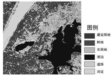
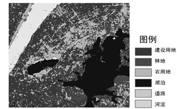
[0047] The present invention improves the traditional FCM classification method with the spectral information of the artificially extracted training area, and proposes a multi-band remote sensing image supervision classification method based on non-equal weighted distances. The method includes the following steps:

[0048] S1. Determine the cluste...


PUM


Abstract

The invention discloses a fuzzy supervised classification method for a multiband remote sensing image based on non-equal weight distances. In the method disclosed by the invention, the non-equal weight distances of the cluster center of the remote sensing image and various land utilization types in different wavebands are redefined by adopting the manually extractive spectrum information of a training region based on a traditional FCM (File Compare Mask) classification method; and the degree of each pixel belonging to the different land utilization types is judged by utilizing the non-equal weight distances as an evaluation criterion, thereby realizing the fuzzy supervised classification of the remote sensing image. The method disclosed by the invention determines the cluster center and the distance value through the spectrum characteristics of the training region and obviously improves the classification efficiency and the classification accuracy.

Description

technical field [0001] The invention relates to the field of computer remote sensing image classification, in particular to a remote sensing image fuzzy supervised classification method. Background technique [0002] Remote sensing image classification has always been a hot issue in the field of remote sensing applications. [1] . The diversity and complexity of the real geographical world lead to the common occurrence of mixed pixels in remote sensing image classification [2] , and the traditional either-or hardening method is difficult to satisfy this uncertain and vague geographical status quo. The remote sensing image fuzzy classification method based on the uncertainty description of sample attributes can better express and deal with the unclear class attributes in remote sensing images, and has become a hot spot in the field of remote sensing image classification. [3] Many experiments have proved that the fuzzy classification method is more effective in expressing th...

Claims


Application Information

Patent Timeline
Patent Type & Authority Applications(China)
IPC IPC(8): G06K9/62G06K9/66
Inventor 王海军张文婷贺三维何青青
Owner WUHAN UNIV
Why Eureka
Try Eureka