Navigation path downloading method and server and position service terminal
A technology for navigation paths and location services, applied in directions such as road network navigators, can solve the problems of insufficient real-time local electronic map data and low practicability of navigation paths, and achieve the effect of saving costs and improving navigation efficiency.
- Summary
- Abstract
- Description
- Claims
- Application Information
AI Technical Summary
Problems solved by technology
Method used
Image
Examples
Embodiment Construction
[0040] In order to make the objectives, technical solutions and advantages of the present invention clearer, the following further describes the present invention in detail with reference to the accompanying drawings and embodiments. It should be understood that the specific embodiments described herein are only used to explain the present invention, but not to limit the present invention.
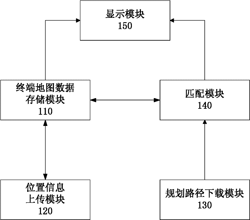
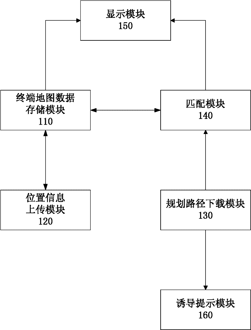
[0041] figure 1 It is a block diagram of a location service terminal according to an embodiment of the present invention. In this embodiment, the location service terminal includes a terminal map data storage module 110, a location information upload module 120, a planned route download module 130, a matching module 140, and a display module 150.
[0042] The terminal map data storage module 110 may be used to store electronic map data. For example, the terminal map data storage module 110 may be used to store the location information of each point on the electronic map, including longitude an...
PUM
 Abstract
Description
Claims
Application Information
 - R&D
- Intellectual Property
- Life Sciences
- Materials
- Tech Scout
- Unparalleled Data Quality
- Higher Quality Content
- 60% Fewer Hallucinations
Browse by: Latest US Patents, China's latest patents, Technical Efficacy Thesaurus, Application Domain, Technology Topic, Popular Technical Reports.
© 2025 PatSnap. All rights reserved.Legal|Privacy policy|Modern Slavery Act Transparency Statement|Sitemap|About US| Contact US: help@patsnap.com


