3D layering of map metadata

A metadata and map technology, applied in the field of 3D layering of map metadata, can solve problems such as losing context and unclear directions, and achieve the effect of improving the overall experience

Active Publication Date: 2012-02-22
MICROSOFT TECH LICENSING LLC
View PDF6 Cites 23 Cited by
  • Summary
  • Abstract
  • Description
  • Claims
  • Application Information

AI Technical Summary

Problems solved by technology

Also, transitions between different view levels may be abrupt when one 2D view is replaced by the next 2D view showing different metadata
As a result, observers can lose context and become disoriented during transitions

Method used


Image

  • 3D layering of map metadata
  • 3D layering of map metadata
  • 3D layering of map metadata

Examples


Embodiment Construction

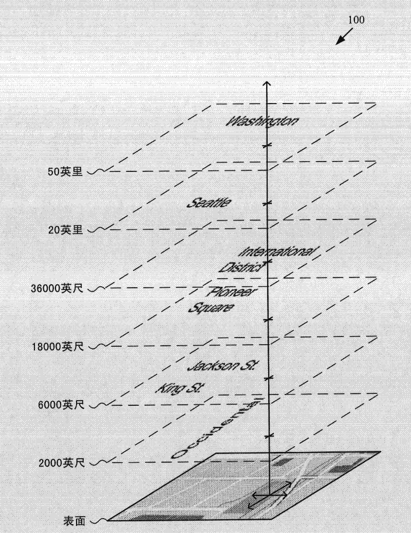
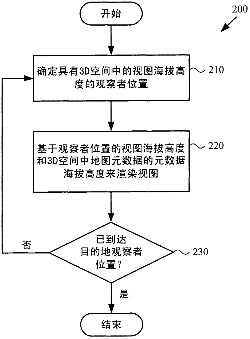
[0026] Techniques and tools for rendering views of maps in which map metadata elements are separated from the map base layer are described. Map metadata elements may be layered over the base layer of the map in 3D space. For example, map metadata elements are associated with features such as buildings, roads, towns, cities, states in the map, and map metadata elements are placed in 3D space depending on the altitude of the feature scale (for buildings and lower elevations for roads, higher elevations for cities, etc.) above the feature with which the map metadata element is associated. In various scenarios, the 3D layering of map metadata elements improves the overall experience of using map navigation tools.

[0027] Separating the map metadata elements from the base layer of the map and using 3D layering of the map metadata elements on the map simplifies the process of deciding which map metadata elements to show or hide for a given task. For example, depending on the search...


PUM


Abstract

Techniques and tools are described for rendering views of a map in which map metadata elements are layered in 3D space through which a viewer navigates. Layering of metadata elements such as text labels in 3D space facilitates parallax and smooth motion effects for zoom-in, zoom-out and scrolling operations during map navigation. A computing device can determine a viewer position that is associated with a view altitude in 3D space, then render for display a map view based upon the viewer position and metadata elements layered at different metadata altitudes in 3D space. For example, the computing device places text labels in 3D space above features associated with the respective labels, at the metadata altitudes indicated for the respective labels. The computing device creates a map view from points of the placed labels and points of a surface layer of the map that are visible from the viewer position.

Description

technical field [0001] The present invention relates to 3D layering of map metadata. Background technique [0002] Computer-aided map navigation tools have achieved widespread acceptance. Users can find addresses or directions with map navigation tools available at various websites. Some software programs allow users to navigate on a map, zoom in toward the ground or zoom out away from the ground, or move between geographic locations. In cars, GPS devices have provided basic road navigation for years. More recently, map navigation software for cell phones and other mobile computing devices has allowed users to zoom in, zoom out, and move around on maps showing information about geographic features, towns, cities, county and state locations, roads, and buildings details. [0003] Map navigation tools typically present metadata about map features as "kneaded into" a flat two-dimensional ("2D") view of the map. For example, in a top-down map view, text labels are written o...

Claims


Application Information

Patent Timeline
Patent Type & Authority Applications(China)
IPC IPC(8): G01C21/32G06F17/30
CPCG01C21/3673G06T17/05G06T15/20G06T15/503G09B29/005G06T15/00G06T17/10G06T17/20G08G1/13
Inventor J·C-Y·方D·A·巴尼特E·N·布拉夫
Owner MICROSOFT TECH LICENSING LLC
Why Eureka
Try Eureka