Multi-source data synergetic refined forest vegetation type information remote sensing updating method

A type of information, multi-source data technology, applied in the direction of radio wave measurement systems, instruments, etc., can solve problems that are difficult to overcome with a single data source, rough land cover and vegetation types, multi-source data and knowledge collaborative application, etc.

Inactive Publication Date: 2012-04-04
SICHUAN NORMAL UNIVERSITY
View PDF1 Cites 7 Cited by
  • Summary
  • Abstract
  • Description
  • Claims
  • Application Information

AI Technical Summary

Problems solved by technology

In terms of supervised classification, a set of samples is used for all pixels to be divided. Due to the phenomenon of the same object with different spectra and different objects with the same spectrum, the extracted land cover and vegetation types are relatively rough in a lar...

Method used


Image

  • Multi-source data synergetic refined forest vegetation type information remote sensing updating method
  • Multi-source data synergetic refined forest vegetation type information remote sensing updating method

Examples


Embodiment Construction

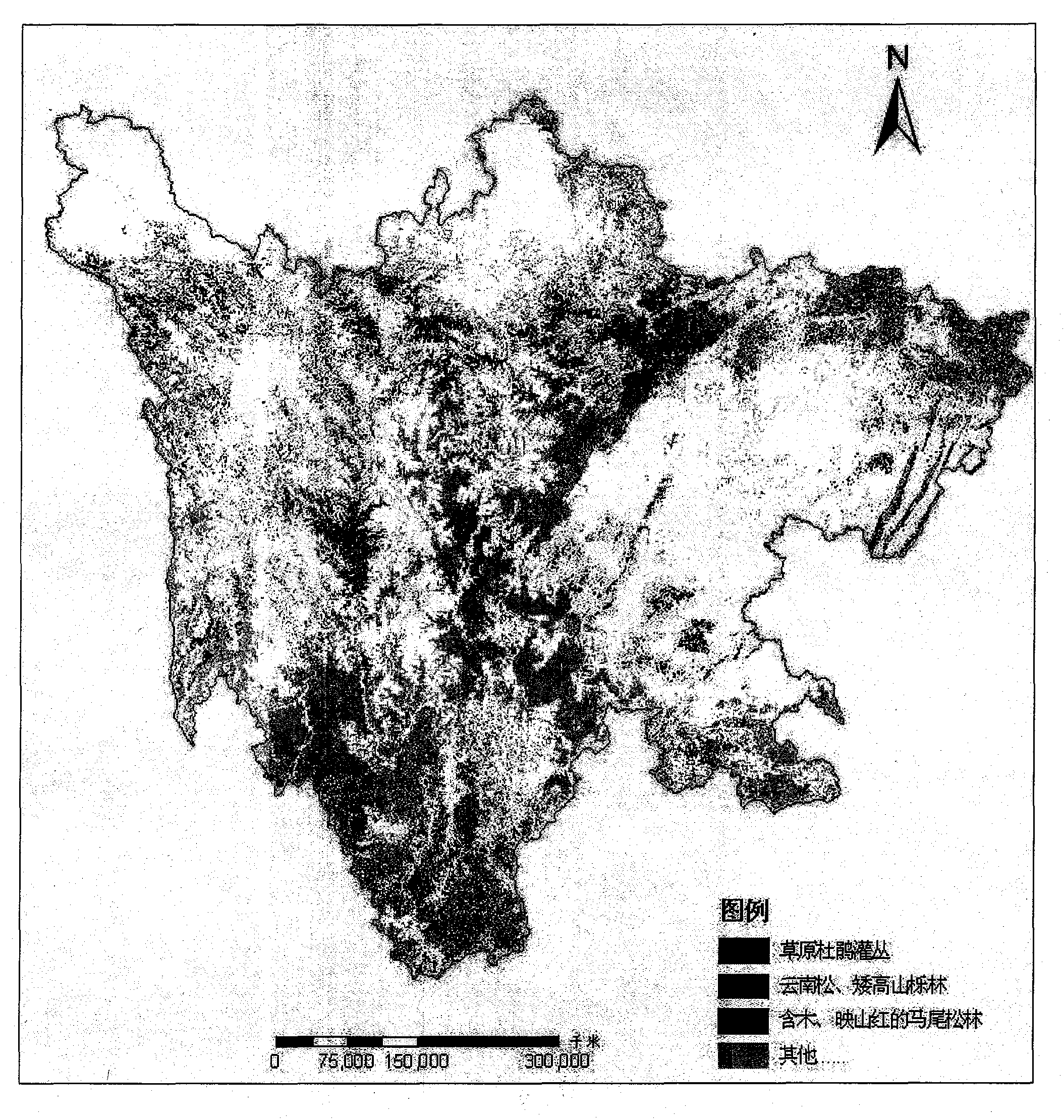
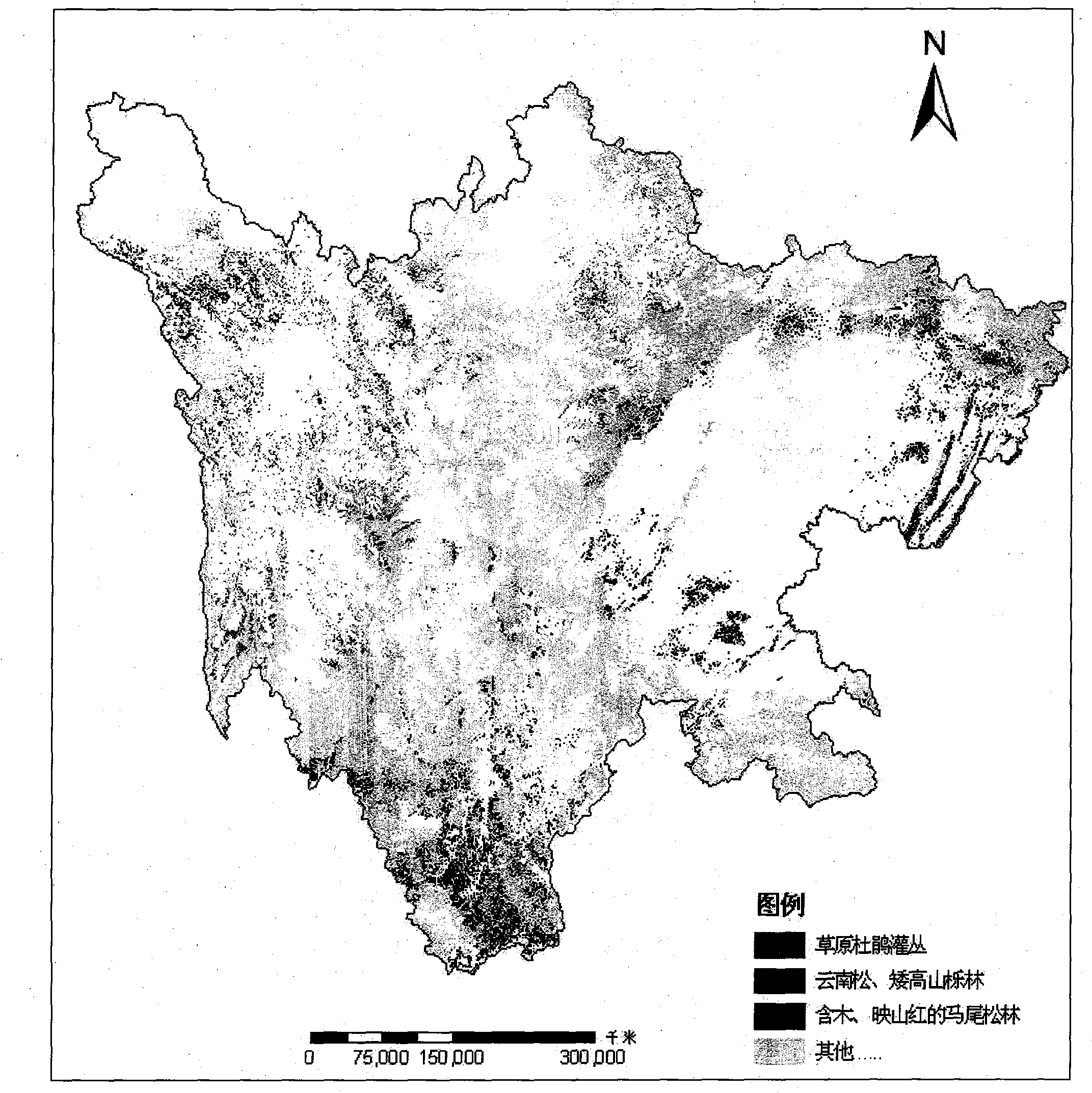
[0015] Taking Sichuan Province as an example, the specific implementation of the invention is described as follows:

[0016] 1. Data preparation: collect land use vector data in the later stage, and extract forest data (mainly including forest land, sparse forest land and shrub land); In each season, MODIS data of two scenes with little cloud were selected; multi-level forest vegetation type vector data were collected in the early stage, such as the multi-level forest vegetation type vector data extracted from the 1:1 million Chinese vegetation map. Combined with the phenological characteristics of the main ground objects in Sichuan Province, the MODIS data imaged on January 25 and February 26 in winter, April 6 and March 13 in spring, and August 28 and June 17 in summer were respectively selected.

[0017] 2. Geometric registration: Based on the later land use vector data, use the polynomial geometric correction model to perform geometric registration with the selected multi-...


PUM


Abstract

The invention relates to a multi-source data synergetic refined forest vegetation type information remote sensing updating technical method, and relates to the technical field of technologies of remote sensing and geographic information systems. The method realizes the key technology of multi-source data synergetic updating of formation level forest vegetation type information. By the aid of the multi-source data synergetic refined forest vegetation type information remote sensing updating technical method, on the basis of later-stage forest data, multi-time-phase MODIS (moderate resolution imaging spectroradiometer) data and earlier-stage forest vegetation type data, later-stage refined forest vegetation type information is updated and obtained. The method has advantages of automation, rapidness, low cost and high precision. After the method is applied in Szechwan, updating precisions of formation and vegetation types respectively can achieve 88% and 90%. The multi-source data synergetic refined forest vegetation type information remote sensing updating technical method is applicable to updating forest vegetation type information in other areas or at other time intervals.

Description

1. Technical field [0001] The technology belongs to the field of remote sensing and geographic information technology 2. Background technology [0002] Fine forest vegetation information refers to the type information of forest vegetation that can be refined down to the biome. It takes a lot of manpower, material resources and financial resources to obtain or update it using conventional ground survey techniques. Remote sensing technology provides advanced technical means for obtaining and updating information on land cover types and vegetation types. For example, my country uses the full-digital human-computer interaction remote sensing rapid extraction method of land resource information to extract land use type information from LANDSAT TM remote sensing images, and forms a multi-period national land use database. In this database, there are forest land, sparse forest land and shrub land The resulting forest has high precision [1-3] . The 1:1 million Chinese vegetation m...

Claims


Application Information

Patent Timeline
IPC IPC(8): G01S7/48
Inventor 杨存建
Owner SICHUAN NORMAL UNIVERSITY
Why Eureka
Try Eureka