Method for carrying out quasigeoid refining on superlarge region on basis of seamless partitioning technology
A geoid and seam zoning technology, applied in the field of surveying and mapping, can solve problems such as low resolution, no smooth connection method, and different zoning results.
- Summary
- Abstract
- Description
- Claims
- Application Information
AI Technical Summary
Problems solved by technology
Method used
Image

Examples
Embodiment Construction
[0035] The present invention will be described in detail below in conjunction with specific embodiments.
[0036] Step 1: Data collection.
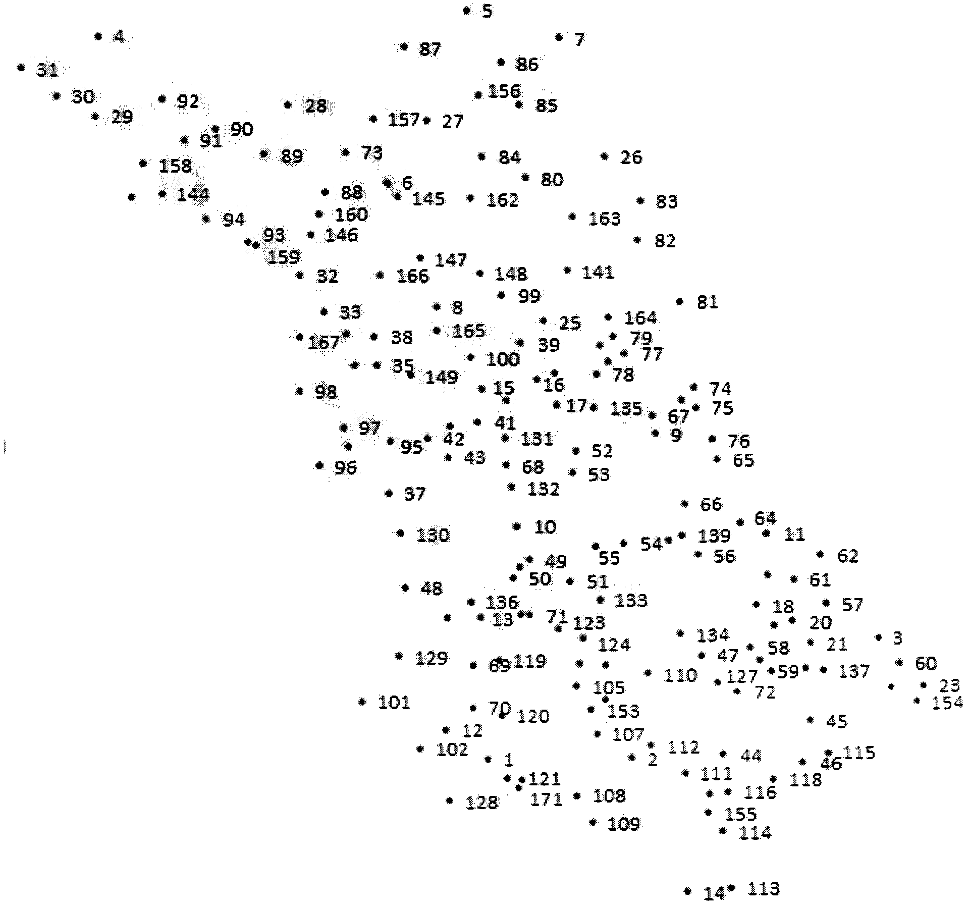
[0037] like image 3 As shown, there are 171 leveling measurement points of the C-level GPS network in JS Province, and the third-level leveling is adopted. Regional scope: the X-axis coordinate range is 3420-3874km; the Y-axis coordinate range is 362-864km. The 171 measurement control points in the area are basically evenly distributed throughout the area. The area is about 100,000km 2 , the average density of measurement control points is: every 1000km 2 The number of survey control points of is equal to 1.7, and the number of survey control points S of the whole area is equal to 171. JS Province is a plain area with a relatively large water area. The maximum elevation anomaly is 12.5377m and the minimum is -8.2549m. The elevation anomaly varies greatly. See Table 1 for the format of the data arrangement.
[0038] Table 1. Altitu...
PUM
 Abstract
Description
Claims
Application Information
 - R&D
- Intellectual Property
- Life Sciences
- Materials
- Tech Scout
- Unparalleled Data Quality
- Higher Quality Content
- 60% Fewer Hallucinations
Browse by: Latest US Patents, China's latest patents, Technical Efficacy Thesaurus, Application Domain, Technology Topic, Popular Technical Reports.
© 2025 PatSnap. All rights reserved.Legal|Privacy policy|Modern Slavery Act Transparency Statement|Sitemap|About US| Contact US: help@patsnap.com