Check patentability & draft patents in minutes with Patsnap Eureka AI!

In-orbit geometrical self-calibration method for multi-mirror aerospace linear array camera system

A multi-lens, antenna array technology, used in surveying and navigation, measuring devices, instruments, etc., can solve problems such as no similar or identical methods

Inactive Publication Date: 2012-08-15
SURVEYING & MAPPING INST HEADQUARTERS OF GENERAL STAFF CHINESE P L A
View PDF2 Cites 27 Cited by
  • Summary
  • Abstract
  • Description
  • Claims
  • Application Information

AI Technical Summary

Problems solved by technology

At present, domestic research in this area is almost blank, and no similar or identical methods have appeared.

Method used


Image

  • In-orbit geometrical self-calibration method for multi-mirror aerospace linear array camera system
  • In-orbit geometrical self-calibration method for multi-mirror aerospace linear array camera system
  • In-orbit geometrical self-calibration method for multi-mirror aerospace linear array camera system

Examples


Embodiment Construction

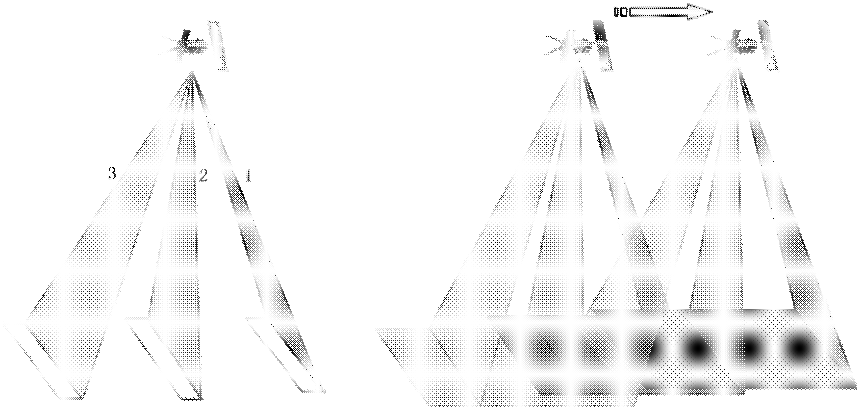
[0231] The following is an example of three image bands on the same band acquired by a multi-lens aerospace three-line array camera system, such as figure 1 As shown, the embodiment of the method for self-checking and calibrating the on-orbit geometry of the multi-lens aerospace linear array camera system proposed by the present invention is explained.

[0232] figure 1 It is the imaging process of multi-lens aerospace three-line array camera system in flight to obtain down-view, front-view and rear-view images. The specific implementation steps of a multi-lens aerospace linear array camera system on-orbit geometric self-checking method are as follows:

[0233] (1) According to the flight trajectory of the sensor and the width of the image strip, high-precision control points are arranged in the ground test area corresponding to the acquired image.

[0234] The arrangement of control points can be carried out in the ground test area according to the trajectory of the satellite's su...


PUM


Abstract

The invention relates to an in-orbit geometrical self-calibration method for a multi-mirror aerospace linear array camera system, and the method can be used for excavating and improving the measurement property of a sensor, so as to meet the actual requirements of photographic surveying and positioning precision of an aerospace linear array camera and surveying of a military topographic map. The in-orbit geometrical self-calibration method comprises the basic steps of: firstly, arranging and measuring a high-precision surface mark control point in a calibration and test area, and obtaining a ground geometrical nominal parameter of the camera system; secondly, obtaining satellite in-orbit flying orbit data, and measuring an image point coordinate corresponding to the mark control point on a corresponding image of a test domain, which is shot by a sensor system; and finally, using a self-calibration balancing technology of a least squares light beam method to calculate parameter correction to influence the geometrical positioning precision of the camera system, so as to improve the measurement properties of the sensor system. Shown by tests, the in-orbit geometrical self-calibration method provided by the invention has the advantages of being better in reliability and higher in precision, and obviously improving the ground position geometrical precision effects of the sensor.

Description

Technical field [0001] The invention relates to a method for calibrating and correcting geometric systematic errors of a multi-lens aerospace linear array sensor mounted on a satellite in the orbiting state, and belongs to the technical field of aerospace photogrammetry and remote sensing mapping. Background technique [0002] Line scan sensors can be divided into single-lens and multi-lens sensors according to the number of lenses. In order to perform stereo rendezvous, usually, single-lens sensors will arrange multiple parallel linear CCDs on the focal plane, while multi-lens A (group) linear CCD is arranged on the focal plane of each individual camera. This difference in structural design determines the system error of the sensor and the on-orbit calibration, whether in the geometric imaging model or in the data processing method. [0003] In recent years, domestic aerospace photogrammetric line-scan cameras have basically been designed with multiple lenses. For example, domest...

Claims


Application Information

Patent Timeline
IPC IPC(8): G01C11/00G01C25/00
Inventor 方勇江振治胡海彦陈虹王刃马永社张丽杨韫澜
Owner SURVEYING & MAPPING INST HEADQUARTERS OF GENERAL STAFF CHINESE P L A
Features
  • R&D
  • Intellectual Property
  • Life Sciences
  • Materials
  • Tech Scout
  • Unparalleled Data Quality
  • Higher Quality Content
  • 60% Fewer Hallucinations
Learn More