Navigation method and device

A navigation method and navigation path technology, applied in the navigation field, can solve problems such as inaccurate navigation and congestion, achieve the best navigation effect and improve accuracy

Active Publication Date: 2016-03-02
ALIBABA (CHINA) CO LTD
View PDF4 Cites 0 Cited by
  • Summary
  • Abstract
  • Description
  • Claims
  • Application Information

AI Technical Summary

Problems solved by technology

[0012] During the research and practice of the prior art, the inventor found that the prior art has the following problems: in the existing navigation scheme, the route used for navigation only refers to the traffic condition information at the time of calculation, because the traffic information is It is constantly changing. For example, during the driving process of the vehicle, a certain section of the road may be in a clear state when the path is initially calculated, but now it may have become a congested state.
It can be seen that the existing navigation scheme has the problem that the navigation is not accurate enough

Method used


Image

  • Navigation method and device
  • Navigation method and device
  • Navigation method and device

Examples


Embodiment Construction

[0034] In order to make the purpose, features and advantages of the embodiments of the present invention more obvious and comprehensible, the present invention will be further described in detail below in conjunction with the accompanying drawings and specific implementation methods.

[0035] First, introduce the contents of the location table and mapping table defined in the TMC protocol:

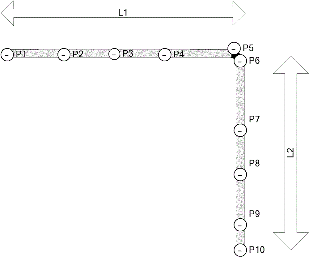
[0036] The TMC protocol stipulates that the geospatial location is encoded based on certain rules, and the corresponding location and the road set associated with the location can be obtained through encoding. like figure 1 As shown, according to the different attributes such as road name and road grade, it is divided into road segment L1 and road segment L2, and according to some important nodes or intersections P1, P2, P3... Multi-segment. In the TMC protocol, L1 and L2 are called line references, and P1, P2, P3...P10 are called point references, that is, position codes.
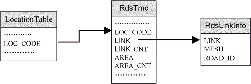
[0037] Loca...


PUM


Abstract

The invention discloses a navigation method and device, relates to the navigation field. The method comprises the following steps of: acquiring present traffic information according to predetermined time intervals; determining whether a route recalculation condition is met according to the present traffic information, and if so, calculating a route with shortest traveling time between a present position and a destination position according to the present traffic information, and using the route as a new navigation route; and if a route updating condition is met, updating the present navigation route into the new navigation route, and continuing performing navigation according to the new navigation route. The device comprises a traffic information acquisition module, a new route calculation module and a route updating module. The navigation method and device provided by the embodiment of the invention are characterized in that in the navigation process, the present traffic information is obtained from a real-time traffic release platform at every predetermined time interval, and the navigation route is adjusted rationally in real time according to the actual situation of the present traffic information; and further, the accuracy of the navigation is improved and relatively good navigation effect can be achieved.

Description

technical field [0001] The invention relates to the field of navigation, in particular to a navigation method and device. Background technique [0002] TMC (TrafficMessageChannel, real-time traffic channel) is the main component of the European traffic guidance system. It defines the completed specifications for the pre-coding of digital maps, the organization and transmission of traffic information. [0003] The existing navigation system requests real-time traffic information from the real-time traffic publishing platform at regular intervals, and displays the obtained traffic information protocol in different colors such as red, yellow, and green after parsing the traffic information protocol. unimpeded. [0004] At present, the realization of the navigation system is mainly based on the path planning of the static road network, and then navigates according to the planned path. The path calculation method based on real-time traffic is mainly: in the path calculation, ac...

Claims


Application Information

Patent Timeline
Patent Type & Authority Patents(China)
IPC IPC(8): G01C21/28G01C21/34
Inventor 胡润波曾利非宋涛
Owner ALIBABA (CHINA) CO LTD
Why Eureka
Try Eureka