
Method and device for dynamically enhancing street view image

A dynamic enhancement and street view technology, applied in image data processing, character and pattern recognition, 3D modeling, etc., can solve problems such as failure to combine traffic information and street view images

Active Publication Date: 2013-06-12
SHENZHEN TENCENT COMP SYST CO LTD
View PDF6 Cites 30 Cited by
  • Summary
  • Abstract
  • Description
  • Claims
  • Application Information

AI Technical Summary

Problems solved by technology

However, the above existing street view map technologies all have the following problems: failing to dynamically and effectively combine traffic information and street view images

Method used


Image

  • Method and device for dynamically enhancing street view image
  • Method and device for dynamically enhancing street view image
  • Method and device for dynamically enhancing street view image

Examples


Embodiment Construction

[0029] The present invention will be further described in detail below in conjunction with the accompanying drawings and embodiments. It should be understood that the specific embodiments described here are only used to explain the present invention, but not to limit the present invention. In addition, it should be noted that, for the convenience of description, only parts related to the present invention are shown in the drawings but not all content.

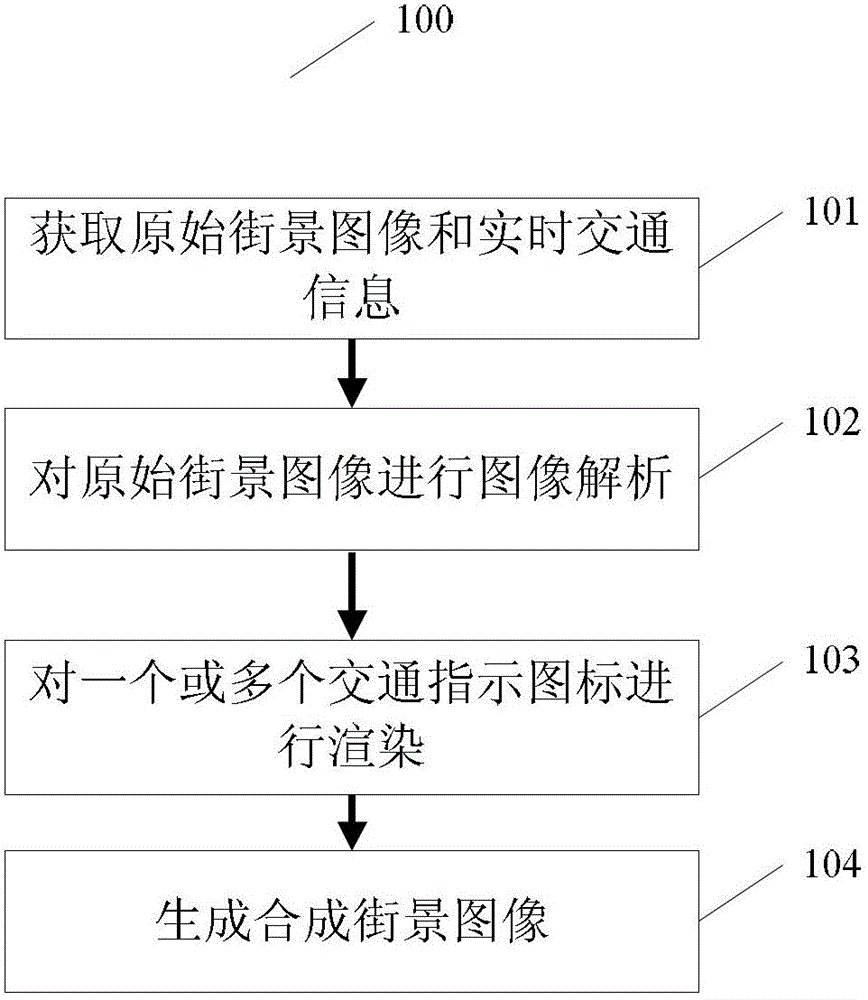
[0030] exist figure 1 A first embodiment of the invention is shown in .

[0031] figure 1 It is an implementation process 100 of the method for dynamically enhancing street view images according to the first embodiment of the present invention, and the implementation process 100 is described in detail as follows:

[0032] In step 101, original street view images and real-time traffic information are obtained.

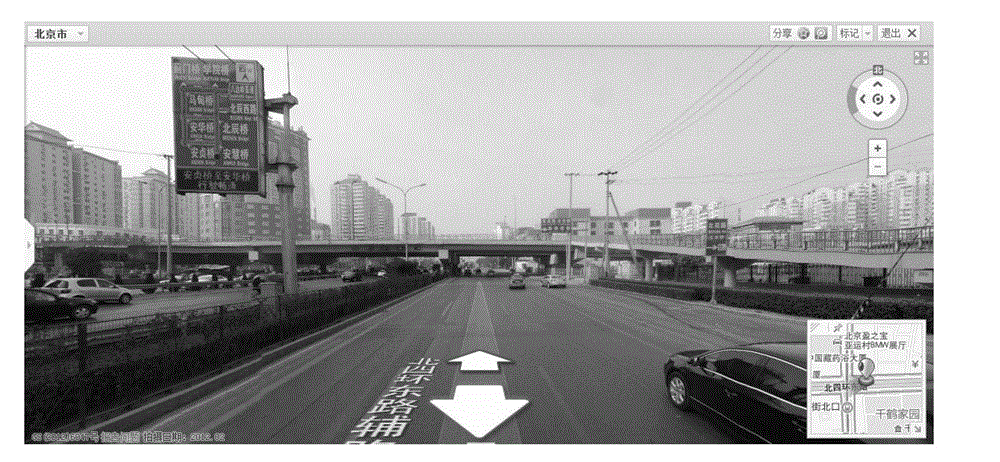
[0033] In the first embodiment, the original street view image is displayed on a terminal with a display screen. ...


PUM


Abstract

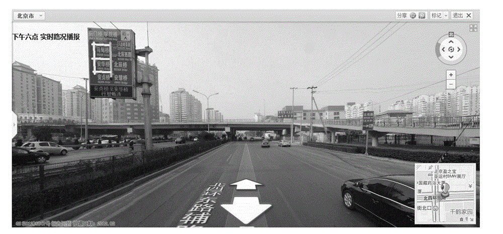
The invention discloses a method and a device for dynamically enhancing a street view image. The method comprises the following steps of obtaining an original street view image and traffic information, wherein the original street view image is displayed on a terminal with a display screen; analyzing the original street view image, and identifying one or a plurality of traffic indication icons from the original street view image; according to the traffic information, rendering one or a plurality of the traffic indication icons by a preset icon rendering rule; and synthesizing one or a plurality of the rendered traffic indication icons and the original street view image, so as to generate and synthesize the street view image. The method and the device have the advantages that content information is dynamically added into the street view image, and the method and the device are favorable for a user to visually and efficiently make decisions related to traveling.

Description

technical field [0001] The invention relates to the field of augmented reality technology, in particular to a method and device for dynamically enhancing street view images. Background technique [0002] Augmented reality (AR) technology is a new technology developed on the basis of virtual reality, also known as mixed reality technology. This technology uses the information provided by the computer system to increase the user's perception of the real world, applies virtual information to the real world, and superimposes computer-generated virtual objects, scenes or system prompt information on the real scene, so as to realize the real scene. enhancement. In recent years, augmented reality technology has developed rapidly with the growth of computing power, and is widely used in street view map navigation, medical treatment, entertainment, games and other fields. [0003] How to apply augmented reality technology to street view map navigation is one of the current research...

Claims


Application Information

Patent Timeline
Patent Type & Authority Applications(China)
IPC IPC(8): G06T17/05G06K9/00
Inventor 桂天宜
Owner SHENZHEN TENCENT COMP SYST CO LTD
Learn More