Evaluating method for geographic data watermarking algorithm
A technology of geographic data watermarking and geographic data, which is applied in image data processing, image data processing, computing and other directions, and can solve problems such as geographic data requirements, navigation errors, and inability to find watermarked data errors.
- Summary
- Abstract
- Description
- Claims
- Application Information
AI Technical Summary
Problems solved by technology
Method used
Image
Examples
Embodiment
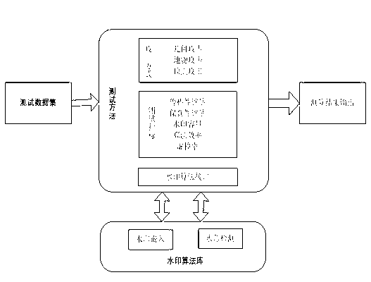
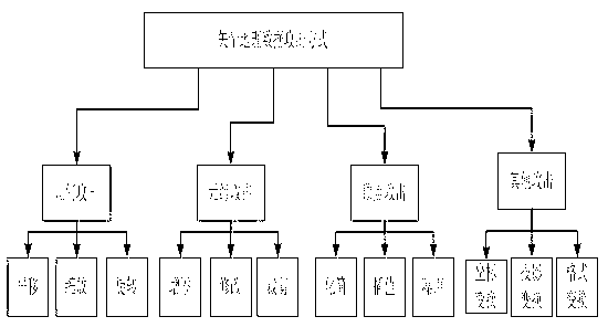
[0079] An evaluation method suitable for geographic data watermarking algorithms, which mainly starts from several evaluation indicators such as robustness, fidelity, watermark capacity, and running speed.
[0080] Define the benchmark dataset D={M 1 , M 1 ,...,M m} represents m geographic datasets; for each geographic dataset M k ={R k ,P k}, where R k Indicates the reference coordinate system, Represents a collection of various types of features, n is the number of features; each feature It consists of a series of vertices, l is the number of vertices of feature i in the kth data set, k∈{1,2,…,m}, i∈{1,2,…,n}.
[0081] The specific operation steps are as follows:
[0082] Step 1. Select the data set for the benchmark test, and use the watermarking algorithm to be tested to embed the watermark into the geographic data;
[0083] Step 2, quantitatively measure the fidelity of the geographic data after the watermark is embedded, and obtain a quantitative value based o...
PUM
 Abstract
Description
Claims
Application Information
 - R&D
- Intellectual Property
- Life Sciences
- Materials
- Tech Scout
- Unparalleled Data Quality
- Higher Quality Content
- 60% Fewer Hallucinations
Browse by: Latest US Patents, China's latest patents, Technical Efficacy Thesaurus, Application Domain, Technology Topic, Popular Technical Reports.
© 2025 PatSnap. All rights reserved.Legal|Privacy policy|Modern Slavery Act Transparency Statement|Sitemap|About US| Contact US: help@patsnap.com


