

Processing method of towrope exploration navigational positioning data
A technology for positioning data and processing methods, which is applied in seismic signal processing, satellite radio beacon positioning systems, instruments, etc., and can solve problems such as the absence of processing technology and processing methods.
- Summary
- Abstract
- Description
- Claims
- Application Information
AI Technical Summary
Problems solved by technology
Method used
Image

Examples
Embodiment Construction
[0062] In order to make the technical solution of the present invention clearer, the present invention will be further elaborated below in conjunction with the accompanying drawings and specific embodiments. It should be noted that, in the case of no conflict, the embodiments in the present application and various manners in the embodiments can be combined with each other.
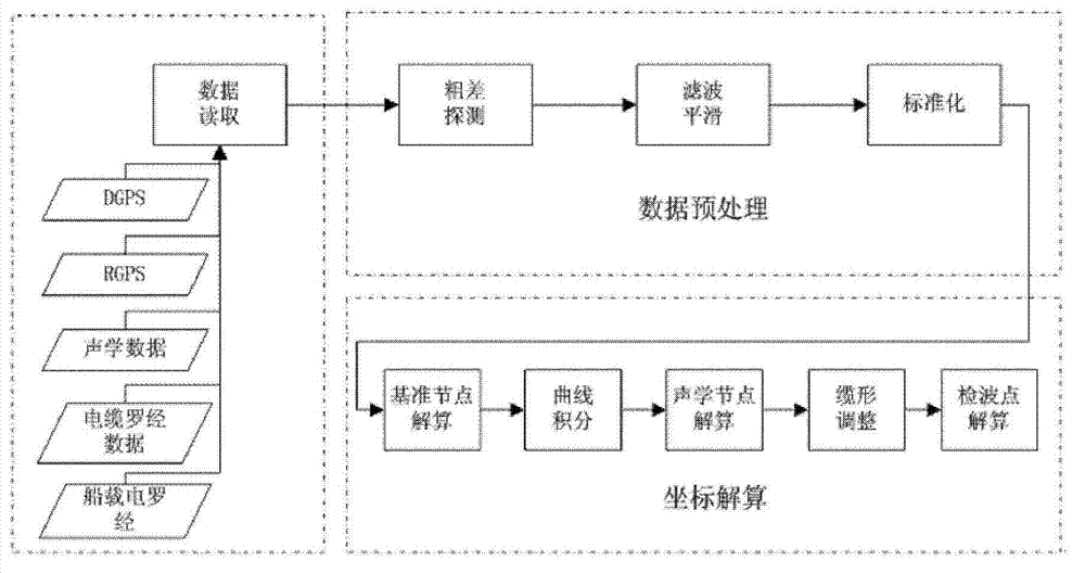
[0063] A method for processing streamer survey navigation and positioning data may include three stages of data reading, data preprocessing and coordinate solution, wherein,
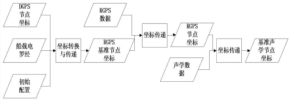
[0064] In the data reading stage, various positioning data are extracted from the data files in P2 / 94 format, including DGPS data, RGPS data, acoustic data, cable compass data and shipboard gyrocompass data. The original positioning file is divided into two parts: the data header and the data body. The basic information of the project, work area and positioning configuration can be obtained by reading the header, and the positioning ...
PUM
 Abstract
Description
Claims
Application Information