Supercharge Your Innovation With Domain-Expert AI Agents!

Street view display method and terminal

A street view and view technology, applied in the Internet field, can solve the problems of cumbersome user operations, weak information volume, and no consideration of ground height fluctuations, etc., to achieve the effect of reducing manual operations, facilitating viewing, and improving display effects

Active Publication Date: 2017-05-24
TENCENT CLOUD COMPUTING BEIJING CO LTD
View PDF5 Cites 0 Cited by
  • Summary
  • Abstract
  • Description
  • Claims
  • Application Information

AI Technical Summary

Problems solved by technology

[0006] 1. The automatic roaming method of the traditional two-dimensional map is only a simple movement along the route from the third perspective, the amount of information is weak, and it lacks a sense of reality and immersion; and the automatic movement of the street view scene in the prior art does not consider the height fluctuation of the ground situation, reducing the performance of the Street View map
[0007] 2. The existing PC-side street view map browsing method generally maintains the continuity of the street view map, and the distance between adjacent scenes is about 10 meters. When users browse a certain route or a large number of scenes, they need to frequently click on the direction guide Arrows are used to switch, making user operations cumbersome

Method used


Image

  • Street view display method and terminal
  • Street view display method and terminal
  • Street view display method and terminal

Examples


Embodiment Construction

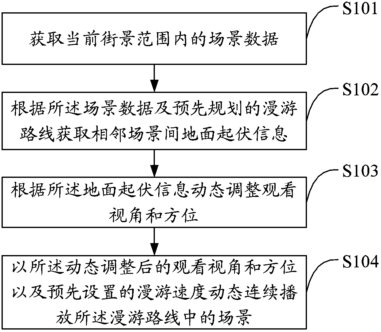
[0025] The solution of the embodiment of the present invention is mainly: use the original shooting trajectory or the user's planned route to set the street view viewing route, combine the three-dimensional information of the scene collected by the street view shooting equipment, calculate the ground height fluctuations, dynamically adjust the observation orientation and angle of view, and collect through the acquisition equipment The original speed or the speed set by the user will automatically and continuously play the street view scenes in the route, which is convenient for the user to view the route, so as to reduce the manual operation of the user and improve the display effect of the street view view on the network terminal.

[0026] Such as figure 1 As shown, the first embodiment of the present invention proposes a street view display method, including:

[0027] Step S101, acquiring scene data within the current street view range;

[0028] Step S102, acquiring ground ...


PUM


Abstract

The invention discloses a street view displaying method and a street view displaying terminal. The method comprises the following steps: acquiring scene data within the scope of a current street view; acquiring surface relief information of two adjacent scenes according to the scene data and a roaming route planed in advance; dynamically adjusting viewing angle and view direction according to the surface relief information; and further, dynamically and continuously displaying scenes in the roaming route at the dynamically adjusted viewing angle and direction as well as the preset roaming speed. Through the method and the terminal, a user can watch the dynamic street view after simple arrangement, so that not only is the operation during street view use process reduced and the route check by the user facilitated, but also the displaying effect of the street view at the network terminal is improved.

Description

technical field [0001] The present invention relates to the technical field of the Internet, in particular to a street view display method and a terminal. Background technique [0002] With the development of Internet technology, various search engines such as Google and Tencent SOSO have launched street view map products, through which users can browse the scenery on both sides of the road to meet the needs of users to search for geographical location. [0003] The traditional PC side uses the road book function (guiding route navigation function) to provide two-dimensional map roaming. By setting the roaming route, a certain object moves along the route to realize the automatic roaming of the two-dimensional map. At present, the PC-side street view map is browsed through the direction guidance generated by the shooting track. The user clicks the direction guidance arrow to switch between different scenes to achieve the purpose of browsing the scenery on both sides of the r...

Claims


Application Information

Patent Timeline
Patent Type & Authority Patents(China)
IPC IPC(8): G06F17/30
Inventor 万聪
Owner TENCENT CLOUD COMPUTING BEIJING CO LTD
Features
  • R&D
  • Intellectual Property
  • Life Sciences
  • Materials
  • Tech Scout
  • Unparalleled Data Quality
  • Higher Quality Content
  • 60% Fewer Hallucinations
Learn More