
Electronic map generation method and device as well as route planning method and device

An electronic map and path planning technology, applied in directions such as road network navigators, can solve problems such as inconsistency and loss of road information, and achieve the effects of good road planning, loss reduction, and accurate expression.

Active Publication Date: 2013-09-11
NAVINFO
View PDF6 Cites 46 Cited by
  • Summary
  • Abstract
  • Description
  • Claims
  • Application Information

AI Technical Summary

Problems solved by technology

However, in the real world, the information on each lane on the same road is often inconsistent. In order to express the information on a road, the traditional navigation electronic map must comprehensively summarize the information on each lane, which will inevitably lose the information on the road. Partial information, unable to provide users with accurate and intelligent guidance

Method used


Image

  • Electronic map generation method and device as well as route planning method and device
  • Electronic map generation method and device as well as route planning method and device
  • Electronic map generation method and device as well as route planning method and device

Examples


Embodiment 1

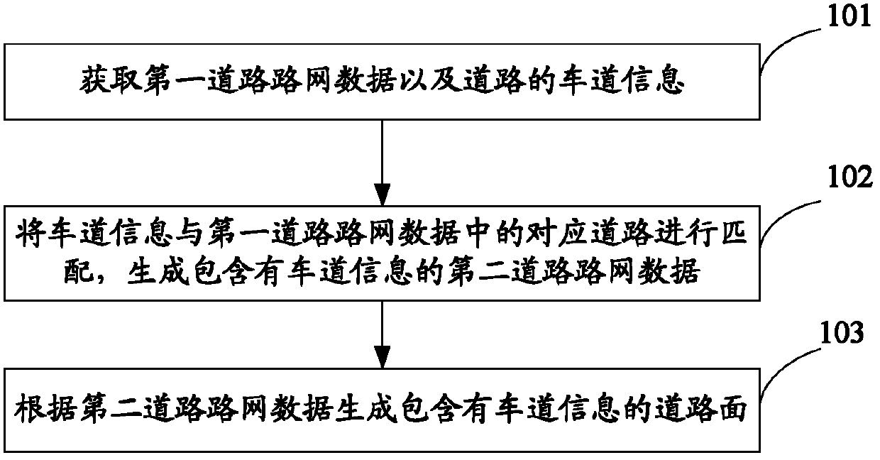
[0059] Step a1: Obtain the first road network data and lane information of the road from the navigation electronic map database. The lane information includes: lane sign, road to which the lane belongs, lane height limit, lane width, lane maximum speed limit, and lane allowed passing vehicle types , Lane markings between the lane and other lanes;

[0060] Step a2: Add the lane attribute field of the road, and fill in the lane attribute field of the corresponding road in the first road network data according to the obtained lane information, and generate the second road network data.

[0061] Step a3: Generate a road surface including lane information according to the second road network data.

[0062] At present, when generating road surfaces in the electronic map, it is impossible to generate road surfaces in real time according to the changes of the on-site roads, and it is necessary to take photos again to make road surfaces. However, in the present invention, the road sur...

Embodiment 2

[0065] Step b1: Obtain the first road network data and lane information of the road from the navigation electronic map database;

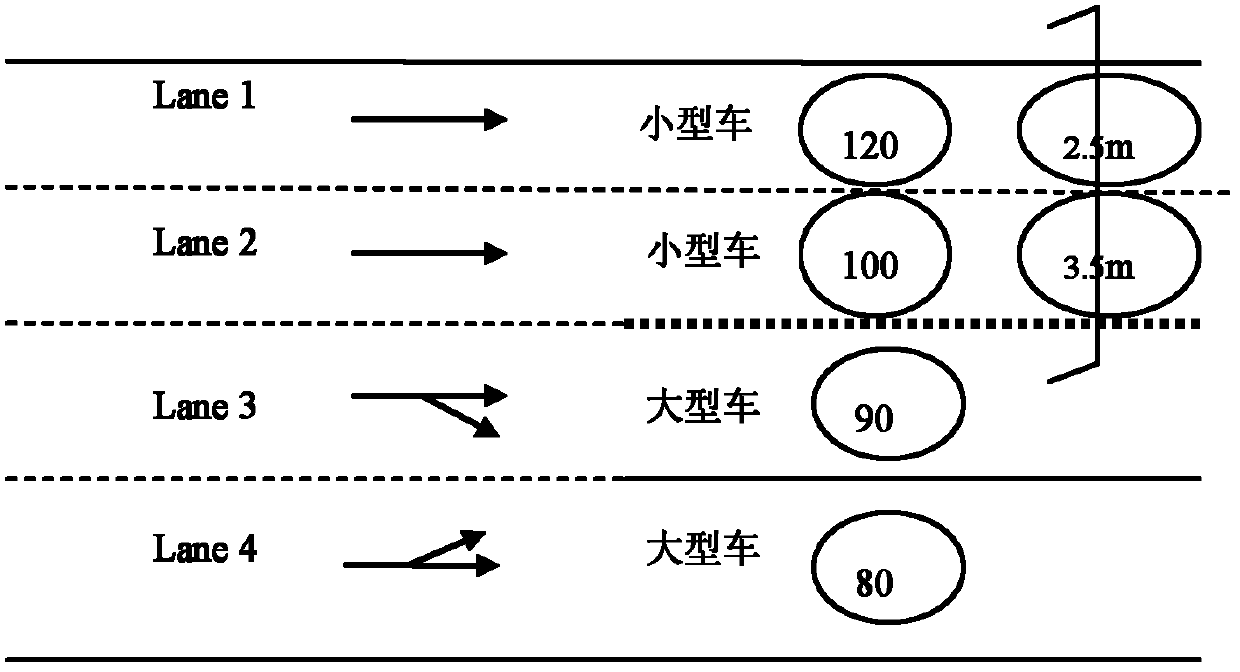
[0066] Wherein, the road information in the first road network data is a comprehensive summary of lane information, and cannot describe specific information of each lane of the road. This step also needs to obtain the lane information of each road from the navigation electronic map database. The lane information of the road includes: lane sign, road to which the lane belongs, lane number, lane driving direction, lane type, turning arrow, lane width, lane limit High, maximum speed limit of the lane, presence or absence of electronic eyes, restricted direction of the lane, disabled time period of the restricted direction, restricted vehicle type and disabled time period of the restricted vehicle, etc. Among them, the lane type expresses the different uses of the lane, and the common lane types according to the function are: bus lane, emergency lane, ...

Embodiment 3

[0095] Step c1: Obtain the road network data of the first road and the lane information of the road;

[0096] Step c2: matching the lane information with the corresponding road in the first road network data to generate the second road network data including the lane information;

[0097] Step c3: Generate an electronic map containing lane information according to the second road network data;

[0098] Step c4: Obtain the user's route planning request including the origin and destination;

[0099] Step c5: Planning the connection route between the origin and the destination according to the electronic map containing lane information, the connection route is composed of more than one interconnected lanes;

[0100] Step c6: Display the connection route on the user's navigation terminal in the form of text description and / or graphic drawing.

[0101] In the path planning method of the present invention, the lane information of the road is first obtained, and the lane informatio...


PUM


Abstract

The invention provides an electronic map generation method and device as well as a route planning method and device, and belongs to the field of electronic navigation. The electronic map generation method comprises the following steps of: obtaining first road network data and lane information of the road, matching the lane information with the corresponding road in the first road network data, and generating second road network data containing the lane information; and according to the second road network data, generating a road surface containing the lane information. The route planning method comprises the following steps of: obtaining a route planning requirement containing starting point and destination of a user, planning a connecting route arranged between the starting point and destination according to an electronic map containing the lane information, wherein the connecting route is composed of more than one lane which is communicated; utilizing the connecting route as a text description and / or graphic plotting manner to display on a navigation terminal of the user. The technical scheme of the invention can accurately express a road surface condition so as to provide the exact guide for navigating mates.

Description

technical field [0001] The invention relates to the field of electronic navigation, in particular to an electronic map generation method and device, and a path planning method and device. Background technique [0002] The prior art provides navigation for users based on traditional navigation electronic maps. The basic data of the road network of the traditional navigation electronic map consists of the geometric shape related to the road position and the road topology data related to the topological connection. The traditional navigation electronic map abstracts a road in the real world into a line, and all attribute information is recorded based on the road line, without recording the detailed information of each lane on a road. If the information of each lane on a road is exactly the same, there is no problem in using the traditional navigation electronic map for navigation. However, in the real world, the information on each lane on the same road is often inconsistent....

Claims


Application Information

Patent Timeline
IPC IPC(8): G01C21/30G01C21/34
Inventor 邹翠
Owner NAVINFO
Learn More