A Method for Measuring Transcentric Latitude of Inertial Navigation System

An inertial navigation system and geocentric latitude technology, applied in the field of inertial navigation system polar area navigation, can solve problems such as lack, and achieve the effects of improving measurement accuracy, simple and convenient measurement methods, and reducing errors

Inactive Publication Date: 2015-08-12
HARBIN ENG UNIV
View PDF4 Cites 0 Cited by
  • Summary
  • Abstract
  • Description
  • Claims
  • Application Information

AI Technical Summary

Problems solved by technology

However, there is currently a lack of research on navigation machinery arrangement and related parameter measurement methods under the abscissa reference frame

Method used


Image

  • A Method for Measuring Transcentric Latitude of Inertial Navigation System
  • A Method for Measuring Transcentric Latitude of Inertial Navigation System
  • A Method for Measuring Transcentric Latitude of Inertial Navigation System

Examples


Embodiment Construction

[0019] The present invention will be further described below in conjunction with the drawings:

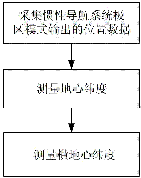
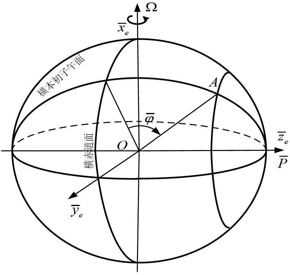
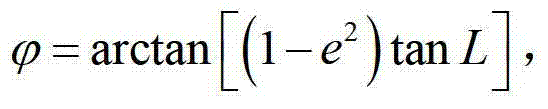
[0020] The invention relates to the technical field of inertial navigation system polar region navigation. When the inertial navigation system enters the polar region mode, it needs to determine the initial value of the horizontal and latitude information. The invention proposes a method for measuring the horizontal and geocentric latitude of the inertial navigation system. Including: determining the ship’s position information, measuring the ship’s geocentric latitude, and measuring the ship’s transverse geocentric latitude. In the polar mode of the inertial navigation system, a regular sphere model is used to describe the earth, which can meet the needs of low- and medium-precision inertial navigation systems; the ellipsoid model is used to describe the earth to meet the needs of high-precision inertial navigation systems. The transverse geocentric latitude measurement method propos...


PUM


Abstract

The invention belongs to the technical field of inertial navigation system polar region navigation, and specifically relates to a method for an inertial navigation system to measure a transverse geocentric latitude by using latitude and longitude information outputted under a normal mode, such that a conversion of the inertial navigation system from a normal mode to a polar region mode is realized. According to the invention, longitude and geographical latitude of a position of a vessel are obtained according to position data outputted by the inertial navigation system under a normal mode; according to the geographical latitude of the position of the vessel, a geocentric latitude measurement value is determined; and according to the vessel longitude outputted by the inertial navigation system and the geocentric latitude, the transverse geocentric latitude measurement method value is obtained. With the method, a common error caused by that a latitude information outputted by the inertial navigation system is approximated as the geocentric latitude is avoided, and measurement precision of transverse geocentric latitude is improved, such that the error of inertial navigation system mode conversion is reduced. The measuring method provided by the invention is simple and convenient, and is suitable for actual application.

Description

Technical field [0001] The present invention belongs to the technical field of inertial navigation system polar region navigation, and specifically relates to a method for inertial navigation system to measure transverse geocentric latitude by using longitude and latitude information output in normal mode, so as to realize the transition of inertial navigation system from normal mode to polar region mode. Latitude measurement method. Background technique [0002] The polar regions have increasingly become areas of competition for the interests of major powers: First, the polar regions are rich in oil and gas resources. According to the US Geological Survey, 25% of the world’s undiscovered oil and gas resources are located in the polar regions, and ships’ cruises in the polar regions will increase. China has the right to speak in the development of resources in the polar regions; secondly, from the perspective of strategic geographical distribution, the Arctic is close to the Unit...

Claims


Application Information

Patent Timeline
Patent Type & Authority Patents(China)
IPC IPC(8): G01C21/16
Inventor 于飞鲍桂清奔粤阳高伟李倩徐文佳邹梅魁王兴彬付艳伟陈斐楠
Owner HARBIN ENG UNIV
Why Eureka
Try Eureka