Hierarchical fast image global positioning system (GPS) position estimation method
An image, fast technology, used in computing, computer components, special data processing applications, etc.
- Summary
- Abstract
- Description
- Claims
- Application Information
AI Technical Summary
Problems solved by technology
Method used
Image
Examples
Embodiment Construction
[0053] The present invention is described in further detail below in conjunction with accompanying drawing:
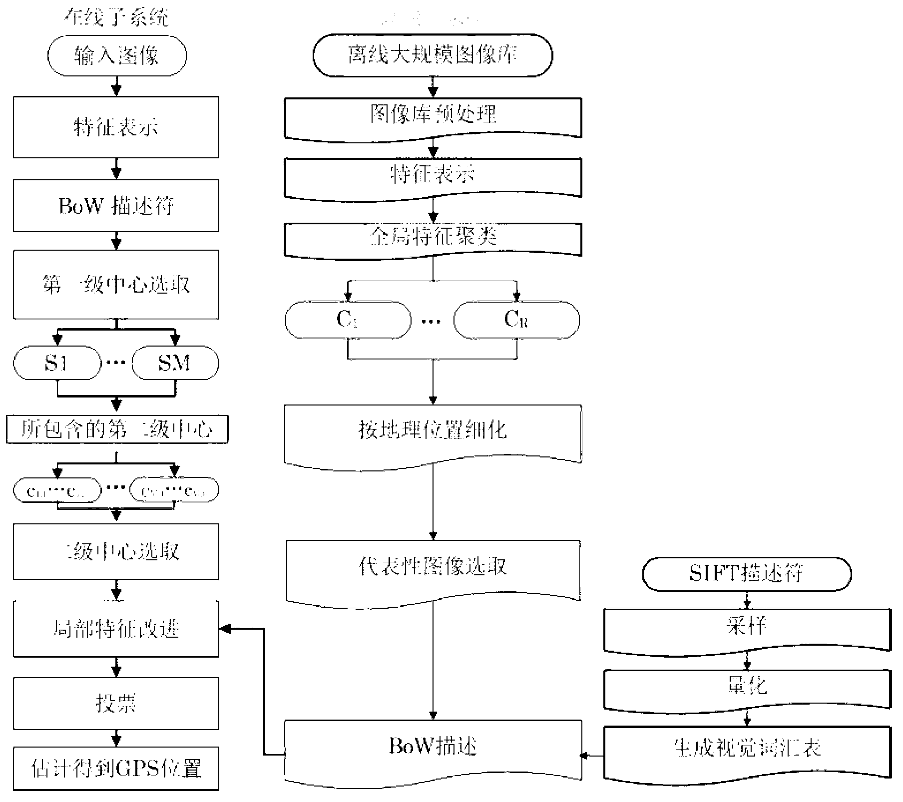
[0054] see figure 1 : the scalable fast image GPS position estimation method of the present invention comprises the following steps:
[0055] (1) Processing of offline image library
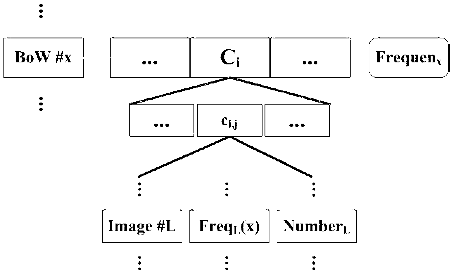
[0056] The purpose of the offline subsystem is mainly to perform offline processing on a large-scale image library with geographic tags, so that it can be better applied to online image location estimation, so as to achieve the purpose of fast and effective GPS estimation. The offline subsystem mainly includes the following six aspects: 1) preprocessing of the image library, 2) description of the global and local features of the images in the image library, and 3) K-means clustering of images in the image library using global features; 4) Subdivide the class obtained by the first-level clustering according to the geographical location to obtain the second-level image group, 5) select th...
PUM
 Abstract
Description
Claims
Application Information
 - R&D
- Intellectual Property
- Life Sciences
- Materials
- Tech Scout
- Unparalleled Data Quality
- Higher Quality Content
- 60% Fewer Hallucinations
Browse by: Latest US Patents, China's latest patents, Technical Efficacy Thesaurus, Application Domain, Technology Topic, Popular Technical Reports.
© 2025 PatSnap. All rights reserved.Legal|Privacy policy|Modern Slavery Act Transparency Statement|Sitemap|About US| Contact US: help@patsnap.com


