
Method for monitoring satellite integrity with vision as auxiliary

A technology for integrity monitoring and satellite assistance, applied in the field of satellite navigation, can solve the problems of reduced redundant information and insufficient algorithm performance, and achieve the effects of improving reliability, enriching navigation observations, and improving detection performance.

Active Publication Date: 2015-06-24
BEIHANG UNIV
View PDF8 Cites 0 Cited by
  • Summary
  • Abstract
  • Description
  • Claims
  • Application Information

AI Technical Summary

Problems solved by technology

[0007] In order to solve the problem of insufficient algorithm performance due to the reduction of redundant information when the original satellite integrity detection algorithm is used in a complex environment, the present invention proposes a visually assisted satellite integrity monitoring method

Method used


Image

  • Method for monitoring satellite integrity with vision as auxiliary
  • Method for monitoring satellite integrity with vision as auxiliary
  • Method for monitoring satellite integrity with vision as auxiliary

Examples


Embodiment Construction

[0025] The present invention will be further described in detail with reference to the accompanying drawings and embodiments.

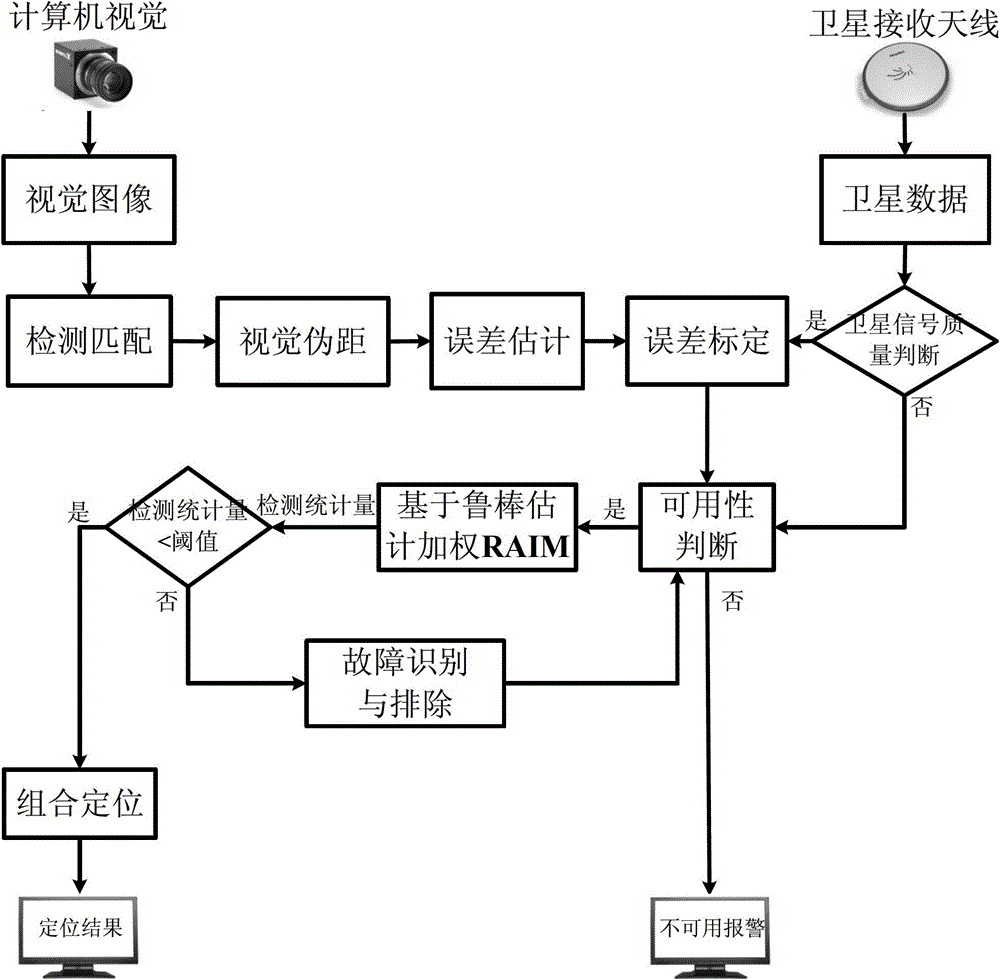
[0026] A visual aid satellite integrity monitoring method of the present invention, the method flow chart is as follows figure 1 As shown, it specifically includes the following steps:

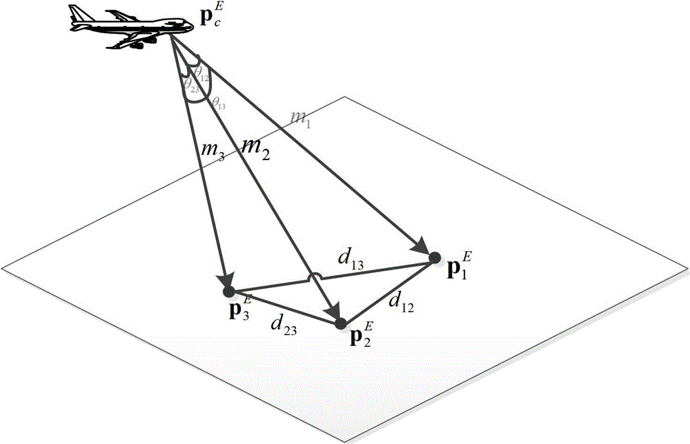
[0027] Step 1: By processing the visually collected images, the high-precision visual navigation model is used to obtain the navigation observations, and the error of the visual navigation observations is estimated.

[0028] Obtain the two-dimensional coordinates of the landmarks in the visual image extracted by the computer vision equipment by using the feature point detection and matching algorithm Wherein the subscript i is the serial number of the ith landmark point, and the superscript I represents the image plane Cartesian coordinate system (because the landmark will be displayed in the image at last, what the present invention obtains is its position in the i...


PUM


Abstract

The invention discloses a method for monitoring satellite integrity with vision as an auxiliary. The method comprises the first step of processing a visually collected image, adopting a high-precision visual navigation model to obtain navigation observation quantity and estimating an error of the visual navigation quantity, the second step of calibrating the visual observation quantity by adopting a relatively good satellite signal in the approaching stage high altitude and restraining the error of the visual observation quantity, the third step of combining the calibrated visual pseudo-range information and the satellite observation information and judging the availability of RAIM, the fourth step of carrying out fault recognition on the situation that a fault satellite exists so that the fault satellite can be determined and removed, and the fifth step of fusing the data of the satellite with the fault removed and the visual observation quantity to obtain the ultimate combined positioning result. According to the method, the observation quantity provided by a visual sensor serves as the auxiliary, the navigation observation quantity is enriched, the integrity detecting performance of the satellite can be improved, and the reliability of the navigation positioning result can be improved.

Description

technical field [0001] The invention belongs to the field of satellite navigation, in particular to a method for monitoring the integrity of a visual aided satellite. Background technique [0002] Receiver Autonomous Integrity Monitoring (RAIM) is a key technology in satellite navigation. It judges the integrity of the received satellite signal and gives an alarm in time when a fault occurs. Therefore, RAIM plays an important role in ensuring the reliability of satellite navigation positioning results. [0003] At present, RAIM technology has been widely used in air traffic control navigation, which uses redundant observation information to detect satellite failures. Usually, in a good flight environment, the number of visible satellites is sufficient and the signal quality is good. At this time, RAIM technology can obtain reliable integrity warnings and reliably ensure flight safety. However, in harsh environments such as complex approaches and landings, such as Linzhi Ai...

Claims


Application Information

Patent Timeline
Patent Type & Authority Patents(China)
IPC IPC(8): G01S19/23
Inventor 张军李锐付立
Owner BEIHANG UNIV
Learn More