Method and system for processing linear feature labeling data in electronic mapping system

A technology of linear elements and electronic maps, applied to maps/plans/charts, instruments, educational tools, etc., can solve problems such as time-consuming, difficult to identify, and inability to target linear elements, etc., to achieve good and easy to use recognition effect

Active Publication Date: 2014-01-01
BEIJING TEAMSUN TECH +2
View PDF4 Cites 12 Cited by
  • Summary
  • Abstract
  • Description
  • Claims
  • Application Information

AI Technical Summary

Problems solved by technology

[0008] The existing technology can only save the marked text information, and then use the geographic information system (GIS) data editing system to manually modify and adjust the marked text content. The manual editing method introduces a lot of workload and is not suitable for Large-scale electronic map mapping work
At the same time, due to its time-consuming, it cannot quickly respond to the needs of mapping, and cannot dynamically adapt the direction of the label text header for linear elements with different inclination angles, and cannot guarantee the order in which the Chinese characters are marked. In this way, all Chinese characters in the electronic map Labeling users is not easy to identify, users feel bad when using, and cannot meet user needs

Method used


Image

  • Method and system for processing linear feature labeling data in electronic mapping system
  • Method and system for processing linear feature labeling data in electronic mapping system
  • Method and system for processing linear feature labeling data in electronic mapping system

Examples


Embodiment Construction

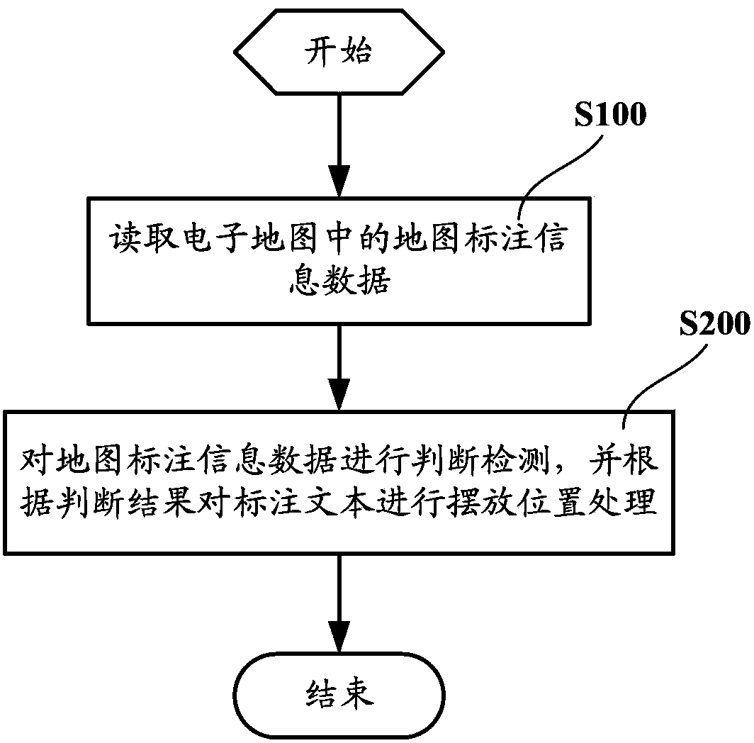
[0041] see figure 1 , as a possible implementation mode, a method for processing linear element labeling data in an electronic map drawing system according to an embodiment of the present invention includes the following steps:

[0042] Step S100, reading the map annotation information data in the electronic map;

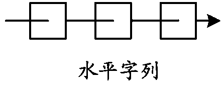
[0043] Preferably, the map label information data includes, but is not limited to, character column labeling methods, labeling linear elements, and labeling text.

[0044] Step S200, judge and detect the map annotation information data, and place the annotation text according to the judgment result.

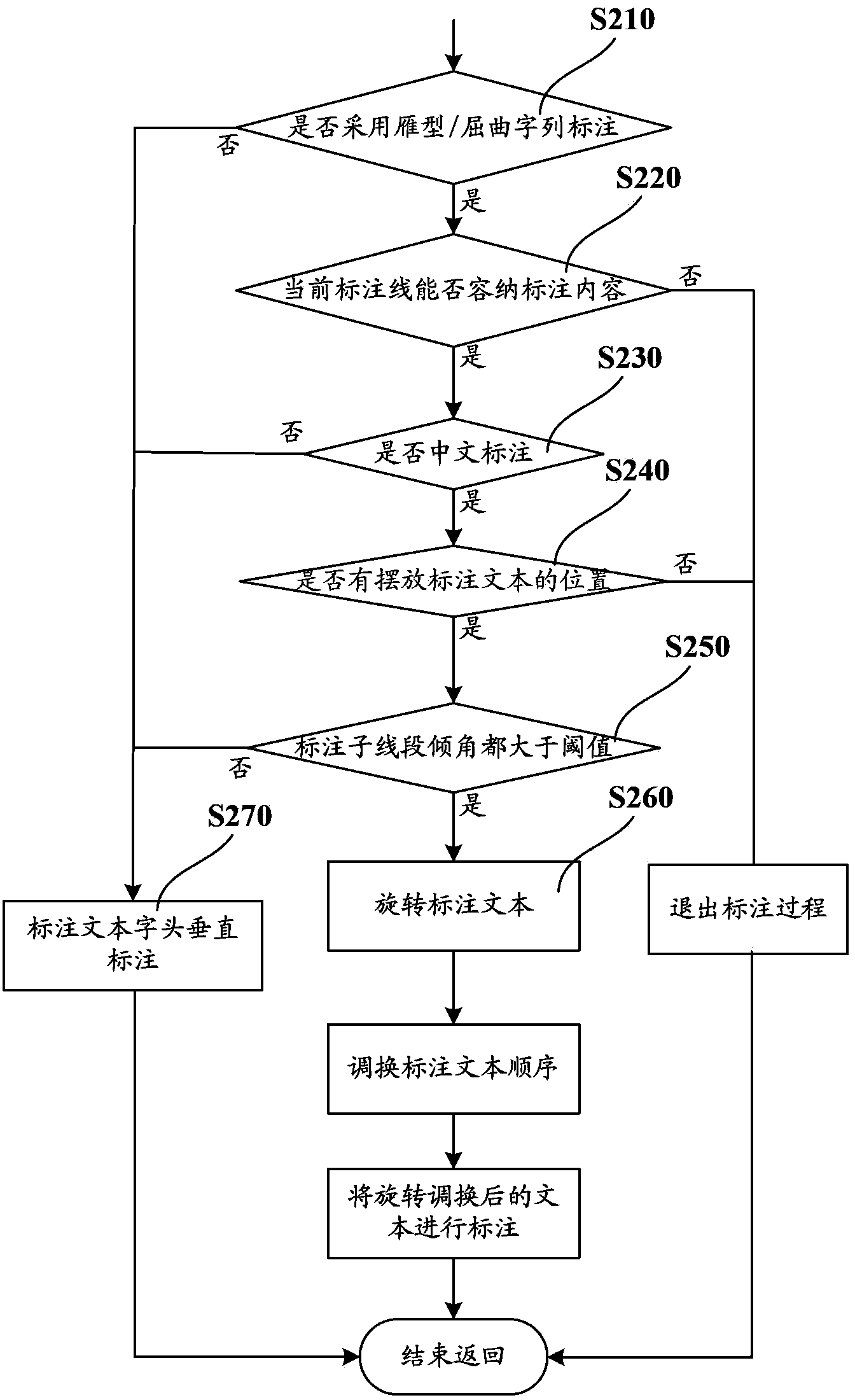
[0045] like figure 2 As shown, as an implementable manner, the step S200 includes the following steps:

[0046] Step S210, judging whether the marking method of character strings adopts geese or buckling character strings; if not, then proceed to step S270; if it chooses to use geese / bucking character string marking, then proceed to step S220;

[0047] In the charac...


PUM


Abstract

The invention provides a method and a system for processing linear feature labeling data in an electronic mapping system. The method comprises the following steps: step S100, reading map labeling information data in an electronic map; and step S200, judging and detecting the map labeling information data and carrying out placement position processing on a labeling text according to a judgment result. The method and the system enable Chinese character labeling in the electronic map to be easily identified, give users a good using feeling and can meet the needs of users.

Description

technical field [0001] The invention relates to the technical field of electronic map drawing of a geographic information system, in particular to a method and system for processing linear element labeling data in an electronic map drawing system. Background technique [0002] In Geographic Information System (GIS), visualization is based on technologies such as computer science, cartography, and cognitive science, and through image processing technology, multimedia technology, dynamic, intuitive and vivid representation, interpretation, and transmission of geographic information. Spatial information and reveal its regularity. Maps are the most dominant and commonly used form of spatial information visualization. The electronic map drawing system is an important system for the visualization of geographic information. With the help of computer graphics and image processing technologies, it presents map information electronically, expresses it intuitively and visually, and st...

Claims


Application Information

Patent Timeline
Patent Type & Authority Applications(China)
IPC IPC(8): G09B29/00G09B29/10
Inventor 胡联奎廖浩均程振林陈霞
Owner BEIJING TEAMSUN TECH
Why Eureka
Try Eureka