
Path planning method and device

A path planning and path technology, applied in the field of map navigation, can solve the problem of inability to analyze the optimal path of complex routes, etc., to achieve accurate and effective navigation planning, beautiful environment, and easy identification

Active Publication Date: 2014-01-15
BEIJING SOGOU TECHNOLOGY DEVELOPMENT CO LTD
View PDF7 Cites 68 Cited by
  • Summary
  • Abstract
  • Description
  • Claims
  • Application Information

AI Technical Summary

Problems solved by technology

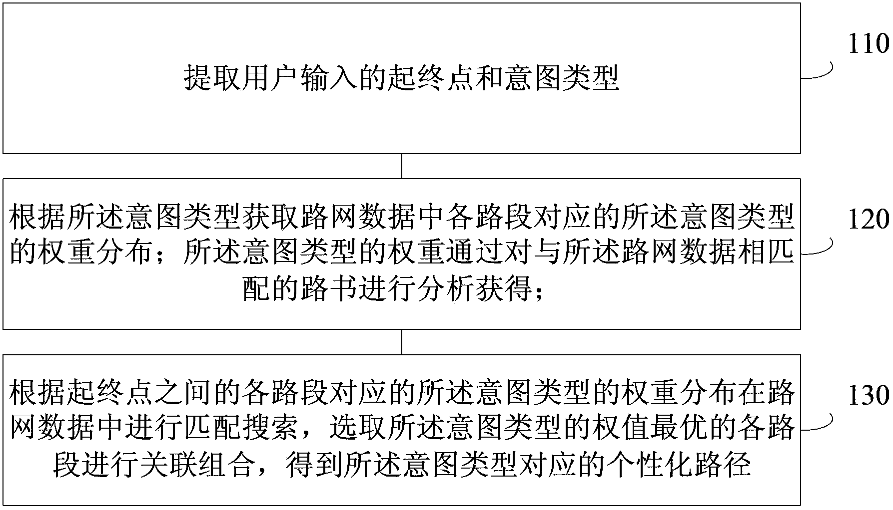
[0004] The technical problem to be solved in this application is to provide a route planning method and device, which solves the situation that the optimal route of complex routes cannot be analyzed in the prior art, and can respond to the user's personalized route planning request according to the information provided by the user's route book. Carry out accurate and efficient navigation planning

Method used


Image

  • Path planning method and device
  • Path planning method and device
  • Path planning method and device

Examples


Embodiment Construction

[0070] In order to make the above objects, features and advantages of the present application more obvious and comprehensible, the present application will be further described in detail below in conjunction with the accompanying drawings and specific implementation methods.

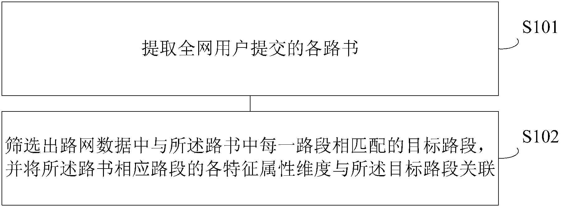
[0071] The road book is a detailed self-driving travel memo. It can be a detailed preparation for the trip, or a travel summary after the return trip. A good road book will include detailed daily itinerary, driving route (including passing locations, mileage, road characteristics, etc.), as well as passing scenic spots, board and lodging arrangements, weather conditions, etc.

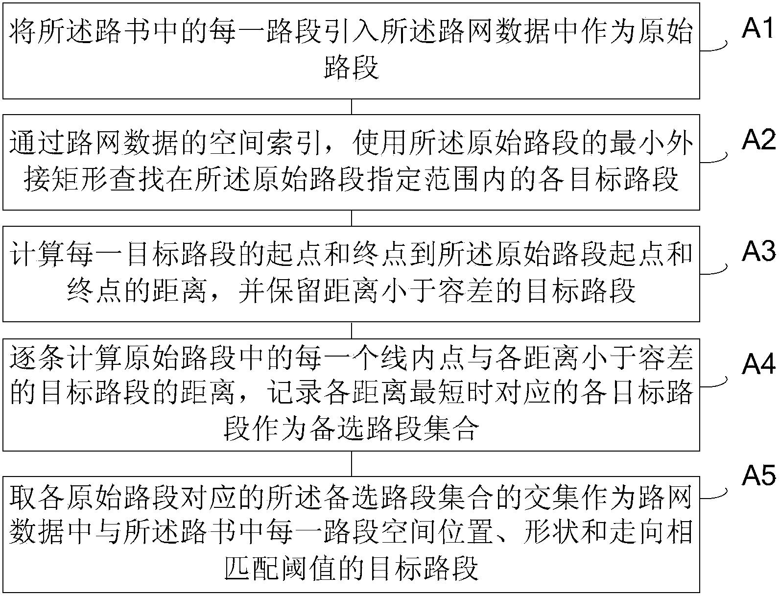
[0072] The production of the road book is to use the road book editing tool to plan the driving route. According to the various road network information behind the editing tool and through the mathematical algorithm based on geometric logic, the connecting path between two points is given. It supplements the information of each ke...


PUM


Abstract

The invention provides a path planning method and device and relates to the field of map navigation. The method comprises the following steps: extracting starting and finishing points and intent types input by a user; acquiring weight distribution of the intent types which correspond to all road sections in road network data according to the intent types; acquiring the weight of the intent types by analyzing a road book matched with the road network data; and performing matching search in the road network data according to the weight distribution of the intent types which correspond to all road sections between the starting point and the finishing point, selecting each road section with the optimized weight of the intent types, and performing associated combination, thus obtaining an individual path which corresponds to the intent types. According to road book acquisition and each characteristic attribute dimensionality different from the traditional basic attribute dimensionality, navigation planning can be accurately and effectively performed, and a corresponding optimized path can be searched according to individual requirements of the users.

Description

technical field [0001] The present application relates to the field of map navigation, in particular to a path planning method and device. Background technique [0002] Road route navigation is a typical application in the technical field of GPS, and it has been widely used at present. In the existing technology, path planning is based on the topological relationship of the road network, considering the basic attributes of the relevant roads in the road network data, such as the grade of the road, the number of lanes, the number of intersections, the number of traffic lights and other basic attributes, and using the topology algorithm to give Path schemes such as the shortest total distance between the start point and the end point or the shortest total time consumption. [0003] However, in the existing technology, the topology calculation is mainly performed with reference to the basic attributes of the road itself, and only the simple route with the shortest distance or ...

Claims


Application Information

Patent Timeline
IPC IPC(8): G01C21/34
CPCG01C21/3484
Inventor 李玉忠孔祥来
Owner BEIJING SOGOU TECHNOLOGY DEVELOPMENT CO LTD
Learn More