Method for calculating road fused travel speed based on various positioning data

A positioning data and vehicle speed technology, which is applied in the field of calculating road fusion travel speed based on multiple positioning data, can solve the problems of insufficient collection of traffic state information, low quality of traffic state information, and small number of taxi samples, etc., and achieve high quality Effect

Active Publication Date: 2014-05-14
SHANGHAI YUNDI INFORMATION TECH
View PDF5 Cites 19 Cited by
  • Summary
  • Abstract
  • Description
  • Claims
  • Application Information

AI Technical Summary

Problems solved by technology

However, for a mobile traffic collection technology, such as the GPS floating car to collect road traffic status, although the traffic status of the main roads in the urban area can be collected in a large area, there are taxi samples in some time periods of the main roads in the urban area. There is little or no traffic, and the performance is more obvious on the expressways in the suburbs of cities
This will lead to the failure to collect the traffic status information of the corresponding road or the quality of the collected traffic status information is not high

Method used


Image

  • Method for calculating road fused travel speed based on various positioning data
  • Method for calculating road fused travel speed based on various positioning data

Examples


Embodiment

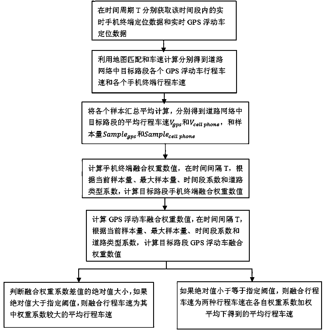
[0046] Embodiment: This embodiment specifically relates to a method for calculating road fusion travel speed based on various positioning data, which is used to detect the traffic state of urban roads. The multiple positioning data described here specifically refers to the positioning data of mobile phone terminals and Positioning data of the GPS floating car.

[0047] like figure 1 As shown, in this embodiment, the road section travel speed fusion processing method based on multiple positioning data includes the following steps:

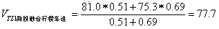
[0048] [Step 1] Within a fixed time interval T, obtain the real-time positioning data of the mobile phone terminal and the real-time positioning data of the GPS floating vehicle from the data source respectively, and use map matching and vehicle speed calculation to obtain the data in the road respectively. The average travel speed V of the target section cellphone and V gps , and the sample size Sample cellphone and Sample gps .

[0049] Usua...


PUM


Abstract

The invention discloses a method for calculating the road fused travel speed based on various positioning data. The method includes the steps of conducting vehicle speed fusion on cell phone terminal positioning data and GPS floating vehicle positioning data, obtaining the average travel speed within the target road section, and then obtaining the traffic state of urban roads. The method has the advantages that the problem that traffic states can not be collected on city district main roads in part of time periods or city suburb highways through a simplex GPS data source traffic collecting method can be solved, information quality of the traffic states which are collected on road sections with small sample capacity through the simplex GPS data source traffic collecting method can be improved, and therefore comprehensive and high-quality traffic state information can be provided for traffic managers and travelers.

Description

technical field [0001] The invention relates to a method for detecting travel speed by fusion of multi-source data, in particular to a method for calculating road fusion travel speed based on multiple positioning data, which is used for detecting the traffic state of urban roads. Background technique [0002] At present, with the rapid advancement of my country's urbanization process, urban congestion is becoming more and more serious. In order to effectively alleviate urban road traffic congestion and other problems, it is necessary to monitor and operate urban traffic conditions, and then take measures to eliminate congestion and maintain smooth urban traffic management. [0003] Obtaining dynamic real-time traffic status information of urban roads is an important basis for traffic management. At present, the collection of urban traffic information includes traditional fixed-point traffic information collection and advanced mobile traffic information collection. Fixed-poi...

Claims


Application Information

Patent Timeline
Patent Type & Authority Applications(China)
IPC IPC(8): G08G1/052
Inventor 方杰戴虹
Owner SHANGHAI YUNDI INFORMATION TECH
Why Eureka
Try Eureka