Matching method for probe car and road section and method for obtaining real-time traffic status in parallel

A matching method, floating car technology, applied in the field of matching floating cars and road sections, obtaining real-time road conditions in parallel, and map matching, can solve problems such as complex algorithms, inability to meet real-time requirements, and reducing the effective number of samples for a single road section

Active Publication Date: 2014-07-16
CHINA AEROSPACE SYST ENG
View PDF4 Cites 37 Cited by
  • Summary
  • Abstract
  • Description
  • Claims
  • Application Information

AI Technical Summary

Problems solved by technology

Therefore, there are a large number of data points with an instantaneous speed of 0 in the collected floating car data. These vehicle records with a speed of 0 account for about half of the entire vehicle data record, and the azimuth angle returned by these parking points with a speed of 0 cannot correctly reflect the vehicle. Therefore, the road segment where the vehicle is located cannot be determined by th

Method used


Image

  • Matching method for probe car and road section and method for obtaining real-time traffic status in parallel
  • Matching method for probe car and road section and method for obtaining real-time traffic status in parallel
  • Matching method for probe car and road section and method for obtaining real-time traffic status in parallel

Examples


Embodiment

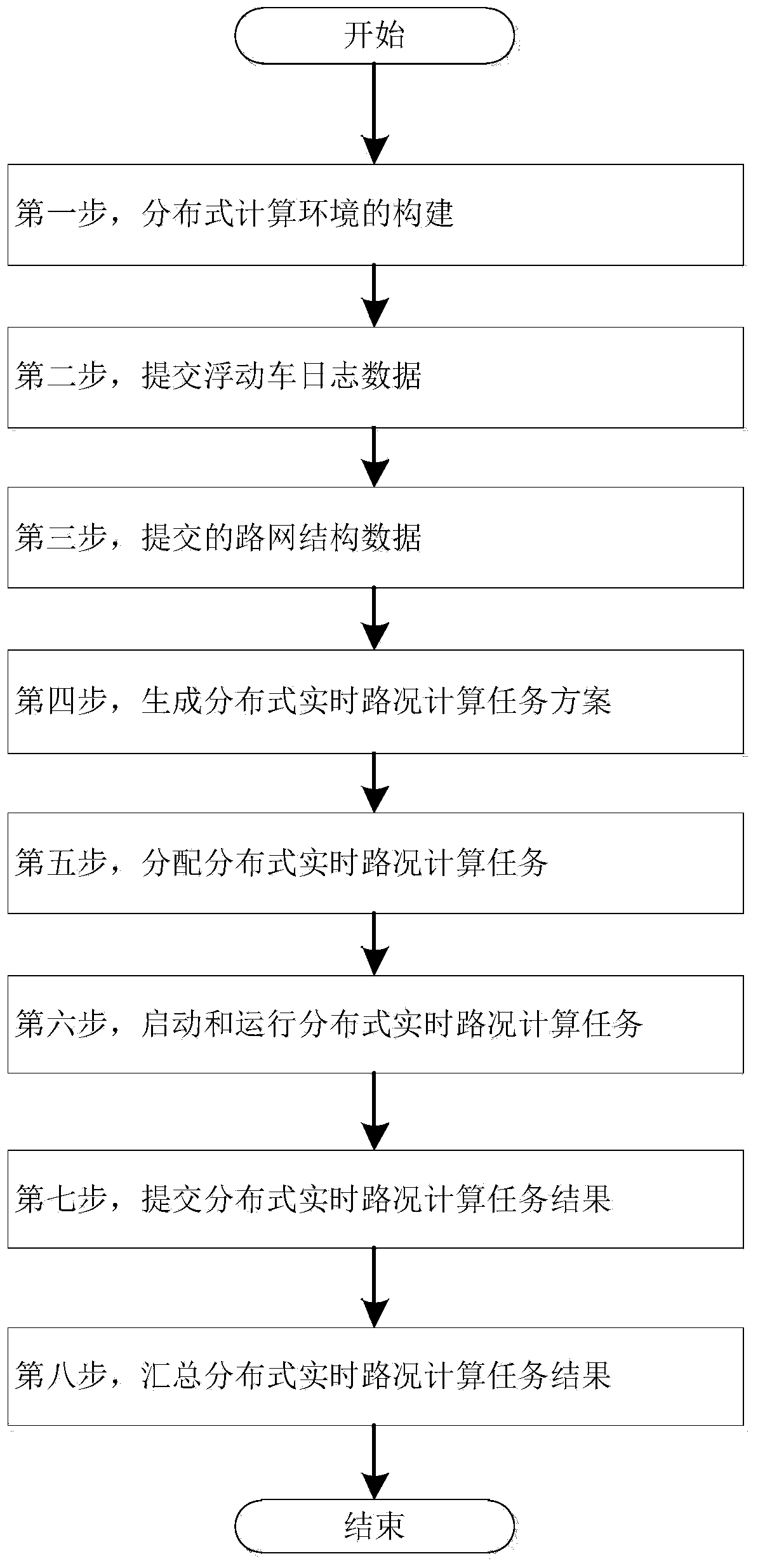
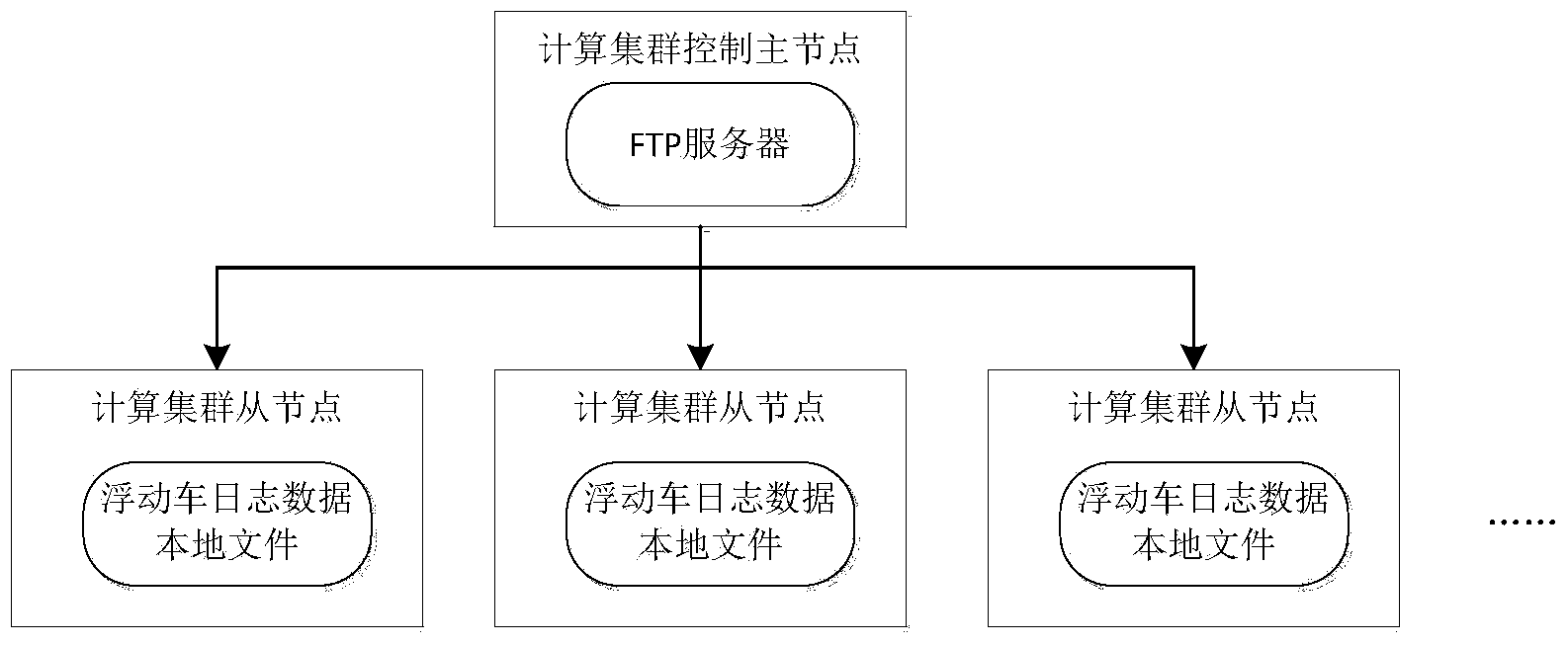
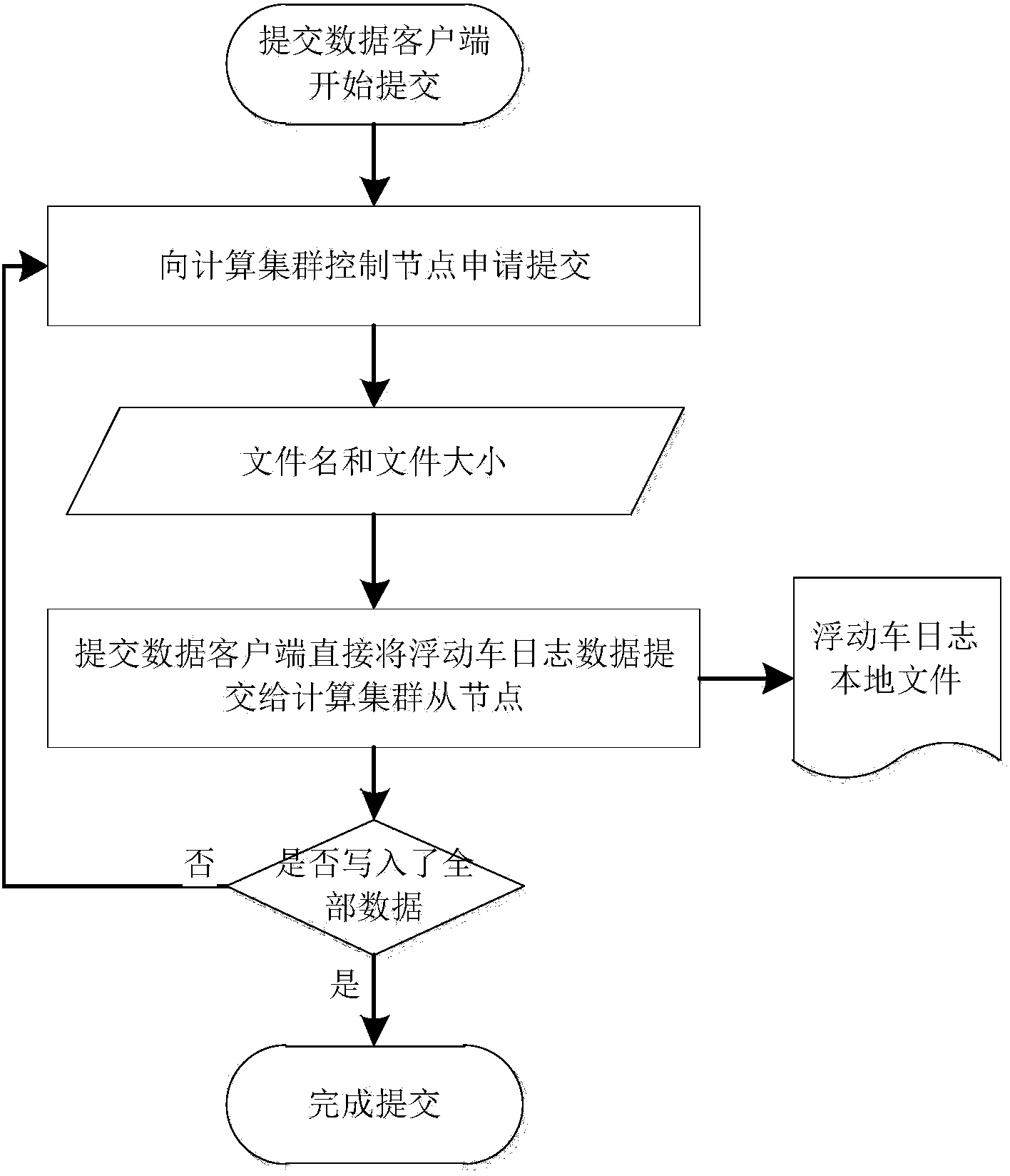
[0067] 1. The process of matching the floating car with the map

[0068] 1. Road network structure data processing:

[0069] The road network is divided into different road sections according to latitude and longitude, and then the map is uniformly gridded and divided from left to right and from top to bottom at a certain distance interval. If the map is divided into m*n grids, one of the grids can be marked as 0≤i ( lon min + i × lon max - lon min m ≤ lon i ≤ lon min + ( i + 1 ) × ...


PUM


Abstract

The invention provides a matching method for a probe car and a road section and a method for obtaining real-time traffic status in parallel. The matching method for the probe car and the road section comprises the steps that (101) a road network is divided into different road sections according to the longitude and the latitude, the road sections are numbered, a map is divided into blocks in an even gridding mode according to a set distance interval from the left to right and from the top to bottom, so that a plurality of boxes are obtained, the road sections correspond to a networked area according to the relation between the longitude and the latitude, namely, all the road sections contained within the longitude and latitude range covered by each box are distributed to the box and the serial numbers of the road sections are recorded, and then the road sections correspond to the corresponding box on the map; (102) according to position coordinates sent back by the probe car, the area area, where the probe car is located, on the map is determined, all the road sections of the box area where the probe car is located are obtained according to a first mapping table and used as a candidate road section set, the matching relation between the probe car and the road sections in the candidate road section set is determined, and then the actual road section where the probe car is located currently is determined.

Description

technical field [0001] The present invention relates to a kind of technology that utilizes parallel computing technology to calculate the real-time operating speed of urban road network through floating car data (taxi operating data). The present invention also relates to a method for map matching. Specifically, the present invention provides a floating car A method for matching road sections and a method for obtaining real-time road conditions in parallel. Background technique [0002] Floating Vehicles Equipped wkh GPS, also known as Global Position System Probe Car, is one of the advanced technical means used in recent years in the International Intelligent Transportation System (ITS) to obtain traffic information on road sections. Convenient, economical and wide coverage. [0003] Floating vehicles are composed of vehicles equipped with on-board GPS (Global Positioning System) equipment and freely travel on actual road sections. Floating vehicles transmit data back to t...

Claims


Application Information

Patent Timeline
IPC IPC(8): G08G1/01G06F17/30
Inventor 陈远迁王法岩雷利军王振华聂炜景泽涛单雅文荆长林万蔚于渊田启华张丹
Owner CHINA AEROSPACE SYST ENG
Why Eureka
Try Eureka