Closed fence drawing method and system

A fence and optimal path technology, applied in the field of transportation, can solve the problem of inaccurate regional monitoring, and achieve the effect of reducing the amount of communication transmission and improving the transmission speed.

Active Publication Date: 2014-07-16
BEIJING TRANWISEWAY INFORMATION TECH
View PDF6 Cites 15 Cited by
  • Summary
  • Abstract
  • Description
  • Claims
  • Application Information

AI Technical Summary

Problems solved by technology

However, the fence formed by the superposition of such geometric figures may

Method used


Image

  • Closed fence drawing method and system
  • Closed fence drawing method and system
  • Closed fence drawing method and system

Examples


Example Embodiment

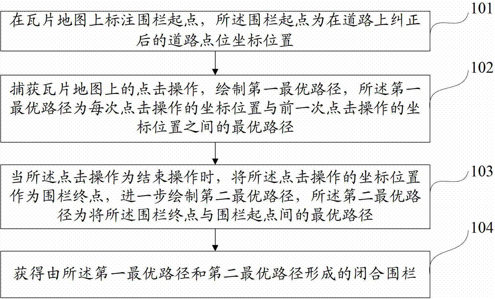
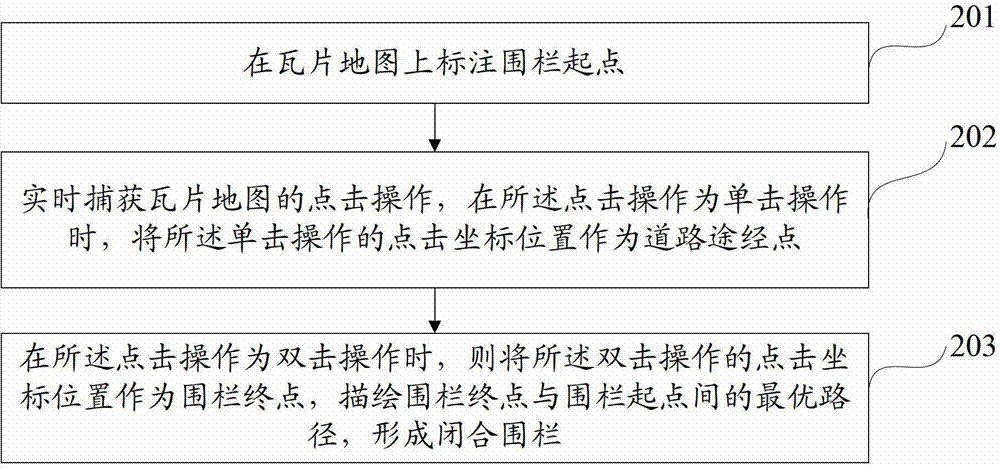
[0054] In order to make the above objectives, features and advantages of the present invention more obvious and understandable, the present invention will be further described in detail below with reference to the accompanying drawings and specific embodiments.
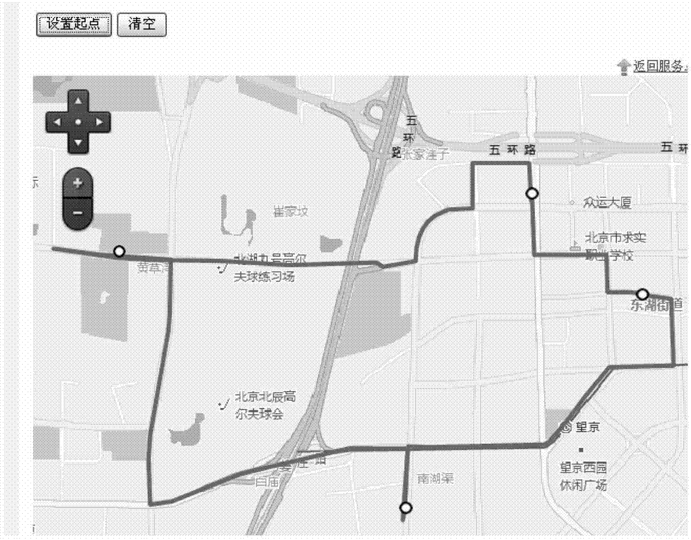
[0055] The core idea of ​​the embodiments of the present invention is to intelligently capture roads and draw closed areas based on the Internet tile map mode following the movement of the mouse, including three parts (client, JSONP protocol, server), and the server implements two directions based on a layered road network. The optimal road between points is calculated, and the obtained optimal road is processed by the non-deformation thinning process and the system conversion (decimal system is converted to 62 system, and the purpose of thinning and conversion is to reduce the communication transmission volume) to obtain the optimal path. The end server interacts through the JSONP protocol. The client captures two points...


PUM


Abstract

The invention provides a closed fence drawing method and system. The method comprises the steps that a fence start point is marked on a tile map, and the fence start point is a corrected road point coordinate position on a road; click operations on the tile map are captured, a first optimal path is drawn, and the first optimal path is the optimal path between the coordinate position of each click operation and the coordinate position of the previous click operation; when the click operation is an end operation, the coordinate position of the click operation is used as a fence end point, a second optimal path is further drawn, and the second optimal path is the optimal path between the fence end point and the fence start point; a closed fence formed by the first optimal path and the second optimal path is obtained. The closed fence drawing method and system can enable users to conveniently, flexibly and accurately draw self-defined electronic fences.

Description

Technical field [0001] The present invention relates to the field of transportation technology, and in particular to a method for drawing a closed fence, and a system for drawing a closed fence. Background technique [0002] There are many professional concepts for electronic fences. When managing vehicles in a GIS (Geographic Information System) client: the electronic fence represents a designated area on the map. Vehicles can drive normally in this designated area, exceeding the designated area. After the area, it will upload the alarm command to the alarm through the GPS of the vehicle equipment. This is very helpful for example: fleet management vehicles, 4S shop management vehicles, rental car rental management, etc. It provides automatic management functions. [0003] At present, in some electronic monitoring systems developed based on maps, for the convenience of operation and recording, the fences drawn on the map mostly adopt the superposition of geometric figures, such a...

Claims


Application Information

Patent Timeline
IPC IPC(8): G09B29/10G06F17/30
Inventor 黄会蓉杜雄朱佳史爱霞张志平胡道生夏曙东
Owner BEIJING TRANWISEWAY INFORMATION TECH
Why Eureka
Try Eureka